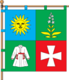
Chemerivtsi
| Chemerivtsi Чемерівці | |||
|---|---|---|---|
| Urban-type settlement | |||
| |||
| Coordinates: 49°00′44″N 26°21′11″E / 49.01222°N 26.35306°ECoordinates: 49°00′44″N 26°21′11″E / 49.01222°N 26.35306°E | |||
| Country |
| ||
| Province | Khmelnytskyi Oblast | ||
| District | Chemerivtsi Raion | ||
| Founded | 1565 | ||
| Town status | 1959 | ||
| Government | |||
| • Town Head | Volodymyr Voitov[1] | ||
| Area | |||
| • Total | 5.61 km2 (2.17 sq mi) | ||
| Elevation[2] | 278 m (912 ft) | ||
| Population (2011) | |||
| • Total |
| ||
| Time zone | EET (UTC+2) | ||
| • Summer (DST) | EEST (UTC+3) | ||
| Postal code | 31600—31607 | ||
| Area code | +380 3859 | ||
| Website | http://rada.gov.ua/ | ||
Chemerivtsi (Ukrainian: Чемерівці) is an urban-type settlement in Khmelnytskyi Oblast (province) in western Ukraine.[3] It serves as the administrative center of the Chemerivtsi Raion (district), housing the district's local administration buildings. The town's population was 5,431 as of the 2001 Ukrainian Census[3] and 5,399 in 2011.[4]
Chemerivtsi was first founded in 1565[3] and it received the Magdeburg rights in 1797.[5] It received the status of an urban-type settlement in 1959.[3]
See also
- Zakupne, the other urban-type settlement in the Chemerivtsi Raion of Khmelnytskyi Oblast
References
- ↑ "Composition of the Executive Committee of the Chemerivtsi Town Council". Chemerivtsi Town Council (in Ukrainian). Retrieved 15 January 2013.
- ↑ "Chemerivtsi (Khmelnytskyi Oblast, Chemerivtsi Raion)". weather.in.ua. Retrieved 15 January 2013.
- 1 2 3 4 "Chemerivtsi, Khmelnytskyi Oblast, Chemerivtsi Raion". Regions of Ukraine and their Structure (in Ukrainian). Verkhovna Rada of Ukraine. Retrieved 15 January 2013.
- ↑ "Actual Population of Ukraine on January 1, 2011". State Statistics Committee of Ukraine (in Ukrainian). Main Statistical Office in L'viv region. Archived from the original (PDF) on 10 October 2012. Retrieved 15 January 2013.
- ↑ "Main Page". Chemerivtsi Town Council (in Ukrainian). Retrieved 16 January 2013.
External links
- "Main Page". Chemerivtsi Town Council (in Ukrainian). Retrieved 15 January 2013.
This article is issued from
Wikipedia.
The text is licensed under Creative Commons - Attribution - Sharealike.
Additional terms may apply for the media files.

