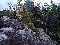
Chapada Diamantina National Park
| Chapada Diamantina National Park | |
|---|---|
|
IUCN category II (national park) | |
|
Escarpments in the park | |
 | |
| Location | Bahia, Brasil |
| Coordinates | 12°52′49″S 41°22′20″W / 12.88028°S 41.37222°WCoordinates: 12°52′49″S 41°22′20″W / 12.88028°S 41.37222°W |
| Area | 152,142 ha (587.42 sq mi) |
| Designation | National park |
| Created | 17 September 1985 |
| Administrator | ICMBio |
The Chapada Diamantina National Park (Portuguese: Parque Nacional da Chapada Diamantina) is a national park in the Chapada Diamantina[lower-alpha 1] region of the State of Bahia, Brazil. The terrain is rugged, and mainly covered by flora of the Caatinga biome.
Location
The park is in the Caatinga biome, and covers 152,142 hectares (375,950 acres). It was created by decree 91.655 of 17 September 1985, and is administered by the Chico Mendes Institute for Biodiversity Conservation.[2] The park covers parts of the municipalities of Palmeiras, Mucugê, Lençóis, Ibicoara and Andaraí in the state of Bahia.[3]
Terrain
The park is in the Chapada Diamantina, a plateau bounded by cliffs of 41,751 square kilometres (16,120 sq mi) in central Bahia. Altitudes in the plateau typically vary from 500 to 1,000 metres (1,600 to 3,300 ft). In the more mountainous parts there are several peaks of 1,600 to 1,800 metres (5,200 to 5,900 ft), and a few over 2,000 metres (6,600 ft). The plateau forms a watershed, draining on one side into the São Francisco River and on the other into the De Contas River and Paraguaçu River.[3]
The park lies in the rugged Sincorá Range in the east of the plateau, an area of folded and heavily eroded structures. The range is elongated in a north-south direction, and has an average width of 25 kilometres (16 mi).[3] The highest point of the state is in the park, the 2,036 metres (6,680 ft) Pico do Barbado. Both gold and diamonds have been found in the range.[4] The range forces moist air moving west from sea upward which causes higher levels of rainfall, particularly in the east.[3] There are many systems of caves formed by the rivers of the region.[1]
Flora and fauna

Vegetation includes typical Caatinga xerophytic formations at altitudes from about 500 to 900 metres (1,600 to 3,000 ft), Atlantic Forest vegetation along the watercourses, meadows and rocky fields higher up. Endemic flora include Adamantinia miltonioides, Cattleya elongata, Cattleya tenuis, Cattleya x tenuata, Cleites libonni and Cleistes metallina. The hooded visorbearer (Augastes lumachellus) hummingbird is endemic.[3] There are few large mammals, but many species of small mammals, reptiles, amphibians, birds and insects.[1]
Conservation
The park is classed as IUCN protected area category II (national park). It has the objectives of preserving natural ecosystems of great ecological relevance and scenic beauty, enabling scientific research, environmental education, outdoors recreation and eco-tourism.[3] Protected birds in the reserve include white-necked hawk (Buteogallus lacernulatus), Chaco eagle (Buteogallus coronatus), Bahia tyrannulet (Phylloscartes beckeri), ochre-marked parakeet (Pyrrhura cruentata) and Bahia spinetail (Synallaxis whitneyi).[2]
Other protected species include Barbara Brown's titi (Callicebus barbarabrownae), cougar (Puma concolor), jaguar (Panthera onca), oncilla (Leopardus tigrinus), giant armadillo (Priodontes maximus) and giant anteater (Myrmecophaga tridactyla).[2]
Notes
References
| Wikimedia Commons has media related to Chapada Diamantina. |
Bibliography
- "Chapada Diamantina National Park", Bahia Guide, retrieved 2016-05-04
- "Chapada Diamantina National Park", ichapada, retrieved 2016-05-04
- Parna da Chapada da Diamantina (in Portuguese), Chico Mendes Institute for Biodiversity Conservation, retrieved 2016-05-04
- Saulo Queiroz da Fonseca, "National Park", Astrotown.de, retrieved 2016-11-01
- Unidade de Conservação: Parque Nacional da Chapada Diamantina (in Portuguese), MMA: Ministério do Meio Ambiente, retrieved 2016-05-04
