Chandlerville Township, Cass County, Illinois
| Chandlerville Township | |
|---|---|
| Township | |
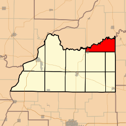 Location in Cass County | |
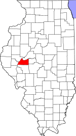 Cass County's location in Illinois | |
| Coordinates: 40°03′58″N 90°03′31″W / 40.06611°N 90.05861°WCoordinates: 40°03′58″N 90°03′31″W / 40.06611°N 90.05861°W | |
| Country | United States |
| State | Illinois |
| County | Cass |
| Established | November 6, 1923 |
| Area | |
| • Total | 25.38 sq mi (65.7 km2) |
| • Land | 25.03 sq mi (64.8 km2) |
| • Water | 0.35 sq mi (0.9 km2) 1.38% |
| Elevation | 479 ft (146 m) |
| Population (2010) | |
| • Estimate (2016)[1] | 480 |
| • Density | 20.6/sq mi (8.0/km2) |
| Time zone | CST (UTC-6) |
| • Summer (DST) | CDT (UTC-5) |
| ZIP codes | 62627, 62673 |
| FIPS code | 17-017-12463 |
Chandlerville Township is one of eleven townships in Cass County, Illinois, USA. As of the 2010 census, its population was 515 and it contained 262 housing units.[2]
Geography
According to the 2010 census, the township has a total area of 25.38 square miles (65.7 km2), of which 25.03 square miles (64.8 km2) (or 98.62%) is land and 0.35 square miles (0.91 km2) (or 1.38%) is water.[2]
Cities, towns, villages
- Chandlerville (east half)
Cemeteries
The township contains these three cemeteries: Harbison-Davis, Hickey and Mount Olive.
Major highways
Rivers
Lakes
- Big Lake
Demographics
| Historical population | |||
|---|---|---|---|
| Census | Pop. | %± | |
| Est. 2016 | 480 | [1] | |
School districts
- A C Central Community Unit School District 262
- Porta Community Unit School District 202
Political districts
- Illinois' 18th congressional district
- State House District 93
- State Senate District 47
References
- "Chandlerville Township, Cass County, Illinois". Geographic Names Information System. United States Geological Survey. Retrieved 2010-01-04.
- United States Census Bureau 2007 TIGER/Line Shapefiles
- United States National Atlas
- 1 2 "Population and Housing Unit Estimates". Retrieved June 9, 2017.
- 1 2 "Population, Housing Units, Area, and Density: 2010 - County -- County Subdivision and Place -- 2010 Census Summary File 1". United States Census. Retrieved 2013-05-28.
- ↑ "Census of Population and Housing". Census.gov. Retrieved June 4, 2016.
External links
| Adjacent places of Chandlerville Township, Cass County, Illinois | ||||
|---|---|---|---|---|
 |
Bath Township, Mason County | |
Kilbourne Township, Mason County | |
| Lynchburg Township, Mason County Sangamon Valley Township |
|
|||
| ||||
| | ||||
| Panther Creek Township | |
Newmansville Township | ||
Municipalities and communities of Cass County, Illinois, United States | ||
|---|---|---|
| Cities | ||
| Villages | ||
| Townships | ||
| Unincorporated communities | ||
| Ghost towns | ||
This article is issued from
Wikipedia.
The text is licensed under Creative Commons - Attribution - Sharealike.
Additional terms may apply for the media files.