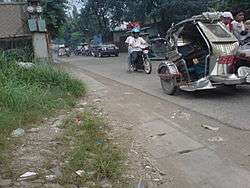
Catmon, Bulacan
| Catmon | |
|---|---|
| Barangay | |
 | |
.svg.png) Catmon | |
| Coordinates: 14°49′48.94″N 121°00′08.18″E / 14.8302611°N 121.0022722°ECoordinates: 14°49′48.94″N 121°00′08.18″E / 14.8302611°N 121.0022722°E | |
| Country | Philippines |
| Municipality | Santa Maria, Bulacan |
| Area | |
| • Land | 3.199 sq mi (8.2860 km2) |
| Elevation | 137 ft (42 m) |
| Population (2007) | |
| • Total | 11,913 |
| • Density | 3,723.7/sq mi (1,437.72/km2) |
Catmon (PSGC: 031423006) is one of the twenty-four barangays comprising the municipality of Santa Maria, Bulacan, in the Philippines.
Geography
Area and Location
Catmon is the 2nd largest barangay in Santa Maria with a land area of 8.2860 square kilometres (3.1992 sq mi), next only to Pulong Buhangin. It is bordered by Barangay Patag on the south-west, Guyong on the west, Bulac on the east, and Balasing on the north.
Climate
The prevailing climatic conditions in the barangay are categorized into two (2) types: dry and wet season.
The annual mean temperature in the area is 27 °C (81 °F). The warmest month is May with a mean temperature of 29.9 °C (85.8 °F) while the coldest is January at 25.2 °C (77.4 °F).
The mean annual relative humidity in the Barangay is 77% which is not high. The mean monthly relative humidity is lowest in March at 64% and highest in September at 84%
Demographics
As of 2007 census, Catmon has a population of 11,913 people with a density of 1,437.72 inhabitants per square kilometre (3,723.7/sq mi). The population is the 5th largest in Sta.Maria, Bulacan.
Schools
Catmon has 4 public schools: 3 elementary schools and 1 highschool:1 Private school
- Kaylawig Elementary School
- Jose Juan Serapio Elementary School
- Pila Elementary School
- Catmon National High School
- Aquinas De Escolar Academy
Transportation and Communication
Transportation
Public vehicles such as buses, jeepneys, and tricycles are the means of transportation in the barangay. Tricycles are available for 24 hours.
References
External links
| Wikimedia Commons has media related to Catmon, Bulacan. |