Cambridge Parish, New Brunswick
| Cambridge | |
|---|---|
| Parish | |
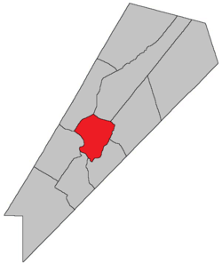
 Location within Queens County, New Brunswick. | |
| Coordinates: 45°50′N 64°35′W / 45.84°N 64.59°W | |
| Country |
|
| Province |
|
| County | Queens County |
| Established | 1852 |
| Area[1] | |
| • Land | 113.97 km2 (44.00 sq mi) |
| Population (2011)[1] | |
| • Total | 651 |
| • Density | 5.7/km2 (15/sq mi) |
| • Pop 2006-2011 |
|
| • Dwellings | 618 |
| Time zone | AST (UTC-4) |
| • Summer (DST) | ADT (UTC-3) |
Cambridge is a Canadian parish in Queens County, New Brunswick.
History
Cambridge Parish created from Wickham Parish and Waterborough Parish in 1852: named for Prince Adolphus-Frederick, Duke of Cambridge (1774-1850) and uncle of Queen Victoria.
Delineation
Cambridge Parish is defined in the Territorial Division Act[2] as being bounded:
- Beginning on the northeastern shore of the Saint John River, at the southeast angle of lot number sixteen, granted to Isaac Gilbert; thence following the course of the lower or southeastern line of said lot numbered sixteen northeasterly until it meets the waters of the Grand Lake; thence by the waters of the Grand Lake to the road[lower-alpha 1] leading from Mill Cove on the said lake, to Fowlers Cove on the Washademoak Lake; thence southeasterly by said road to Washademoak Lake; thence southwesterly by the waters of the Washademoak Lake and through the Colwells Creek and Lawson Passage to the Saint John River; and thence following the shore of the Saint John River up stream to the place of beginning.
Communities
Parish population total does not include incorporated municipalities (in bold):
|
|
Bodies of water & Islands
This is a list of rivers, lakes, streams, creeks, marshes and Islands that are at least partially in this parish
- Coreys Island
- Nevers Island
Demographics
PopulationPopulation trend[3]
|
LanguageMother tongue language (2006)[4]
|
Access Routes
Highways and numbered routes that run through the parish, including external routes that start or finish at the parish limits:[5]
|
|
|
See also
Footnotes
- ↑ Fowler Road.
References
- 1 2 2011 Statistics Canada Census Profile: Cambridge Parish, New Brunswick
- ↑ "Territorial Division Act (R.S.N.B. 1973, c. T-3)". Government of New Brunswick website. Retrieved 17 August 2016.
- ↑ Statistics Canada: 2001, 2006 census
- ↑ Profile: Cambridge Parish, New Brunswick
- ↑ Atlantic Canada Back Road Atlas ISBN 978-1-55368-618-7
| Adjacent places of Cambridge Parish, New Brunswick | ||||
|---|---|---|---|---|
 |
Canning Parish | Canning Parish | Waterborough Parish |  |
| Gagetown Parish | |
Johnston Parish | ||
| ||||
| | ||||
| Hampstead Parish | Wickham Parish | |||
Coordinates: 45°49′22″N 66°04′14″W / 45.822639°N 66.07049°W
This article is issued from
Wikipedia.
The text is licensed under Creative Commons - Attribution - Sharealike.
Additional terms may apply for the media files.