Calheta, Cape Verde
| Calheta | |
|---|---|
| Settlement | |
 Calheta | |
| Coordinates: 15°13′48″N 23°12′43″W / 15.230°N 23.212°WCoordinates: 15°13′48″N 23°12′43″W / 15.230°N 23.212°W | |
| Country | Cape Verde |
| Island | Maio |
| Municipality | Maio |
| Civil parish | Nossa Senhora da Luz |
| Population (2010)[1] | |
| • Total | 1,156 |
Calheta (Cape Verdean Creole: ALUPEK: Kadjéta , Maio: Cadjeta, sometimes known as Calheta do Maio (Capeverdean Creole: Kadjeta du Maiu) is a village in the western part of the island of Maio. The village is around 10 km north of the island capital of Vila do Maio. Its population at the 2010 census is 1,156 making it the island's second largest settlement. About 500 to 600 m to the west is the Atlantic with its bay. The village is connected with the western island road (paved since the 1990s) stretching from Vila do Maio to Cascabulho. The other three rural dirt roads do not connect to any place on the east of the island but the northeast with Cascabulho as an alternate road. The geography today is predominantly with fields and groves around it, northeast is a large acacia forest, grasslands still exists in the eastern area. Until the 1980s, almost the whole area were made up of grasslands.
The urban area (with some gaps) reaches west to the Atlantic.
The city was known as Porto Português (Portuguese for "Portuguese port") which is in opposition of Porto Inglês which is still called today (the other name is Vila do Maio). The Portuguese used it to export salt to Portugal, the salt were mined by slaves from Terras Salgadas up north up to the early 19th century.
The settlement was mentioned as "Kalyete" (Middle Portuguese: Calleta) in the 1747 French/Dutch map by Jacques Nicolas Bellin.[2]
Sports
- Académica da Calheta, it has a football (soccer) stadium near the center but much of its matches are played in the island capital. Another football club is Cruzeiro, the club first competed in the Second Division in 2015.
See also
References
- ↑ "2010 Census results". Instituto Nacional de Estatística Cabo Verde (in Portuguese). 17 March 2014.
- ↑ Jacques-Nicolas Bellin; Pieter de Hondt (1747). "Carte des Isles du Cap Verd = Kaart van de Eilanden van Kabo Verde" (in French).
The island of Maio and the surrounding islands | ||
|---|---|---|
| Communities and settlements | 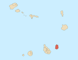 | |
| Parishes | ||
| Mountains | ||
| Other geographical features | ||