Cèze
| Cèze | |
|---|---|
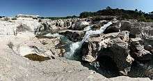
 Sautadet Rapids at La Roque-sur-Cèze | |
| Country | France |
| Basin features | |
| Main source | Cévennes |
| River mouth |
Rhone 44°6′30″N 4°42′13″E / 44.10833°N 4.70361°ECoordinates: 44°6′30″N 4°42′13″E / 44.10833°N 4.70361°E |
| Progression | Rhône→ Mediterranean Sea |
| Physical characteristics | |
| Length | 128 km (80 mi) |
The river by Montclus (Gard)
The Cèze is a French river, a tributary of the Rhone. It runs through the departments of Lozère and Gard in the Languedoc-Roussillon region. Its source is in the Cévennes mountains, near Saint-André-Capcèze. It flows through Bessèges, Saint-Ambroix, Bagnols-sur-Cèze, and it flows into the Rhone at Codolet, southwest of Orange.
Among its tributaries is the Aiguillon.
References
| Wikimedia Commons has media related to Cèze. |
This article is issued from
Wikipedia.
The text is licensed under Creative Commons - Attribution - Sharealike.
Additional terms may apply for the media files.