Brockton (MBTA station)
BROCKTON | |||||||||||||||||||||||||||||||
|---|---|---|---|---|---|---|---|---|---|---|---|---|---|---|---|---|---|---|---|---|---|---|---|---|---|---|---|---|---|---|---|
 Brockton station and the Anglim Building in 2017 | |||||||||||||||||||||||||||||||
| Location |
7 Commercial Street Brockton, Massachusetts | ||||||||||||||||||||||||||||||
| Coordinates | 42°05′05″N 71°01′00″W / 42.0847°N 71.01655°WCoordinates: 42°05′05″N 71°01′00″W / 42.0847°N 71.01655°W | ||||||||||||||||||||||||||||||
| Line(s) | Middleborough Main Line | ||||||||||||||||||||||||||||||
| Platforms | 1 island platform | ||||||||||||||||||||||||||||||
| Tracks | 2 | ||||||||||||||||||||||||||||||
| Connections |
| ||||||||||||||||||||||||||||||
| Construction | |||||||||||||||||||||||||||||||
| Parking |
266 spaces ($3.00 daily) 10 accessible spaces | ||||||||||||||||||||||||||||||
| Bicycle facilities | 8 spaces | ||||||||||||||||||||||||||||||
| Disabled access | Yes | ||||||||||||||||||||||||||||||
| Other information | |||||||||||||||||||||||||||||||
| Fare zone | 4 | ||||||||||||||||||||||||||||||
| History | |||||||||||||||||||||||||||||||
| Opened | September 29, 1997[1] | ||||||||||||||||||||||||||||||
| Closed | June 30, 1959 (former station) | ||||||||||||||||||||||||||||||
| Traffic | |||||||||||||||||||||||||||||||
| Passengers (2013) | 778 (weekday inbound average)[2] | ||||||||||||||||||||||||||||||
| Services | |||||||||||||||||||||||||||||||
| |||||||||||||||||||||||||||||||
Brockton is an MBTA Commuter Rail station in Brockton, Massachusetts on the Middleborough/Lakeville Line. The station is located right behind the Brockton Police Station, near the intersections of Routes 27, 28, and 123. Brockton Station was built on a line that was once part of the original Fall River Railroad.
History
Early history
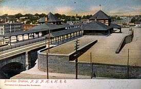
The Fall River Railroad opened from Myricks to South Braintree on December 21, 1846, including a stop at the town of North Bridgewater.[3] The line went though several mergers and became part of the Old Colony Railroad system in 1854. Unusually among significant cities in Massachusetts, Brockton was never a railroad junction. A charter for a branch from Stoughton to North Bridgewater was applied for in 1845 - before the railroad had even been completed - but nothing became of the plan.[4] East-west branches were built from Bridgewater proper before North Bridgewater became a major manufacturing area. The town was renamed Brockton in 1874, with the railroad station changing its name on May 7.[3][5] The Victorian-style station was located at Church Street on the west side of the railroad tracks.[6][7]
Grade crossing elimination

On June 21, 1890, the Massachusetts General Court passed An Act to Promote the Abolition of Grade Crossings, which allowed town officials or a railroad company to petition the state superior court to create an independent commission to determine whether a grade crossing could and should be eliminated. The costs of such eliminations were to be borne 65% by the railroad, not more than 10% by the town, and the remainder by the state.[8]
The small local cost provided towns incentive to petition for crossing eliminations to prevent public thoroughfares from being blocked by trains. Numerous municipalities soon agitated for crossing eliminations, with Brockton's April 1891 petition the first of the lot. Shortly before then, the Old Colony Railroad announced plans to replace the aging and undersized Brockton station with a more appropriate structure. The station design was well-received, but its at-grade design - which would have precluded crossing eliminations - was seen as a threat to the economic future of the city. Brockton then had no fire station east of the railroad, adding fire safety concerns to the more widespread issue of pedestrian safety. Frequent delays for fire engines responding to calls caused higher insurance rates and lower land values in the eastern part of the city.
The petition to consider elimination of all grade crossings in the city was accepted, and the city engineer prepared a preliminary plan. The plan called for tracks to be raised and streets lowered through the city center, and the tracks lowered and streets raised in the Campello village to the south. Brockton station and Montello station to the north would be completely replaced, while the more adequate Campello station would remain.[9] The railroad was initially opposed to the expense of the plan; however, city engineers made a convincing case that grade separation would only be more expensive, and the two parties reached an agreement in June 1893.[9] The Massachusetts Board of Railroad Commissioners approved the grade separation project on April 21, 1894, allowing construction to proceed.
The stone viaduct was 0.7 miles (1.1 km) long, with stone arch bridges spanning five downtown streets; seven new bridges over the railroad were built near Montello and Campello.[10]
Closure and revival
Remaining passenger service on the Old Colony Division was ended by the New Haven Railroad on June 30, 1959. The bridge over the Neponset River was destroyed by fire in 1960; the need for a replacement bridge drastically increased the cost of restoring passenger service. The MBTA was founded in 1964 to subsidize suburban commuter rail service; the agency restored service on several other lines, but southeastern Massachusetts remained without passenger service.[11] The station buildings were torn down in the late 1960s during an urban renewal project.[12] A new police station, which lacked the grandeur of both the former railroad buildings and the former police station, was constructed on the eastern site in 1967.[7][13] The retaining walls and several stone stairwells to the street remain intact.

In the 1970s, calls began to restore service on the former Old Colony Division. On January 27, 1973, the MBTA purchased most of Penn Central's commuter rail rights-of-way in southeastern Massachusetts, including the Middleborough main line from Braintree to Campello.[1] A 1974 state analysis of restoring commuter rail service indicated that the Brockton platforms were still extant, but would need refurbishing for use.[14] From 1984 to 1988, Cape Cod and Hyannis Railroad excursion seasonal commuter and excursion service stopped in Brockton at the former station site.[15][16]
In 1984, a state-directed MBTA study found that restoration of commuter rail service would be feasible.[11] A Draft Environmental Impact Statement (DEIS) was released in May 1990, followed by a Final Environmental Impact Statement (FEIS) in 1992. Both the DEIS and FEIS included conceptual plans placing Brockton station between Crescent Street and Lawrence Street - south of the former location and just outside the downtown core.[17][18] However, the station was instead constructed at the previous site, accessed behind the police station. The island platform occupies the former inner track spaces, with the line's two current tracks location where the outer tracks originally were.[19] The Middleborough/Lakeville Line and Kingston/Plymouth Line opened for commuter service on September 29, 1997.[1]
On February 15, 1999, the Brockton Intermodal Centre (BAT Centre) opened one block away as a terminal for Brockton Area Transit Authority local bus service. The $4 million bus station was designed to imitate the architecture of the former railroad station. The project also included a 250-space surface parking lot.[20] In December 2001, the state congressional delegation secured $1 million to support a parking garage at the bus terminal.[21] The garage opened on April 30, 2004.[22]
Bus connections

BAT Centre, the Brockton Area Transit Authority (BAT) bus terminal, is located east of the station across Commercial Street. Most BAT routes connect there:[23]
- Route 1 Montello Street Via North Main Street
- Route 2 S. Plaza/Campello Via Main Street
- Route 3 VA Hospital Via Belmont
- Route 4 Westgate Via Pleasant
- Route 4A Westgate Mall Via N. Warren
- Route 5 Brockton Hospital Via Centre St.
- Route 6 Massasoit Via Crescent St.
- Route 8 Southfield Via Warren & Plan St.
- Route 9 Pearl Via W. Elm & Torrey
- Route 10 Lisa & Howard Via N. Quincy & Court
- Route 11 Cary Hill and the Village
- Route 12 Ashmont
- Route 14 Stoughton
References
- 1 2 3 Belcher, Jonathan (March 25, 2017). "Changes to Transit Service in the MBTA district 1964-2016" (PDF). NETransit.
- ↑ "Ridership and Service Statistics" (PDF) (14th ed.). Massachusetts Bay Transportation Authority. 2014.
- 1 2 Kingman, Bradford (1895). History of Brockton, Plymouth County, Massachusetts, 1656-1894. D. Mason & Company. pp. 19–20, 570 – via Internet Archive.
- ↑ Kingman, Bradford (1866). History of North Bridgewater: Plymouth County, Massachusetts, from Its First Settlement to the Present Time, with Family Registers. Innes and Niles. pp. 303–304 – via Google Books.
- ↑ Jacobs, Warren (October 1928). "Dates of Some of the Principal Events in the History of 100 Years of the Railroad in New England. 1826-1926". The Railway and Locomotive Historical Society Bulletin. Railway & Locomotive Historical Society (17): 15–28.
- ↑ "City of Brockton". Atlas of Massachusetts. Walker Lithograph & Publishing Company. 1891 – via Ward Maps.
- 1 2 Benson, James E. (2010). Brockton (Images of America). Arcadia Publishing. pp. 92–93, 108. ISBN 9780738573083 – via Google Books.
- ↑ "Chapter 428: An Act to Promote the Abolition of Grade Crossings". Acts and resolves passed by the General Court. Secretary of the Commonwealth. 1890. pp. 463–468.
- 1 2 Snow, F. Herbert; Rollins, James W., Jr. (1895). "III. Abolition of Grade Crossings in the City of Brockton". Journal of the Association of Engineering Societies. 14. pp. 435–446.
- ↑ "IX. LATE INDUSTRIAL PERIOD (1870 - 1915)". MHC Reconnaissance Survey Town Report: Brockton (PDF). Massachusetts Historical Commission. 1981. p. 11.
- 1 2 "Executive Summary". Old Colony Railroad Rehabilitation Project from Boston to Lakeville, Plymouth and Scituate, Massachusetts: Final Environmental Impact Statement/Report. United States Department of Transportation Urban Mass Transportation Administration. March 1992. p. ES-4 – via Internet Archive.
- ↑ Benson, James E. (2015). Brockton (Images of Modern America). Arcadia Publishing. p. 67. ISBN 9781467133951.
- ↑ Benson, James E. (2012). Brockton Revisited (Images of America). Arcadia Publishing. p. 86. ISBN 9780738576688 – via Google Books.
- ↑ Massachusetts General Court Legislative Research Council (1974). Report relative to railroad service from Boston to Brockton and cape cod. p. 31 – via Internet Archive.
- ↑ Pillsbury, Fred (June 30, 1984). "Passenger train service to Cape Cod begins anew: Hyannis, Falmouth--All aboard!". Boston Globe. p. 1 – via ProQuest Historical Newspapers. (Subscription required (help)).
- ↑ Cape Cod & Hyannis Railroad Spring Schedule, Cape Cod and Hyannis Railroad, May 27, 1988 – via Wikimedia Commons
- ↑ "Figure VIII-B4: Brockton Station Conceptual Site Plan". Old Colony Railroad Rehabilitation Project from Boston to Lakeville, Plymouth and Scituate, Massachusetts: Draft Environmental Impact Statement/Report. 3. United States Department of Transportation Urban Mass Transportation Administration. May 1990 – via Google Books.
- ↑ "Figure VIII-B4: Brockton Station Conceptual Site Plan". Old Colony Railroad Rehabilitation Project from Boston to Lakeville, Plymouth and Scituate, Massachusetts: Final Environmental Impact Statement/Report. 3. United States Department of Transportation Urban Mass Transportation Administration – via Google Books.
- ↑ Held, Patrick R. (2010). "Massachusetts Bay Colony Railroad Track Charts" (PDF). Johns Hopkins Association for Computing Machinery. Archived from the original (PDF) on 8 October 2013.
- ↑ Reid, Alexander (February 14, 1999). "New Brockton bus terminal fuels hope for downtown". Boston Globe – via Highbeam Research. (Subscription required (help)).
- ↑ "SENATORS KENNEDY AND KERRY ANNOUNCE CONGRESSIONAL APPROVAL OF $1 MILLION FOR BROCKTON’S TRANSPORTATION CENTER" (Press release). Office of Senator Edward M. Kennedy of Massachusetts. December 4, 2001. Archived from the original on December 22, 2001.
- ↑ "bat intermodal centre". Brockton Area Transportation Agency. April 30, 2004. Archived from the original on June 3, 2004.
- ↑ "Brockton Routes". Brockton Area Transit Authority.
External links
| Wikimedia Commons has media related to Brockton (MBTA station). |
- MBTA - Brockton
- Google Maps Street View: Centre Street entrance, Court Street entrance, Commercial Street entrance