Braintree District
| Braintree District | |
|---|---|
| Non-metropolitan district | |
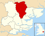 Braintree shown within Essex | |
| Sovereign state | United Kingdom |
| Constituent country | England |
| Region | East of England |
| Non-metropolitan county | Essex |
| Status | Non-metropolitan district |
| Admin HQ | Braintree |
| Incorporated | 1 April 1974 |
| Government | |
| • Type | Non-metropolitan district council |
| • Body | Braintree District Council |
| • Leadership | Leader & Cabinet (Conservative (council NOC)) |
| • MPs |
James Cleverly Priti Patel |
| Area | |
| • Total | 236.18 sq mi (611.71 km2) |
| Area rank | 68th (of 326) |
| Population (mid-2016 est.) | |
| • Total | 151,000 |
| • Rank | 129th (of 326) |
| • Density | 640/sq mi (250/km2) |
| • Ethnicity |
95.% White 1.1% Mixed 1.3% S.Asian 1.0% Black |
| Time zone | GMT (UTC0) |
| • Summer (DST) | BST (UTC+1) |
| ONS code |
22UC (ONS) E07000067 (GSS) |
| OS grid reference | TL7522 |
| Website |
www |
Braintree is a local government district in the English county of Essex, with a population (2011 census) of 147,084. Its main town is Braintree.
The main centres of population are Braintree, Witham and Halstead.
The district was formed on 1 April 1974 by the merger of the urban districts of Braintree and Bocking, Halstead, and Witham and (for list of Parishes) Braintree Rural District and Halstead Rural District.
References
External links
| Wikimedia Commons has media related to Braintree. |
- Enjoy Braintree District; places to stay, arts, museum, culture events listing by the Braintree Council
- Braintree District Council
- Enjoy Braintree District

Coordinates: 51°52′55″N 0°33′09″E / 51.8819°N 0.5525°E
This article is issued from
Wikipedia.
The text is licensed under Creative Commons - Attribution - Sharealike.
Additional terms may apply for the media files.