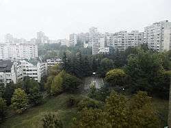
Braće Jerković

Braće Jerković or colloquially Jerković (Serbian Cyrillic: Браће Јерковић or Јерковић, pronounced [brât͡ɕɛː jɛ̌ːrkɔv̞it͡ɕ]) is an urban neighborhood of Belgrade, the capital of Serbia. It is located in Belgrade's municipality of Voždovac.
Location
Braće Jerković is located between the valleys of the former creeks of Kumodraški potok and Mokroluški potok. It borders the neighborhoods of Marinkova Bara (north), Dušanovac (north-west), Voždovac (west), Medaković II (north-east), Padina (east), while in the south it extends into the neighborhood of Braće Jerković II. It is bounded by the elbow-shaped street of the same name (on the west and south) and the street of Ignjata Joba (on the east). Northern border to Dušanovac and Marinkova Bara, just as it case with many neighborhoods of Belgrade, can not be clearly established, though majority of city maps place it between the Darvinova and Ignjata Joba streets.
Name and history
| Historical population | ||
|---|---|---|
| Year | Pop. | ±% |
| 1981 | 23,527 | — |
| 1991 | 25,801 | +9.7% |
| 2002 | 24,010 | −6.9% |
| 2011 | 23,162 | −3.5% |
| Source: [1][2][3][4] | ||
The name of the neighborhood means "Jerković Brothers" and it was named after two brothers, fighters during the World War II, who were both killed in 1941. Nebojša (1912-41), commander of the Mačva partisan detachment, and Dušan Jerković (1914–41), commander of the Užice partisan detachment, were both teachers. Dušan was killed during the Battle of Kadinjača, in November 1941, and was declared a National Hero of Yugoslavia. A street, today central one in the neighborhood, was named in their honor in 1946 so as the neighborhood which later developed around it.[5]
Characteristics
Even though it leans on the Voždovac's industrial zone along the Kumodraška street, the neighborhood itself is entirely residential, built since the 1960s and the newer sections consist solely of residential buildings. Population of the local community Braće Jerković was 13,413 in 1981, 13,225 in 1991, 11,453 in 2002 and 9,661 in 2011, while the combined population of Braće Jerković and Mitrovo Brdo was 23,162 in 2011 and is often named as one of the largest neighborhoods in both municipality of Voždovac and the city of Belgrade.[5]
The main feature in the neighborhood is the Centralno groblje ("central cemetery"), one of two main graveyards in urban Belgrade (the other one being the Novo groblje ("new cememtery") in Zvezdara. The church dedicated to Saint John the Baptist is within the cemetery complex.
A green area between the streets of Braće Jerković, Jovana Bijelića and Meštrovićeva was reconstructed in May 2017 and turned into a mini-park which covers and area of 890 m2 (9,600 sq ft). It has two children playgrounds and area for the senior citizens. New paths were placed so as the new lawn. Seedlings of the white birch were planted, so as the both deciduous and evergreen shrubs, including honeysuckle and Syrian rosemallow. In the vicinity of the park is a monument dedicated to Jerković brothers, erected in 1979.[5]
Braće Jerković II
Braće Jerković II or Veljko Vlahović (Serbian Cyrillic: Вељко Влаховић) was officially assigned name to the newer, southern extension of the neighborhood. It occupies the area between the streets of Braće Jerković, Pive Karamatijevića and Dragice Končar. Even though built in the 1970s, the name didn't live up and except for some official uses (like the real estate agencies advertising or the official style of the terminal station of the bus line 26). It was named after the Communist politician Veljko Vlahović (1914–75). In the early 2000s the name of the neighborhood was officially changed to Mitrovo Brdo. It had a population of 10,114 in 1981, 12,576 in 1991, 12,557 in 2002 and 13,501 in 2011.
Braće Jerković III
Eastern, residential extension of the neighborhood. It is located between the streets of Dragice Končar on the south, Ignjata Joba on the north and Svetozara Radojčića on the east, with Central cemetery on the north-west. Main street in the neighborhood is Indire Gandi.
References
- ↑ Osnovni skupovi stanovništva u zemlji – SFRJ, SR i SAP, opštine i mesne zajednice 31.03.1981, tabela 191. Savezni zavod za statistiku (txt file). 1983.
- ↑ Stanovništvo prema migracionim obeležjima – SFRJ, SR i SAP, opštine i mesne zajednice 31.03.1991, tabela 018. Savezni zavod za statistiku (txt file). 1983.
- ↑ Popis stanovništva po mesnim zajednicama, Saopštenje 40/2002, page 4. Zavod za informatiku i statistiku grada Beograda. 26 July 2002.
- ↑ Stanovništvo po opštinama i mesnim zajednicama, Popis 2011. Grad Beograd – Sektor statistike (xls file). 23 April 2015.
- 1 2 3 Branka Vasiljević (17 May 2017), "Obnovljen parkić u naselju Braće Jerković", Politika (in Serbian), p. 16
Coordinates: 44°46′09″N 20°29′20″E / 44.76917°N 20.48889°E