Bila Baxo
| Bila Baxo | |
|---|---|
| Neighborhood | |
|
300px | |
| Country | Cape Verde |
| Island | Fogo Island |
| City | São Filipe |
| Postal code | 8220 |
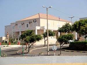
Bila Baxo (Portuguese: planalto) is the historic center of the city of São Filipe, being the second oldest town in the country after Ribeira Grande (now as Cidade Velha) founded in the 16th century. It is located in the western part by the Atlantic Ocean. Its length is about 600 to 700 meters and the ranges from 250 meters in the south to about 500 meters in the north and is bordered by two streamsm both of them named Ribeira da Trindade, the east is bordered near EN1-FG01, the island's circular route, One portion in the northeast where the basketball court is along with a square at Rua Cobom is not part of the neighborhood. Its elevation is 40 meters about sea level. The area at the beach is being the closest part of the island to Brava which is 18.1 km apart but not their nearby islets.
.jpg)
.jpg)
Bordering neighborboods is Santa Filomena to the East and, Lem de Maio and Lem de Baixo in the southeast and Achada de São Filipe to the south.

.jpg)

Its main streets are Cobom, Biblioteca (after its library) and Las Vegas.
History
In 1655 São Filipe was destroyed by Flemish pirates.[1] After what happened, Fortim Carlota was built in 1667 in the south part. The 1680 eruption did not affected the town. Houses with colonial architecture were built in the end of the 19th century. A merchant's house was built in 1820. The church of Nossa Senhora da Conceição (Our Lady of Conception) which was built in a comparatively simple style at the end of the 19th century.[2] Some of the houses in the center are dominated by sobrado style residential houses, the largest in Cape Verde. A town charter was not granted before 1922.[3] After it became a town, the city hall was built in 1928.[4] It was the city hall of Fogo until the breakup into two municipalities in 1991, it became the town hall of São Filipe.
Since 2000, many houses have been renovated. Many houses have a colourful or richly-decorated façade, wooden balconies or bay windows. In addition to picturesque streets with smaller colonial houses there are about 50 representative mansions to be seen. Some of the buildings have become museums including Casa da Memória and São Filipe Municipal Museum[5] opened on December 13, 2008.

After independence, some of the street names were changed, the square became 12 de Setembro.
World Heritage Site elevation plans
A plan to make the historic center as a World Heritage Site began as a nomination in 2004, one of eight in the tentative list. No plans have been made.[6]
About Bila Baxo
Its streets are mainly on the old fashioned system. Notable streets includes Rua Pensão Las Vegas, Rua Biblioteca Municipal where Fogo's chief library is located, Rua Mercado where the city market is Rua Tribunal and Rua Caixa Elétrica, where the public utility's office is located.

The most important catholic church of the town is Nossa Senhora da Conceição which was built in a comparatively simple style at the end of the 19th century.[2] The church with its two impressive clock towers was renovated several times. The last renovation was completed in 2007. Opposite the church there are several well-preserved colonial houses dating from the 18th century.
The Museum Casa da Memória is at Praça 12 de Setembro in a merchant's house which was built in 1820. The neighbouring house is the municipal museum (Museu Municipal). In its inner court several endemic plants of Fogo, some of which are endangered species, were planted, e.g. Crabo bravo (Erysimum caboverdiana) and Língua de vaca (Echium vulcanorum). A small house (Funco) was rebuilt in the traditional style using volcanic stones. A part of the pavement of the inner court consists of basalt stones. Southeast of the circle is São Filipe's post office.
Praia da Bila located in the west, a black beach, is 40 m below the city center. It is not very clean, and on many days the sea is very rough.[4]
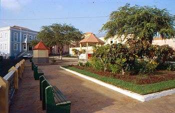
The historic place Praça Serpa Pinto is in the northwest of the center about 40 m above the beach Praia da Bila consisting of black volcanic sand. There are several colonial houses, monuments and a small park. The view point Miradouro da Bila Baxo in the northern part of the place offers a beautiful view of the beach and the neighbouring island of Brava and the surrounding islets.
In the south is Praça Alberto da Silva, a rectangular place with a small park and a chapel in a typical residential area seldom visited by tourists, is worth a visit. There are several shops, a bakery and a small internet café. The place offers a beautiful view of a part of the city and its surroundings. That portions has most of the buildings built during the 20th century.
Several hotels are in Bila Baxo including Las Vegas, Bela Vista and Savana (the dominant feature of the lower part of the island)
Landmarks and points of interest
- Praça 12 de Setembro
- Praça Alberto da Silva - south
- Praça Francisco d'Assis
- Praça Serpa Pinto - northwest
- São Filipe City Hall
- Nossa Senhora da Conceição church
- São Filipe Municipal Museum
- Casa da Memória
- Funco house
- Market Hall
- São Filipe Library
- Miradouro da Bila Baxo
- Fortim Carlota
- Seventh Day Adventist Church - eastern part
References
- ↑ Ingrid und Peter Kirschey: Kapverden, p. 156. Köln 2009
- 1 2 Susanne Lipps: Kapverdische Inseln, p. 253-254. Ostfildern 2009.
- ↑ Pitt Reitmeier: Cabo Verde - Kapverdische Inseln, p. 386. Bielefeld 2009.
- 1 2 Rolf Osang. Kapverdische Inseln, p. 134-135. Cologne 2001.
- ↑ "Ilha do Fogo - Históroa dos sobrados" [Fogo Island - History of Sobrados] (in Portuguese).
- ↑ "Town of São FIlipe". UNESCO's Tentative List of Turning to World Heritage Sites.
External links
Coordinates: 14°53′42″N 24°29′53″W / 14.895°N 24.498°W

