Bedburn Beck
| Bedburn Beck | |
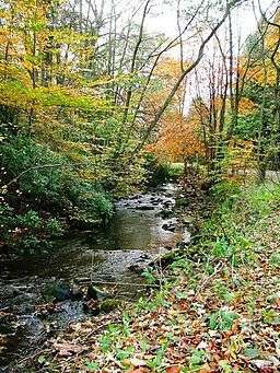
 Bedburn Beck in Hamsterley Forest | |
| Country | England |
|---|---|
| County | County Durham |
| Source | |
| - location | Woodland Fell |
| Mouth | |
| - location | River Wear |
| - coordinates | 54°41′05″N 1°48′00″W / 54.684743°N 1.800°WCoordinates: 54°41′05″N 1°48′00″W / 54.684743°N 1.800°W |
| Length | 16.8 km (10 mi) |
| Basin | 76 km2 (29 sq mi) |
| Discharge | for Bedburn |
| - average | 1.23 m3/s (43 cu ft/s) |
 Location of the mouth within County Durham | |
Bedburn Beck is a 16.8 kilometres (10.4 mi) long, upper tributary of the River Wear in County Durham, England. The beck and its tributaries, including the Euden, Harthorpe and South Grain becks, have a catchment area of 76 square kilometres (29 sq mi), much of which is covered by the coniferous Hamsterley Forest.[1][2][3][4][5]
Course
Its headwaters rise on the high ground of Woodland Fell, where it is known as the Spurlswood Beck which flows in an easterly direction through a rocky gill of the same name. It then enters Hamsterley Forest, where it is joined by the Euden Beck and becomes known as the Bedburn Beck.[1]
Passing beside the hamlet of Redford before being joined by the Ayhope or South Grain Beck, it then reaches the village of Bedburn where it is bridged by a minor road. Beyond the village it meets the Harthorpe Beck, before descending into the Wear valley between Hamsterley and Witton-le-Wear.[2]
Hydrology
The flow of the beck has been measured at a gauging station in its lower reaches at Bedburn since 1959. The catchment to the station of 75 square kilometres (29 sq mi) measures 99% of the total catchment of the beck, and yields an average flow of 1.23 cubic metres per second (43 cu ft/s).[6][7]
The highest river level recorded at the station occurred on the 17 July 2009, with a height of 2.31 metres (7 ft 7 in) and a flow of 79 cubic metres per second (2,800 cu ft/s).[8]
The catchment has an average annual rainfall of 894 millimetres (35.2 in) and a maximum altitude of 533 metres (1,749 ft) near Pawlaw Pike at the western edge of the basin.[9]
Land use within the basin is rural, consisting of moorland, grassland and the coniferous Hamsterley Forest.[9]
See also
References
- 1 2 "Bedburn Beck from Euden Beck to Wear". Catchment Data Explorer. Environment Agency. Retrieved 15 December 2016.
- 1 2 "Bedburn Beck from Source to Euden Beck". Catchment Data Explorer. Environment Agency. Retrieved 15 December 2016.
- ↑ "Euden Beck". Catchment Data Explorer. Environment Agency. Retrieved 15 December 2016.
- ↑ "Harthorpe Beck". Catchment Data Explorer. Environment Agency. Retrieved 15 December 2016.
- ↑ "South Grain Beck". Catchment Data Explorer. Environment Agency. Retrieved 15 December 2016.
- ↑ "24004 - Bedburn Beck at Bedburn Info". National Rivers Flow Archive. Centre for Ecology & Hydrology. Retrieved 15 December 2016.
- ↑ "24004 - Bedburn Beck at Bedburn Daily Flow Data". National Rivers Flow Archive. Centre for Ecology & Hydrology. Retrieved 15 December 2016.
- ↑ "24004 - Bedburn Beck at Bedburn Peak Flow Data". National Rivers Flow Archive. Centre for Ecology & Hydrology. Retrieved 15 December 2016.
- 1 2 "24004 - Bedburn Beck at Bedburn Catchment Info". National Rivers Flow Archive. Centre for Ecology & Hydrology. Retrieved 15 December 2016.
External links
| Wikimedia Commons has media related to Bedburn Beck. |