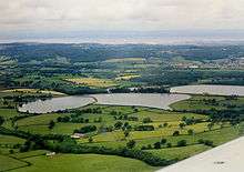
Barrow Gurney Reservoirs

Barrow Gurney Reservoirs (grid reference ST5468) (also known as Barrow Gurney Tanks or Barrow Tanks) are three artificial reservoirs for drinking water near the village of Barrow Gurney, which lies southwest of Bristol, England. They are known by their numbers rather than names.
They are fed by several springs including one which becomes the Land Yeo. Some of the outfall is also used to feed the river which flows to the Bristol Channel.
There are three reservoirs in total, one (Tank number three, 60 acres (24 ha) to the north of the A38 and two (Tank number one, 25 acres (10 ha) and number two, 40 acres (16 ha) to the south.
The reservoirs are operated by Bristol Water. The first opened in 1852 to store the water from the newly finished "Line of Works", but within two years it developed a leak and had to be drained for repair, causing serious disruption to Bristol's water supply.[1] Over the following decades, work was undertaken to improve the water quality. First with sand filters and in 1935 with chlorination [2]
During 1962 maximum output was increased from 26 million imperial gallons (120,000 m3) to 31 million imperial gallons (140,000 m3) a day by lowering the outlet of the filtered tank and duplicating inlets to the seven filters which received microstrained water.[3]

The stony banks on all the tanks provide a habitat for sedges.
Fishing (under permit) is generally for rainbow (Oncorhynchus mykiss, formerly Salmo iridia) and Brown trout (Salmo trutta morpha fario and S. trutta morpha lacustris).
References
- ↑ Scott, Shane (1995). The hidden places of Somerset. Aldermaston: Travel Publishing Ltd. p. 37. ISBN 1-902007-01-8.
- ↑ "Archived copy". Archived from the original on 2011-07-16. Retrieved 2009-11-14.
- ↑ Hodgson, Alan (1991). The story of the Bristol Waterworks Company 1939-1991. p. 35.
Coordinates: 51°24′33″N 2°39′46″W / 51.40915°N 2.66276°W