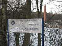
Bangour Village Hospital

Bangour Village Hospital was a psychiatric hospital located west of Dechmont in West Lothian, Scotland. It was officially opened in October 1906 (under the name Edinburgh District Asylum), over two years after the first patients were admitted in June 1904. In 1918 Bangour General Hospital was created in the grounds, but the hospital began winding down in 1989 with services being transferred to the newly built St. John's Hospital in the Howden area of Livingston. The final ward at Bangour eventually closed in 2004.
History
The hospital was modelled on the example of the Alt-Scherbitz asylum of the 1870s, at Schkeuditz, Germany, and represents one of the first village-plan psychiatric hospitals in Scotland.[1] The Bangour institution comprised individual villas which would house approximately 30 patients each. The village also incorporated its own railway connection, a farm, bakery, workshops, recreation hall, school, shop, library and, latterly, a multi-denominational church.
The hospital was requisitioned by the War Office during both wars when it became the "Edinburgh War Hospital" and "The Scottish Emergency Medical Hospital", reverting to a psychiatric hospital between the wars and after 1945. During the Second World War the patients were evacuated to Hartwoodhill Hospital.[2]:33
The number of patients rose to over 3,000 in 1918. Temporary marquees and prefabricated huts were erected to cope with the demand for bed space, for both patients and staff. This led to the creation of Bangour General Hospital in the surrounding grounds, which was to become a world leader in many medical fields, in particular its esteemed burns and plastic surgery unit which was established in 1940. It also had a 1st class Maternity Unit serving the whole of the county.
In 1989, St John's Hospital opened in nearby Livingston, and services were transferred from Bangour General Hospital, which closed in the early 1990s.[3] The Village Hospital also started to wind down after the opening of St Johns, with the last remaining ward closing in 2004.
The buildings
The hospital site comprises numerous buildings and structures, including 13 category A listed buildings. An architectural competition held in 1898 was won by Hippolyte Blanc. The villas are domestic in character, while the nurse's home is more institutional. The villas were set within landscaped grounds, and are built in a 17th-century Scottish Renaissance style, with numerous individual variations. At the centre of the site is an Edwardian Baroque hall, and a Romanesque style church, which was designed by H. O. Tarbolton and built 1924-1930.[1]
Railway branch line
When the hospital was built, road access was poor, and considerable volumes of coal and general stores were required for the running of the facility. A private railway line was built, branching from the former Edinburgh and Bathgate Railway line at Uphall. It was authorised by the Edinburgh and District Lunacy Board Act of 30 July 1900, and it was opened to passengers on 19 June 1905. It may have been used before that date in connection with construction of the hospital.
The North British Railway operated the line, but the Bangour station was considered private. However, there was an intermediate station at Dechmont, which was open to the public generally, and was much used by staff at the hospital who lived at Dechmont.
During World War I the road network was improved, and the railway became unnecessary; it was closed on 1 August 1921, although passenger services probably ceased on 4 May 1921.[4][5]
Present use
The closed hospital was used as a filming location for the 2005 film The Jacket, starring Keira Knightley and Adrien Brody.[6]
During September 2009, the hospital grounds were used as the site for "Exercise Green Gate", a counter-terrorist exercise run by the Scottish Government to test de-contamination procedures in the event of a nuclear, chemical or biological incident. This involved 250 volunteer "casualties" and 400 emergency staff.[7]
The site is now also popular with Urban Explorers people who enjoy exploring old and abandoned buildings, taking pictures to document their existence before they disappear due to either severe decay or demolition. The local health board however are not keen and as of 2005 have security patrolling the grounds to stop people entering the now dangerous and unstable buildings.
On 1 October 2015 Planning Permission for a residential and mixed use redevelopment of the former hospital site is being sought. The application notes some of the listed buildings at the site may be proposed for full demolition in a subsequent application. This may include villas 7,8,9 and 21, with other buildings potentially proposed for partial demolition. - "Buildings At Risk".
References
- 1 2 Historic Scotland. "Bangour Village Hospital Listed Building Report". Retrieved 2008-04-01.
- ↑ Gallacher, Mark. "From mental patient to service user: deinstitutionalisation and the emergence of the Mental Health Service User Movement in Scotland, 1971-2006." (PDF). theses.gla.ac.uk/. Glasgow University. Retrieved 26 July 2017.
- ↑ "Bangour General Hospital". Archived from the original on 2007-11-09. Retrieved 2008-04-01.
- ↑ John Thomas revised J S Paterson, A Regional History of the Railways of Great Britain: Volume 6, Scotland, the Lowlands and the Borders, David and Charles, Newton Abbot, 1984, ISBN 0 946537 12 7
- ↑ Gordon Stansfield, Lost Railways of the Lothians, Stenlake Publishing, Catrine, 2003, ISBN 1 84033 2700
- ↑ "The Jacket". Internet Movie Database. Archived from the original on 6 April 2008. Retrieved 2008-04-01.
- ↑ "Village hosts training exercise for treating radiation casualties". Edinburgh Evening News. 17 September 2009. Retrieved 2010-04-01.
External links
- Pictures of Bangour Village Hospital
- Bangour Village Hospital, by Dazzababes: a photoset on Flickr
- Bangour Village Hospital Villas 3, 4, and 5, by mybabyangel85: a photoset on Flickr
- Bangour Village Hospital - Before and After: A video on YouTube
- Bangour Village Hospital - Urban Exploration Photography
- Lothian Health Services Archive
Coordinates: 55°55′25″N 3°33′00″W / 55.92361°N 3.55000°W