Bà Rịa-Vũng Tàu Province
| Bà Rịa-Vũng Tàu Province Tỉnh Bà Rịa-Vũng Tàu | |
|---|---|
| Province | |
 | |
| Coordinates: 10°35′N 107°15′E / 10.583°N 107.250°ECoordinates: 10°35′N 107°15′E / 10.583°N 107.250°E | |
| Country |
|
| Region | Southeast |
| Capital | Bà Rịa |
| Former seat | Vũng Tàu (until 2 May 2012) |
| Government | |
| • People's Council Chair | Nguyễn Tuấn Minh |
| • People's Committee Chair | Trần Minh Sanh |
| Area[1] | |
| • Total | 1,989.5 km2 (768.2 sq mi) |
| Population (2015)[1] | |
| • Total | 1,072,600 |
| • Density | 540/km2 (1,400/sq mi) |
| Demographics | |
| • Ethnic groups |
97.53% Vietnamese[2] |
| Time zone | ICT (UTC+7) |
| Area codes |
64 (until 16 July 2017) 254 (from 17 June 2017) |
| ISO 3166 code | VN-43 |
| Website |
www |
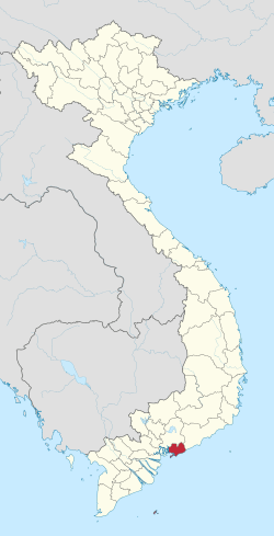
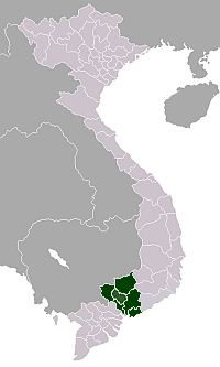
Bà Rịa-Vũng Tàu (Hanoi accent: [ɓa˨˩ ɹɨə˨˧ vuŋ˧ˀ˥ taʊ̯˨˩], Saigon accent: [ɓa˨˩ ɹɨə˨˧ vuŋ˧˩˧ taːw˨˩]) is a province of Vietnam. It is located on the coast of the country's Southeast region. It also includes the Côn Đảo islands, located some distance off Vietnam's southeastern coast. From 1954 to 1975, this province belonged to South Vietnam with the name Phước Tuy.
History
With the exception of the Côn Đảo islands, all of Bà Rịa-Vũng Tàu Province was once a part of Đồng Nai Province to the north. In 1979, Vũng Tàu was broken away from Đồng Nai and merged with the Côn Đảo islands (formerly part of Hậu Giang Province), forming the new Vũng Tàu-Côn Đảo "special zone". Later, in 1992, Bà Rịa broke away from Đồng Nai Province, merging with Vũng Tàu-Côn Đảo to form the modern province of Bà Rịa-Vũng Tàu.
Administrative divisions
Bà Rịa-Vũng Tàu is subdivided into 8 district-level sub-divisions:
- 6 districts:
- 2 provincial cities:
They are further subdivided into 8 commune-level towns (or townlets), 49 communes, and 25 wards.
Demographics
According to 2015 statistics from the General Statistics Office of Vietnam, the province has a population of 1,072,600.[1] Urbanization in the province is above the country's average (50.52%).[3]
Economy
Bà Rịa-Vũng Tàu provincial economic activities include: petroleum (the most important), electricity at the Phú Mỹ Power Plants and Bà Rịa Power Plant (accounting for approx. 40% of the country's total power capacity), petrochemicals: Phu My Urea Plant (800,000 metric tonnes per year, polyethylene (100,000 metric tonnes/year), steel production, and cement production. Tourism, commerce and fishing are also important economic activities of the province. Bà Rịa–Vũng Tàu contributes greatly to the country's budget. In 2005, it accounted for around 24 percent of Vietnam's budget (42,000 billion dong) of a total of 180,000 billion dong (exchange rate is 16,000 dong/dollar), ranking second, after Ho Chi Minh City before Hanoi (28,000 billion dong in 2005). The provincial GDP per capita ranks second to none in the country, over $4,000, if excluding petroleum GDP, it is over $2000 (Hồ Chí Minh City ranks second with this index $1,850). In term of living standards, Bà Rịa-Vũng Tàu ranks third, behind Hồ Chí Minh City and Hanoi.
Bà Rịa-Vũng Tàu is also one of the leading direct foreign investment (FDI) attractions of Vietnam, in the top five of FDI acquisition provinces of Vietnam. In tourism, there are some big projects licensed or to be licensed soon: Saigon Atlantis resort (capitalized USD 300 million), Vũng Tàu Aquarium and Bàu Trũng entertainment park ($500), and Xuyên Mộc safari ($200).
Vũng Tàu is an important tourist destination, being particularly well known for its beaches, for its colonial-era architecture, and the Christ of Vũng Tàu, a large statue built by Vietnam's Catholic minority. It was completed in 1974, with the height of 32 metres and two outstretched arms spanning 18.4 metres. It is among the tallest statues of Christ in Asia. Among the most famous tourist destinations are the existing very popular and crowded beaches of Vũng Tàu and Long Hải and the new up and coming destinations of Hồ Tràm and Hồ Cốc located further along the South China Sea coast. The main media agency in the province is the Bà Rịa-Vũng Tàu Daily Newspaper.
Gallery
- Vũng Tàu, the province's largest city
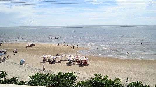
 Beach at Long Hải, a tourist attraction
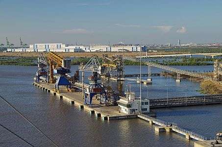
 Port in Phú Mỹ, an industrial town
References
- 1 2 3 "Số liệu thống kê – Diện tích, dân số và mật độ" [Interractive statistics tables – Area, population and density] (To access, click the desired location in column 1 (Địa phương), click "2015" in column 2 (Năm), and click the desired field in column 3 (Chỉ tiêu): click Diện tích for Area, Dân số for Population, and Mật độ dân số for Population density) (in Vietnamese). General Statistics Office of Vietnam. Retrieved 5 January 2017.
- ↑ "Area and Population". Ba Ria-Vung Tau People's Committee. Retrieved 5 January 2017.
- ↑ "Diện tích và dân số" [Area and population] (in Vietnamese). Ba Ria-Vung Tau People's Committee. Retrieved 5 January 2017.
External links
- Official website (in Vietnamese)
- Official English website
-
 Media related to Bà Rịa-Vũng Tàu Province at Wikimedia Commons
| Adjacent places of Bà Rịa-Vũng Tàu Province | ||||
|---|---|---|---|---|
 |
Đồng Nai Province | Đồng Nai Province | Bình Thuận Province |  |
| Ho Chi Minh City | |
East Sea | ||
| ||||
| | ||||
| Bến Tre Province | East Sea | East Sea | ||
