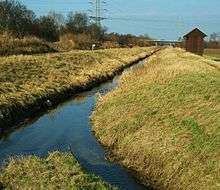
Auer (Odenwald)
The Auer (also called Mühlbach or Ziegelbach) springs from the western edge of the Felsberg in the Hessian Odenwald between Balkhausen and Bensheim-Hochstädten.
| Auer | |
|---|---|
 Mouth of the Auer | |
| Country | Germany |
| Location | Odenwald, Hesse |
| Basin features | |
| River system | Rhine |
| Physical characteristics | |
| Length | 6.7 km (4.2 mi) |
It is a river in Hesse, Germany, that measures 6.7 kilometers in length and is part of the Rhine river system.
Table of Contents
- Mühlbach
- Auerbach
- Ziegelbach
- References
- Links
Mühlbach
The Auer is reinforced in its course by ten further tributaries and flows through the Bensheim district of Hochstädten, past the Marionite factory and the Goethe Fountain through the Mühltal towards Bensheim-Auerbach. In the Mühltal there were (in the past) seven mills, which were powered by the water of the Auer. This is why the brook, in the Volksmund, is also called Mühlbach. The village mill in the village center is now a wine cellar, another mill is now a nursing home, another mill is now a studio and residential house of an artist based in Auerbach. The other four mills (Kadels, Wiemers, Mößingers and Jungmühle) are used as residential houses. [1]
To the north, the Auerberg mountain is on the border of Mühltal along with Auerbach castle - an old castle ruin - and south of the state capital Fürstenlager.
Auerbach
In the district of Bensheim-Auerbach, the Auer splits into two streams. The ever-recurring floods of the Bachgasse led to the construction of the largest part of the Auer in the 1980s. [2] According to the model of the Freiburger Bächle, an always unchanged part of the Auer flows through the Bachgasse, through the old village of Auerbach, past numerous houses towards Bundesstraße 3 (Darmstädter Straße).
Ziegelbach
After the two streams have been brought together, the Auer crosses the federal road (underground) and flows towards the Auerbach station. Since around 1850 there is a brick and porcelain factory, called Ziegelbach [3].
After crossing the railway line Darmstadt-Heidelberg, it flows (after approximately 1 km) into the Bensheim, before it turns into the Winkelbach river, which flows at Gernsheim in the Rhine .
The total length of the Auer from the source to the mouth is 6.7 km.
References
- Stadtteild documentation Bensheim-Auerbach
- ↑ Report in the newspaper report of 29 April 2011: Flood in Auerbach
- ↑ Landesamt für Denkmal-Pflege Hessen: Porcelain factory
Links
Commons: Auerauerbach - Collection of pictures, videos and audio files
See also
Coordinates: 49°42′08″N 8°36′06″E / 49.70222°N 8.60167°E