Arugot
| Arugot | |
|---|---|
 | |
 Arugot | |
| Coordinates: 31°44′4.92″N 34°46′14.51″E / 31.7347000°N 34.7706972°ECoordinates: 31°44′4.92″N 34°46′14.51″E / 31.7347000°N 34.7706972°E | |
| Council | Be'er Tuvia Regional Council |
| Affiliation | Moshavim Movement |
| Founded | 1949 |
| Founded by | Polish and Romanian immigrants |
| Population (2015)[1] | 1,124 |
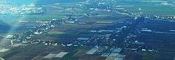
Arugot (Hebrew: עֲרוּגוֹת, lit. Flowerbeds) is a moshav in central Israel. Located near Kiryat Malakhi, it falls under the jurisdiction of Be'er Tuvia Regional Council. In 2015 its population was 1,124.[1]
History
The moshav was founded in 1949 by immigrants from Poland and Romania on the land belonging to the depopulated Arab village of Qastina.[2] Its name was taken from Chapter 17, verse 7 of the Book of Ezekiel.[3]
References
- 1 2 "List of localities, in Alphabetical order" (PDF). Israel Central Bureau of Statistics. Retrieved 16 October 2016.
- ↑ Khalidi, Walid (1992). All That Remains: The Palestinian Villages Occupied and Depopulated by Israel in 1948. Washington D.C.: Institute for Palestine Studies. p. 131. ISBN 0-88728-224-5. ISBN 0-88728-224-5.
- ↑ Mapa's concise gazetteer of Israel (in Hebrew). Yuval Elʻazari (ed.). Tel-Aviv: Mapa Publishing. 2005. p. 435. ISBN 965-7184-34-7.
This article is issued from
Wikipedia.
The text is licensed under Creative Commons - Attribution - Sharealike.
Additional terms may apply for the media files.