List of counties in Arizona
| Counties of Arizona | |
|---|---|
| Category | Federal Unit |
| Location | State of Arizona |
| Number | 15 |
| Populations | 7,754 (Greenlee) – 3,990,181 (Maricopa) |
| Areas | 1,238 square miles (3,210 km2) (Santa Cruz) – 18,661 square miles (48,330 km2) (Coconino) |
| Government | County government |
| Subdivisions | cities, towns, unincorporated communities, census designated place |
There are 15 counties in the U.S. state of Arizona.[1] Four counties (Mohave, Pima, Yavapai and Yuma) were created in 1864 following the organization of the Arizona Territory in 1862. The now defunct Pah-Ute County was split from Mohave County in 1865, but merged back in 1871. All but La Paz County were created by the time Arizona was granted statehood in 1912.[2]
Eight of Arizona's fifteen counties are named after various Native American groups that are resident in parts of what is now Arizona, with another (Cochise County) being named after a native leader. Four other counties, Gila County, Santa Cruz County, Pinal County, and Graham County, are named for physical features of Arizona's landscape: the Gila River, the Santa Cruz River, Pinal Peak, and Mount Graham, respectively. Another county, La Paz County, is named after a former settlement, while the final county, Greenlee County, is named after one of the state's early pioneers.[3]
Arizona's postal abbreviation is AZ and its FIPS code is 04.
Alphabetical listing
| County |
FIPS County Code [4] |
County seat [5] |
Est. [5] |
Formed from [2] |
Etymology [3] |
Population [5][6] |
Area [5][6] |
Map |
|---|---|---|---|---|---|---|---|---|
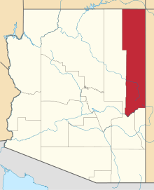
| Apache County | 001 | St. Johns | 1879 | Yavapai County | The Apache (Ndee) people. Apache is an exonym from Zuni ʔapaču "Navajos" or Yavapai ʔpačə "enemy". | 69,980 | 11,218 sq mi (29,054 km2) | 
|
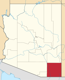
| Cochise County | 003 | Bisbee | 1881 | Pima County | Cochise, a Chiricahua Apache chief and leader of an 1861 uprising. Cochise is an anglicisation of K'uu-ch'ish "oak". | 127,866 | 6,219 sq mi (16,107 km2) | 
|
| Coconino County | 005 | Flagstaff | 1891 | Yavapai County | Coconino is a former designation for the Havasupai, Hualapai, and/or Yavapai, derived from the Hopi exonym Kohonino. | 134,421 | 18,661 sq mi (48,332 km2) | 
|
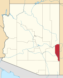
| Gila County | 007 | Globe | 1881 | Maricopa and Pinal Counties | The Gila River, a tributary of the Colorado. Possibly from Apache dzil "mountain," via Spanish Xila. | 51,994 | 4,796 sq mi (12,422 km2) | 
|
| Graham County | 009 | Safford | 1881 | Apache and Pima Counties | Mount Graham, in the Pinaleños. Mt. Graham itself is named for topographical engineer James Duncan Graham.[7] | 34,769 | 4,641 sq mi (12,020 km2) | 
|
| Greenlee County | 011 | Clifton | 1909 | Graham County | Mason Greenlee, early prospector. Named by an amendment initially intended to delay the bill creating "Lincoln County".[8] | 7,754 | 1,848 sq mi (4,786 km2) | 
|
| La Paz County | 012 | Parker | 1983 | Yuma County | La Paz, Arizona, a historic boomtown on the Colorado River. A common placename, La Paz means "The Peace" in Spanish. | 20,172 | 4,513 sq mi (11,689 km2) | 
|
| Maricopa County | 013 | Phoenix | 1871 | Pima and Yavapai Counties | The Maricopa (Piipaash) people. First attested in Spanish as Cocomaricopa, no origin or meaning is definitively known. | 3,990,181 | 9,224 sq mi (23,890 km2) | 
|
| Mohave County | 015 | Kingman | 1864 | — | The Mohave (Aha Makhav) people. The Mohave endonym means "along the water," referring to the Colorado.[9] | 194,944 | 13,470 sq mi (34,887 km2) | 
|
| Navajo County | 017 | Holbrook | 1895 | Apache County | The Navajo (Diné) people. Navajo is an exonym from Tewa Navahu "big field," referring to the San Juan River Valley | 111,273 | 9,959 sq mi (25,794 km2) | 
|
| Pima County | 019 | Tucson | 1864 | — | The Pima (Akimel O'odham) people. Pima is a Spanish exonym from the O'odham phrase pi mac "(I) don't know," presumably heard during initial encounters. | 1,003,235 | 9,189 sq mi (23,799 km2) | 
|
| Pinal County | 021 | Florence | 1875 | Maricopa and Pima counties | Pinal Peak, possibly from Spanish pinal "place of pines". Pinal Peak is now within the borders of Gila County. | 324,962 | 5,374 sq mi (13,919 km2) | 
|
| Santa Cruz County | 023 | Nogales | 1899 | Cochise and Pima counties | Santa Cruz River, a tributary of the Gila. A common placename, Santa Cruz means "Holy Cross" in Spanish. | 42,845 | 1,238 sq mi (3,206 km2) | 
|
| Yavapai County | 025 | Prescott | 1864 | — | The Yavapai people. The Yavapé are one of four major Yavapai bands. | 212,635 | 8,128 sq mi (21,051 km2) | 
|
| Yuma County | 027 | Yuma | 1864 | — | Yuma is a former name of the Quechan people, derived from the O'odham exonym Yumĭ. | 190,557 | 5,519 sq mi (14,294 km2) |  |
Defunct counties
- Pah-Ute County (1865–1871), now part of Clark County, Nevada and Mohave County, Arizona
Proposed counties
- Sierra Bonita County was proposed at the 13th Arizona Territorial Legislature in 1885, with Willcox proposed as the county seat. The proposal died by one vote. [10]
It has also been proposed that Maricopa County be split in two at approximately 112.1°W.
See also
- Bannon County, a fictional county in Arizona, was the site of the UFO crash in the film Hangar 18.
- Arizona Association of Counties
References
- ↑ "Find A County". uscounties.org. Retrieved 2012-04-07.
- 1 2 Adams, Ward R. (1997). History of Arizona. Higginson Book Company. ISBN 0-8328-7044-7.
- 1 2 Kane, Joseph & Aiken, Charles (2004). The American Counties: Origins of County Names, Dates of Creation, and Population Data, 1950-2000. Scarecrow Press. ISBN 0-8108-5036-2.
- ↑ "EPA County FIPS Code Listing". EPA. Archived from the original on 2004-09-28. Retrieved 2007-04-09.
- 1 2 3 4 National Association of Counties. "NACo - Find a county". Archived from the original on 2005-04-10. Retrieved 2008-04-30.
- 1 2 "Arizona QuickFacts". U.S. Census Bureau. Archived from the original on 2008-10-06. Retrieved 2007-07-17. (2000 Census)
- ↑ "A Little Bit of Mount Graham History". University of Arizona. Archived from the original on 2014-02-27. Retrieved 2015-03-0. Check date values in:
|access-date=(help) - ↑ "History of Greenlee County: Mason Greenlee". Greenlee County Government. Archived from the original on 2014-02-19. Retrieved 2007-07-20.
- ↑ "The Name Mojave". Mojave Desert Heritage and Cultural Association. Archived from the original on 2015-02-13. Retrieved 2015-03-01.
- ↑ McClintock, James H. (1916). Arizona, Prehistoric, Aboriginal, Pioneer, Modern: The Nation's Youngest Commonwealth Within a Land of Ancient Culture, Volume 2. Arizona: S. J. Clarke publishing Company. p. 334. Retrieved 17 February 2017.

