Antonio (Nery) Juarbe Pol Airport
| Antonio (Nery) Juarbe Pol Airport | |||||||||||
|---|---|---|---|---|---|---|---|---|---|---|---|
| Summary | |||||||||||
| Airport type | Public | ||||||||||
| Owner | Puerto Rico Ports Authority | ||||||||||
| Serves | Arecibo, Puerto Rico | ||||||||||
| Elevation AMSL | 23 ft / 7 m | ||||||||||
| Coordinates | 18°27′04″N 066°40′32″W / 18.45111°N 66.67556°WCoordinates: 18°27′04″N 066°40′32″W / 18.45111°N 66.67556°W | ||||||||||
| Map | |||||||||||
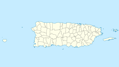
 ABO Location of airport in Puerto Rico | |||||||||||
| Runways | |||||||||||
| |||||||||||
| Statistics (1998) | |||||||||||
| |||||||||||
Antonio (Nery) Juarbe Pol Airport (IATA: ARE, ICAO: TJAB, FAA LID: ABO) is a public use airport located three nautical miles (6 km) of the central business district of Arecibo, Puerto Rico. It is owned by the Puerto Rico Ports Authority.[1] This airport is included in the National Plan of Integrated Airport Systems for 2011–2015, which categorized it as a general aviation airport.[2]
Although most U.S. airports use the same three-letter location identifier for the FAA and IATA, Antonio (Nery) Juarbe Pol Airport is assigned ABO by the FAA and ARE by the IATA (which assigned ABO to Aboisso Airport in Aboisso, Côte d'Ivoire). The airport's ICAO identifier is TJAB.[3][4]
History
World War II
During World War II, the airport was used by the United States Army Air Forces Sixth Air Force conducting antisubmarine patrols. It was known as Arecibo Field. Flying units using the airfield were:
- 32d Fighter Squadron (36th Fighter Group) 11 December 1941 – 19 February 1942; 19 February – 9 March 1942 (P-36 Hawk)
- 23rd Fighter Squadron (36th Fighter Group), 11 March – 16 May 1943 (P-39 Airacobra)
Name
The airport was named after a prominent Arecibo-born businessman and pilot, who perished along with his wife and two passengers, on a flight from Isla Grande airport in San Juan to Arecibo on Mother's day, 1979. His wife's body was recovered the next day being picked up by fishermen from La Perla in San Juan. His body, the two other passengers, and the aircraft (a Cessna) were recovered from the sea on Father's day 1979. They were visiting his parents in San Juan for Mother's day. The weather was particularly rough that evening and it's believed to be the cause of the accident.
Facilities and aircraft
Antonio (Nery) Juarbe Pol Airport covers an area of 178 acres (72 ha) at an elevation of 23 feet (7 m) above mean sea level. It has one runway designated 8/26 with an asphalt surface measuring 3,975 by 60 feet (1,212 × 18 m).[1]
For the 12-month period ending March 17, 1998, the airport had 1,836 aircraft operations, an average of 153 per month: 65% general aviation, 21% air taxi, and 14% military.[1]
Antonio (Nery) Juarbe Pol Airport also has a large number of light-sport aircraft and ultralights. It has become the main center of Sport Aviation in Puerto Rico. The airport is very popular with skydiving community, with a private skydiving school located there.
References
- 1 2 3 4 FAA Airport Master Record for ABO (Form 5010 PDF). Federal Aviation Administration. Effective April 5, 2012.
- ↑ "2011–2015 NPIAS Report, Appendix A" (PDF). National Plan of Integrated Airport Systems. Federal Aviation Administration. October 4, 2010. Archived from the original (PDF, 2.03 MB) on 2012-09-27.
- ↑ Great Circle Mapper: ARE / TJAB – Arecibo, Puerto Rico
- ↑ Great Circle Mapper: ABO / DIAO – Aboisso, Côte d'Ivoire
- ↑
 This article incorporates public domain material from the Air Force Historical Research Agency website http://www.afhra.af.mil/.
 - ↑ Maurer, Maurer (1969), Combat Squadrons of the Air Force, World War II, Air Force Historical Studies Office, Maxwell AFB, Alabama. ISBN 0-89201-097-5
External links
- XtremeDivers.com
- Fly4Fun
- Resources for this airport:
- FAA airport information for ABO
- AirNav airport information for TJAB
- ASN accident history for ARE
- FlightAware airport information and live flight tracker
- SkyVector aeronautical chart for TJAB
.jpg)