Antarctandes

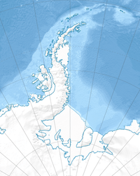
The Antarctandes (Antartandes in Spanish), also known as the Antarctic Peninsula cordillera,[1] is the mountain range that is located on the northern Antarctic Peninsula, in the Graham Land and Palmer Land regions of Antarctica
Geology
Some geologists consider the Antartandes a southernmost continuation of the Andes Range System on Antarctica. According to this theory the Andes start at the border between Colombia and Venezuela; run along western South America; submerge into the Atlantic Ocean to the east of Tierra del Fuego to form the underwater Scotia Arc mountain range; resurface periodically in the Shag Rocs, South Georgia and the South Sandwich Islands, South Orkney Islands and South Shetland Islands; and finally resurfacing on the northern Antarctic Peninsula. Chile calls the peninsula Tierra de O'Higgins, and Argentina Tierra de San Martín.
Geography
The highest mountain of the Antartandes is Mount Coman (3,657 m) in the Eternity Range section in Palmer Land. Mount Hope (2,860 m) is also in the range.
Southwest of the Antartandes are the Ellsworth Mountains, a low mountain range much-covered by glaciers in Palmer Land; and then the major transcontinental Transantarctic Mountains System begins. To the southeast of the peninsula, the Antarctic Plateau extends to the South Pole.
The Antartandes range is claimed by Argentina for Argentine Antarctica, Chile for Chilean Antarctic Territory, and the United Kingdom for the British Antarctic Territory. All these claims are frozen by Article 4 of the 1960s Antarctic Treaty System.
See also
- Antarctic Peninsula topics