Ancient trackway
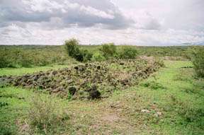
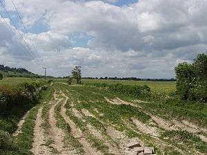
Ancient trackway can refer to any track or trail whose origin is lost in antiquity. Such paths existed from the earliest prehistoric times and in every inhabited part of the world. Many ancient trackways can still be seen and walked in the United Kingdom and Ireland.
History
The Concise Oxford Dictionary gives the definition of "trackway" as "a path formed by the repeated treading of people or animals". Over time, many of these trackways were developed into roads. Many trackways, of both animals and people, have been preserved in volcanic ash or bog land, and reveal historical details of life in ancient times.
Africa
Tanzania

Some of the earliest trackways for human ancestors have been discovered in Tanzania. The Laetoli trackway is famous for the hominin footprints preserved in volcanic ash. After the footprints were made in powdery ash, soft rain cemented the ash layer to tuff, preserving the prints. The hominid prints were produced by three individuals, one walking in the footprints of the other, making the original tracks difficult to discover. As the tracks lead in the same direction, they might have been produced by a group — but there is nothing else to support the common reconstruction of a nuclear family visiting the waterhole together.
South Africa
In South Africa, two ancient trackways have been found containing footprints, one at Langebaan and one at Nahoon. Both trackways occur in calcareous eolianites or hardened sand dunes. At Nahoon, trackways of at least five species of vertebrates, including three hominid footprints, are preserved as casts.[1] The prints at Langebaan are the oldest human footprints, dated to approximately 117,000 years old.[2]
United States

In the United States, dinosaur footprints and trackways are found in the Glen Rose Formation, the most famous of these being the Paluxy River site in Dinosaur Valley State Park. These were the first sauropoda footprints scientifically documented, and were designated a US National Natural Landmark in 1969. Some are as large as about 3 feet across. The prints are thought to have been preserved originally in a tidal flat or a lagoon.[3] There are tracks from two types of dinosaur. The first type of tracks are from a sauropoda and were made by an animal of 30 to 50 feet in length, perhaps a brachiosaurid such as Pleurocoelus,[3] and the second tracks by a theropoda, an animal of 20 to 30 feet in length, perhaps an Acrocanthosaurus. A variety of scenarios was proposed to explain the tracks, but most likely represent twelve sauropods "probably as a herd, followed somewhat later by three theropods that may or may not have been stalking -- but that certainly were not attacking." [3]
Europe
Ireland
In Ireland, in the Iron Age, the Corlea trackway is an ancient road built on a bog consisting of packed hazel, birch and alder planks placed lengthways across the track, and occasional cross timbers for support. Other bog trackways or "toghers" have also been discovered dating to around 4000 BC. The Corlea trackway dates from approx 148 BC and was excavated in 1994. It is the largest trackway of its kind to be uncovered in Europe. Other examples of this type of trackway can be seen in England (Somerset Levels) and Germany.[4]
Great Britain
In Roman Britain, many trackways were built upon by the Romans to form the foundations for their roads. Prior to this, people used trackways to travel between settlements but this was unsuitable for the swift movement of troops and equipment.[5]


These settlements were connected with each other by the ancient trackways, sometimes referred to as green ways. The tracks often followed natural contours in the landscape, and evolved over time as animals were driven from place to place and people walked to and from neighbouring settlements. Much of the land was forested; the lower valleys provided fertile land and were ideal places for fishing, agriculture and the rearing of cattle.
The trackways provided links between farmsteads and fields, other farmsteads, and neighbouring long barrow tombs. Trackways also joined the separate localities to the camp meeting places and cross-country flint roads. Others were more likely to have been processional ways, such as the one leading to the gigantic temple at Avebury in Wiltshire. Long distance ways included those now known as
- the Icknield Way, running over 100 miles (161 km) from Buckinghamshire to Norfolk,
- the Ridgeway National Trail, running 85 miles (137 km) along chalk hills from Wiltshire to Buckinghamshire,
- the Harrow Way and
- the Pilgrims' Way in the North Downs.
- the Mariners' Way in Devon
- the Saints' Way in Cornwall
Some trackways followed the tops of higher land, whilst others progressed along the lower slopes. The lowland areas were thickly forested and poorly drained and for long distance travel there was an advantage in following the top of a line of hills or ridgeways. The Ridgeway in fact probably ran from The Wash along the chalk escarpment across Britain via Avebury to the English Channel across Salisbury Plain, a much longer route than the current national footpath suggests.
The skills needed to develop tracks across boglands, such as those in the Somerset Levels, were learnt by early people. Known as corduroy roads, they were formed when huge quantities of alder poles and brushwood were used to link the fen islands across the marshes. The Sweet track in the Glastonbury fens, Somerset is believed to be the oldest purpose built road in the world and has been dated to the 3800s BC.
On occasion, where rivers caused an obstacle to progress, bridges were built across them, and several roads met to use the bridge. Major settlements grew around the bridges, providing sustenance to travellers and their animals using the trackways. There are many good examples of this: three follow.
Wallingford
The original settlement at Wallingford in Oxfordshire dates back to the dawn of British history, when its founders showed remarkable discrimination in choosing its site. Nestling in a fertile valley on the banks of the River Thames, it was an ideal place for fishing, agriculture and the rearing of cattle. The ancient trackways, in particular the Icknield Way, provided lines of communication converging on its ford. The remains of the ramparts still surround the town and are the successors of the rudimentary fortifications of the old British settlement, which were adapted in turn by Roman, Anglo Saxon and Norman conquerors.
Brownhills
A similar site is Brownhills in West Midlands. Brownhills has been a meeting point for ancient roads and trackways since prehistoric times. It is thought that the Watling Street was in use before the Romans came and predates Roman roads; what were later called the Chester Road and Coventry Road are also thought to have been ancient trackways.
Cadbury Castle and South Cadbury Village
Cadbury Castle in Somerset is an Iron Age camp covering some 18 acres (73,000 m²) and is considered to be one of the most impressive Iron Age sites in Britain. It is the focal point of many ancient trackways and is guarded by four huge banks with a height in places of over 40 feet (12 m) from the bottom of the ditch.
Germany
The Wittmoor Bog Trackways are two prehistoric boardwalks or trackways discovered in Wittmoor in northern Hamburg.
Leylines
The existence of leylines and their relationship with ancient trackways was first suggested in 1921 by the amateur archaeologist Alfred Watkins, in his books Early British Trackways and The Old Straight Track. Watkins theorized that these alignments were created for ease of overland trekking on ancient trackways during neolithic times and had persisted in the landscape over millennia.[6][7]
See also
References
- ↑ Last Interglacial Hominid and Associated Vertebrate Fossil Trackways in Coastal Eolianites, South Africa, 2008
- ↑ South Africa West Coast article on Langebaan footprints
- 1 2 3 Martin Lockley & Adrian P. Hunt, Dinosaur Tracks and Other Fossil Footprints of the Western United States, Columbia U. Press, New York (1995)
- ↑ Corlea Trackway
- ↑ Dartford Town Archive - Roman and Saxon Roads and Transport
- ↑ Watkins, Alfred Watkins (1925). The old straight track: its mounds, beacons, moats, sites, and mark stones. Methuen & Co Ltd.
- ↑ BBC Hereford and Worcester - Ley Lines explored
