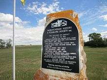
Amulet, Saskatchewan
Amulet is an unincorporated community in Norton Rural Municipality No. 69, Saskatchewan, Canada. It previously held the status of a village until January 1, 1965. The community has a population of 33 people.

The townsite was formally founded in 1911 when the railway station was constructed in 1910. A post office, a general store, and two grain elevators were also built in 1910, but all were closed in 1973. A school was also built in 1910 and a second room added in 1919, but it was closed in 1961. St. Boniface Anglican Church was built in 1916, but moved to Weyburn Heritage Village in 1990.[1]
History
Prior to January 1, 1965, Amulet was incorporated as a village, and was restructured as an unincorporated community under the jurisdiction of the Rural municipality of Norton on that date.[2]
Demographics
| Canada census – Amulet, Saskatchewan community profile | |||
|---|---|---|---|
| Population: | |||
| Land area: | |||
| Population density: | |||
| Median age: | |||
| Total private dwellings: | |||
| Median household income: | |||
| References: earlier[3] | |||
Climate
| Climate data for Amulet, Saskatchewan | |||||||||||||
|---|---|---|---|---|---|---|---|---|---|---|---|---|---|
| Month | Jan | Feb | Mar | Apr | May | Jun | Jul | Aug | Sep | Oct | Nov | Dec | Year |
| Record high °C (°F) | 11 (52) |
16.5 (61.7) |
22.2 (72) |
32 (90) |
38 (100) |
40 (104) |
40 (104) |
39 (102) |
37 (99) |
33 (91) |
23 (73) |
14.5 (58.1) |
40 (104) |
| Average high °C (°F) | −8.9 (16) |
−5 (23) |
1.5 (34.7) |
11.1 (52) |
18.4 (65.1) |
23.1 (73.6) |
25.8 (78.4) |
25.7 (78.3) |
18.9 (66) |
11.7 (53.1) |
0.5 (32.9) |
−6.3 (20.7) |
9.7 (49.5) |
| Average low °C (°F) | −19.1 (−2.4) |
−14.9 (5.2) |
−8.9 (16) |
−1.6 (29.1) |
4.9 (40.8) |
9.7 (49.5) |
11.9 (53.4) |
11 (52) |
5.2 (41.4) |
−0.8 (30.6) |
−9.1 (15.6) |
−16.2 (2.8) |
−2.3 (27.9) |
| Record low °C (°F) | −39.4 (−38.9) |
−40 (−40) |
−35 (−31) |
−25 (−13) |
−8.5 (16.7) |
−1.5 (29.3) |
3.3 (37.9) |
−1.5 (29.3) |
−9 (16) |
−21 (−6) |
−32 (−26) |
−42 (−44) |
−42 (−44) |
| Average precipitation mm (inches) | 25.1 (0.988) |
19.9 (0.783) |
29.6 (1.165) |
30.5 (1.201) |
61.3 (2.413) |
68.3 (2.689) |
61 (2.4) |
43.5 (1.713) |
35.1 (1.382) |
21.9 (0.862) |
17.8 (0.701) |
24.8 (0.976) |
438.8 (17.276) |
| Average snowfall cm (inches) | 24.9 (9.8) |
19.3 (7.6) |
26 (10.2) |
11.7 (4.61) |
6.8 (2.68) |
0.1 (0.04) |
0 (0) |
0 (0) |
1.1 (0.43) |
6.7 (2.64) |
16.9 (6.65) |
24.3 (9.57) |
137.8 (54.25) |
| Source: Environment Canada[4] | |||||||||||||
See also
References
- ↑ Village of Amulet, Waymarking
- ↑ "Restructured Villages". Saskatchewan Ministry of Municipal Affairs. Archived from the original on March 25, 2008. Retrieved 2008-02-10.
- ↑ "2001 Community Profiles". Canada 2001 Census. Statistics Canada. February 17, 2012.
- ↑ "Canadian Climate Normals 1971–2000". Environment Canada. Retrieved May 5, 2013.
Coordinates: 49°37′N 104°45′W / 49.62°N 104.75°W