Altenkunstadt
| Altenkunstadt | ||
|---|---|---|
|
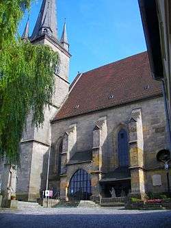
Church in Altenkunstadt | ||
| ||
 Altenkunstadt | ||
Location of Altenkunstadt within Lichtenfels district  | ||
| Coordinates: 50°07′N 11°15′E / 50.117°N 11.250°ECoordinates: 50°07′N 11°15′E / 50.117°N 11.250°E | ||
| Country | Germany | |
| State | Bavaria | |
| Admin. region | Oberfranken | |
| District | Lichtenfels | |
| Government | ||
| • Mayor | Robert Hümmer (CSU) | |
| Area | ||
| • Total | 32.91 km2 (12.71 sq mi) | |
| Elevation | 292 m (958 ft) | |
| Population (2015-12-31)[1] | ||
| • Total | 5,380 | |
| • Density | 160/km2 (420/sq mi) | |
| Time zone | CET/CEST (UTC+1/+2) | |
| Postal codes | 96264 | |
| Dialling codes | 09572 | |
| Vehicle registration | LIF/STE | |
| Website | www.altenkunstadt.de | |
Altenkunstadt is a municipality in the district of Lichtenfels in Bavaria, Germany. It lies on the left or south bank of the river Main across the valley from Burgkunstadt which sits on the hillside to the north.
Sons and daughters
- Wolfgang Mack (1808-1883), German surgeon
- Alfred Nikolaus Witt (1914-1999), orthopedist and surgeon, university professor in Berlin and Munich
- Josef Seiz (1934-2010), German table tennis player
References
- ↑ "Fortschreibung des Bevölkerungsstandes". Bayerisches Landesamt für Statistik und Datenverarbeitung (in German). June 2016.
This article is issued from
Wikipedia.
The text is licensed under Creative Commons - Attribution - Sharealike.
Additional terms may apply for the media files.

