Akasaka, Tokyo
| Akasaka 赤坂 | |
|---|---|
| District | |
|
Akasaka with Akasaka-mitsuke Station beneath the intersection in the foreground | |
| Country | Japan |
| City | Tokyo |
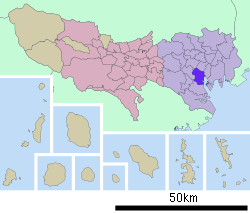
| Ward | Minato |
| Area | Akasaka Area |
| Population (January 1, 2016) | |
| • Total | 17,603 |
| Time zone | JST (UTC+9) |
| Area code(s) | 03 |
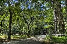
Akasaka (赤坂 "Red Slope") is a residential and commercial district of Minato, Tokyo, Japan, located west of the government center in Nagatachō and north of the Roppongi nightlife district.
Akasaka (including the neighboring area of Aoyama) was a ward of Tokyo City from 1878 to 1947, and maintains a branch office of the Minato City government.
Notable sites


- Akasaka Sacas
- Embassy of the United States, Mexico, Cambodia, Canada, Iraq, Spain and Syria as well as San Marino
- Ark Hills and Suntory Hall
- Hikawa Shrine
- Nogi Shrine
- Tokyo Midtown - currently the tallest high-rise complex in Tokyo
- Takahashi Korekiyo's residence and memorial park
In neighbouring Moto-Akasaka (literally "original Akasaka") to the North:
- Akasaka Palace (State Guest House)
- Togu Palace Residence of the Crown Prince of Japan
Companies based in Akasaka
- DefSTAR Records 4-5 Akasaka[1]
- EMI Music Japan 5-3-1 Akasaka[2]
- Epic Records Japan 9-6-35 Akasaka[3]
- Fujifilm[4]
- Fuji Xerox[5]
- Hazama Ando[6]
- Hudson Soft[7]
- JETRO (Japan External Trade Organization)-1-12-32 Akasaka[8]
- Johnny & Associates 8-11-20 Akasaka
- Ki/oon Records: Same as Epic Records Japan[9]
- Kaneka Corporation[10]
- Komatsu 2-3-6 Akasaka[11]
- Sigma Seven 2-16-8 Akasaka[12]
- Tokyo Broadcasting System Holdings, Inc. 5-3-6 Akasaka[13]
- Tokyo Broadcasting System Television, Inc.
- TBS Radio & Communications, Inc.
- BS-TBS, Inc.
- C-TBS, Inc.
- Toraya Confectionery[14]
- Universal Music Japan LLC 8-5-30 Akasaka[15]
- Wa Group Japan 4-3-27 Akasaka[16]
- Geneon Universal Entertainment 5-2-20 Akasaka[17]
- WOWOW (Akasaka Park Building)[18][19]
Previously Jaleco Holding had its headquarters in the Akasaka DS Building (赤坂DSビル Akasaka DS Biru) in Akasaka.[20][21]
The Japanese offices of the following are based in Akasaka:
- Becton, Dickinson and Company 4-15-1 Akasaka[22]
- Clifford Chance[23]
- Iran Air[24]
- ING 4-1 Akasaka[25]
- Milbank Tweed[26]
- Thomson Reuters[27]
Subway stations

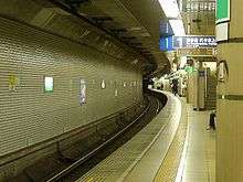
- Akasaka Station (Tokyo Metro Chiyoda Line)
- Akasaka-mitsuke Station (Tokyo Metro: Ginza Line, Marunouchi Line)
- Nagatacho Station (Tokyo Metro Hanzomon Line)
- Aoyama-itchōme Station (Tokyo Metro Hanzomon Line, Tokyo Metro Ginza Line, Toei Oedo Line)
- Nogizaka Station (Tokyo Metro Chiyoda Line)
- Tameike-Sannō Station (Tokyo Metro: Ginza Line, Namboku Line)
Education
Schools
Akasaka's public elementary and junior high schools are operated by the Minato City Board of Education ( in English, [28] in Japanese).
Akasaka High School was operated by the Tokyo Metropolitan Government Board of Education. It closed down in March 2009. It reopened the next month as the Aoyama campus of Ōta Sakuradai High School .
Libraries
The Akasaka Library has moved to a new building in 2007, near the Aoba Park and the Aoyama-itchōme subway station.[29]
References
- ↑ "Sony Music Group Company Site - グループ会社情報". Sme.co.jp. Archived from the original on 2013-07-16. Retrieved 2013-08-16.
- ↑ Archived June 2, 2009, at the Wayback Machine.
- ↑ "Sony Music Group Company Site - グループ会社情報". Sme.co.jp. Retrieved 2013-08-16.
- ↑ "Head Office." Fujifilm. Retrieved on July 12, 2010.
- ↑ "FUJI XEROX Company Profile." Fuji Xerox. Retrieved on July 12, 2010.
- ↑ "Corporate Profile." Hazama Ando. Retrieved on April 10, 2015.
- ↑ "Corporate overview Archived 2010-08-19 at the Wayback Machine.." Hudson Soft. Retrieved on July 12, 2010.
- ↑ "About Us". JETRO. Retrieved 2013-08-16.
- ↑ "Sony Music Group Company Site - グループ会社情報". Sme.co.jp. Retrieved 2013-08-16.
- ↑ "Corporate Data". Kaneka Corporation. Retrieved 2016-02-26.
- ↑ "Location of Head Office and Domestic Plants". Komatsu. Retrieved 2013-08-16.
- ↑ "Company Profile." Sigma Seven. Retrieved on February 22, 2009.
- ↑ "Access - TBS Global Site". Tbs.co.jp. Retrieved 2013-08-16.
- ↑ "Privacy Policy." Toraya Confectionery. Last updated on October 11, 2005. Retrieved on November 20, 2010. "4-9-22 Akasaka, Minato-ku, Tokyo, JAPAN."
- ↑ "会社情報 - Universal Music Japan". Universal-music.co.jp. Retrieved 2013-08-16.
- ↑ "会社情報 - Wa Group Japan". waspacetokyo.com. Retrieved 2015-09-14.
- ↑ "会社案内 -Geneon Universal Entertainment". Geneonuniversal.jp. Retrieved 2013-08-16.
- ↑ "Corporate Info." WOWOW. Retrieved on November 20, 2010. "THE HEAD OFFICE 21F, Akasaka Park Building, 5-2-20,Akasaka, Minato-ku Tokyo 107-6121 Tel.81-3-4330-8111WOWOW INC. MAP." Address in Japanese: "東京都港区赤坂5-2-20 赤坂パークビル21F"
- ↑ "Head office." (Direct image link) WOWOW. Retrieved on November 20, 2010. Map in Japanese (Direct link)
- ↑ "Company Information." Jaleco. Retrieved on August 10, 2010.
- ↑ "JalecoHD+map.pdf." Jaleco. Retrieved on August 10, 2010.
- ↑ "会社概要 | 日本BD". Bdj.co.jp. Retrieved 2013-08-16.
- ↑ "Tokyo". Clifford Chance. Retrieved 25 May 2015.
- ↑ "Iran Air Tokyo Office Archived 2011-07-13 at the Wayback Machine.." Iran Air. Retrieved on January 29, 2011. ""Address c/o Akasaka Habitation Bldg., 1-3-5 Akasaka, Minato-ku, Tokyo 107-0052"
- ↑ "取引時確認について|会社案内|アイエヌジー生命保険株式会社". Ing-life.co.jp. Retrieved 2013-08-16.
- ↑ "Tokyo". Milbank, Tweed, Hadley & McCloy LLP. Retrieved 25 May 2015.
- ↑ "Japan". Thomson Reuters. Retrieved 26 August 2016.
- ↑ "港区公式ホームページ/みなと教育ネットは港区公式ホームページに統合されました。". City.minato.tokyo.jp. 2012-03-30. Retrieved 2013-08-16.
- ↑ https://www.lib.city.minato.tokyo.jp/e/akasaka-inst.html
External links
 Media related to Akasaka, Tokyo at Wikimedia Commons
 Akasaka, Tokyo travel guide from Wikivoyage
Coordinates: 35°40′29″N 139°43′54″E / 35.6747°N 139.7317°E

