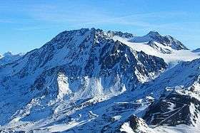
Aiguille de Péclet
| Aiguille de Péclet | |
|---|---|
 Aiguille de Péclet | |
| Highest point | |
| Elevation | 3,561 m (11,683 ft) |
| Prominence | 766 m (2,513 ft) [1] |
| Coordinates | 45°16′52″N 06°37′26″E / 45.28111°N 6.62389°ECoordinates: 45°16′52″N 06°37′26″E / 45.28111°N 6.62389°E |
| Geography | |
 Aiguille de Péclet Location in the Alps | |
| Location | Savoie, France |
| Parent range | Graian Alps |
Aiguille de Péclet (3,561 m) is a mountain of Savoie, France. It lies in the Massif de la Vanoise in the Graian Alps east of the resort of Val Thorens, on the edge of the Vanoise National Park.[2]
References
- ↑ "Aiguille de Péclet - peakbagger". peakbagger.com. Retrieved 24 February 2015.
- ↑ "Aiguille de Péclet - peakware". peakware.com. Retrieved 24 February 2015.
This article is issued from
Wikipedia.
The text is licensed under Creative Commons - Attribution - Sharealike.
Additional terms may apply for the media files.