Aguilares, Texas
| Aguilares, Texas | |
|---|---|
| CDP | |
| Coordinates: 27°27′6″N 99°5′36″W / 27.45167°N 99.09333°W | |
| Country | United States |
| State | Texas |
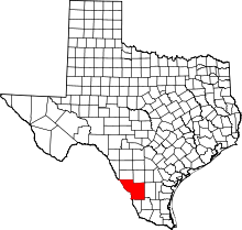
| County | Webb |
| Established | 1870 |
| Area | |
| • Total | 0.3 sq mi (0.8 km2) |
| • Land | 0.3 sq mi (0.8 km2) |
| • Water | 0.0 sq mi (0 km2) |
| Elevation | 595 ft (181 m) |
| Population (2010) | |
| • Total | 21 |
| Time zone | Central (CST) (UTC-6) |
| • Summer (DST) | CDT (UTC-5) |
| Zip Code | 78369 |
| Area code(s) | +1-361 |
| Nearest Airports: Laredo: Laredo International Airport KLRD LRD Nuevo Laredo: Quetzalcoatl International Airport MMNL NLD | |

Aguilares is a CDP in Webb County, Texas, United States. This was a new CDP for the 2010 census with a population of 21.[1]
Geography
Aguilares is located at 27°27′6″N 99°5′36″W / 27.45167°N 99.09333°W (27.451627, -99.093233). The CDP has a total area of 0.3 square miles (0.78 km2), all land.[2]
History
Aguilares dates to 1870. It is named for the first settlers and ranchers, José, Locario, Francisco, Próspero, and Librado Aguilar. It became a stop on the Texas-Mexican Railroad in 1881 and was granted a post office nine years later. The population (thought to be a huge exaggeration) was given as 1,500 in 1910 - but four years later it was reportedly a mere 300. The Aguilar family owned a store - one of the two businesses in the community.
Oil was discovered nearby in Oilton and for a short time the town seemed to have a future - but although (or because) it was on a railroad - it lost population to the nearby county seat of Laredo. In the 1930s, the post office was discontinued and in 1939 Aquilares' population was ten.
It rose to twenty-five by 1945, but the 1990 census again reported ten residents.
Notable people
- Pedro Gonzalez-Gonzalez, television and film character actor, born in Aguilares.
- Gene S. Walker, Sr., South Texas rancher and businessman, lived at his Vaquillas Ranch in Aguilares until his death in January 2015.[3]
References
- ↑ "Population and Housing Unit Counts, 2010 Census of Population and Housing" (PDF). Texas: 2010. Retrieved 2017-01-03.
- ↑ "Boundary Map of Aguilares, Texas". MapTechnica. Retrieved 2017-01-03.
- ↑ Elizabeth M. Pease, "Modern Times bring changes to ranching", Laredo Morning Times, August 24, 2014, Walker Supplement, p. 7D, reprint of a November 2000 article
- Aguilares, Texas from the Handbook of Texas Online. Retrieved 2007-05-03.
Coordinates: 27°26′55″N 99°05′14″W / 27.44861°N 99.08722°W