Agout
| Agout | |
|---|---|
 | |
| Country | France |
| Basin features | |
| Main source | Massif Central |
| River mouth |
Tarn River 43°47′4″N 1°41′1″E / 43.78444°N 1.68361°ECoordinates: 43°47′4″N 1°41′1″E / 43.78444°N 1.68361°E |
| Progression | Tarn→ Garonne→ Atlantic Ocean |
| Basin size | 3,500 km2 (1,400 sq mi) |
| Physical characteristics | |
| Length | 195 km (121 mi) |
| Discharge |
|
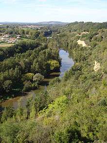
The Agout (Occitan: Agot) is a 195-kilometre (121 mi) long river in south-western France, left tributary of the Tarn River. Its source is in the southern Massif Central, in the Parc naturel régional du Haut-Languedoc. It flows generally west through the following départements and towns:
The Agout flows into the Tarn River in Saint-Sulpice.
Among its tributaries are the Dadou, the Gijou and the Thoré.
References
| Wikimedia Commons has media related to Agout. |
This article is issued from
Wikipedia.
The text is licensed under Creative Commons - Attribution - Sharealike.
Additional terms may apply for the media files.