Adirondack Mountains
| Adirondack Mountains | |
|---|---|
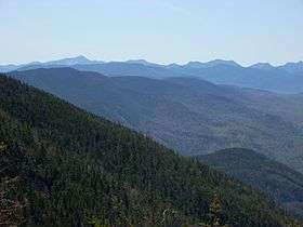
 The Adirondack Mountains from the top of Whiteface Mountain | |
| Highest point | |
| Peak | Mount Marcy |
| Elevation | 5,344 ft (1,629 m) |
| Coordinates | 44°06′45″N 73°55′26″W / 44.11250°N 73.92389°WCoordinates: 44°06′45″N 73°55′26″W / 44.11250°N 73.92389°W |
| Geography | |
 Map of the main mountainous regions of the northeastern United States. Strictly speaking, neither the Adirondacks nor the Catskills and Poconos are part of the Appalachian Mountains, having much different origins.
| |
| Country | United States |
| State | New York |
| Geology | |
| Orogeny | Grenville Orogeny |
| Age of rock | Tonian |
The Adirondack Mountains /ædᵻˈrɒndæk/ form a massif in the northeast of Upstate New York in the United States. Its boundaries correspond to the boundaries of Adirondack Park. The mountains form a roughly circular dome, about 160 miles (260 km) in diameter and about 1 mile (1,600 m) high. The current relief owes much to glaciation.
History
The earliest written use of the name, spelled Rontaks, was in 1724 by the French missionary Joseph-François Lafitau. He defined it as tree eaters. In the Mohawk language, Adirondack means porcupine, an animal that may eat bark. The Mohawks had no written language at the time so Europeans have used various phonetic spellings. An English map from 1761 labels it simply Deer Hunting Country and the mountains were named Adirondacks in 1837 by Ebenezer Emmons.[1]
People first arrived in the area following the settlement of the Americas around 10,000 BC. The Algonquian peoples and the Mohawk nation used the Adirondacks for hunting and travel but did not settle. European colonisation of the area began with Samuel de Champlain visiting what is now Ticonderoga in 1609, and Jesuit missionary Isaac Jogues visited the region in 1642.[2]
In 1664 the land came under the control of the English when New Netherland was ceded to The Crown. After the American Revolutionary War, the lands passed to the people of New York State. Needing money to discharge war debts, the new government sold nearly all the original public acreage about 7 million acres for pennies an acre. Lumbermen were welcomed to the interior, with few restraints,[3] resulting in massive deforestation.
For the history of the area since industrialization, see The History of Adirondack Park.
In 1989, part of the Adirondack region was designated by UNESCO as the Champlain-Adirondack Biosphere Reserve.[4]
Geology
The rocks of the Adirondack mountains originated about two billion years ago as 50,000 feet (15,000 m) deep sediments at the bottom of a sea which was located near the equator. Because of continental drift these collided with Laurentia ( the precursor of modern North America) in a mountain building episode known as the Grenville orogeny. During this time the sedimentary rock was changed into metamorphic rock. It is these Proterozoic minerals and lithologies that make up the core of the massif. Such minerals of interest include:
- wollastonite, mined near Harrisville
- magnetite and hematite, formerly mined at the Benson Mines,[5] Lyon Mountain, Mineville, Tawahus, and Witherbee.
- graphite, mined near Hague and Ticonderoga.
- garnet, mined at the Barton Mine, north of Gore Mountain.
- anorthosite, visible in road cuts on the New York State Route 3 between Saranac Lake and Tupper Lake.[6]
- marble
- zinc: The Balmat-Edwards district on the northwest flank of the massif also in St. Lawrence County was a major zinc ore deposit
- titanium was mined at Tawahus.
Around 600 million years ago the area began to be pulled apart, as Laurentia drifted away from Baltica (European Craton), forming the Iapetus Ocean. Faults developed, running north to north east which formed valleys and deep lakes. Examples visible today include the grabens Lake George and Schroon Lake. By this time the Grenville mountains had been eroded away and the area was covered by a shallow sea. Several thousand feet of sediment accumulated on the sea bed. Trilobites were the principal life-form of the sea bed, and fossil tracks can be seen in the Potsdam sandstone floor of the Paul Smiths Visitor Interpretive Center.[6]
About 10 million years ago the region began to be uplifted. It has been lifted about 7000 feet (2100 m) and is continuing at about 2 millimetres per year, which is greater than the rate of denudation. The cause of the uplift is unknown, but geologists theorize that it is caused by a hot spot in the earth's crust.[6] Evidence of this may be the occurrence of earthquake swarms near the center of the massif at Blue Mountain Lake. Earthquakes have exceeded 5 on the Richter magnitude scale. Note that neither the Adirondacks (uplifted by a hot spot) nor the Catskills or Poconos (a dissected plateau formed from delta deposits) are part of the Appalachian Mountain chain (faulted and folded by continental collisions).
Starting about 2.5 million years ago a cycle of Pleistocene glacial and interglacial periods began which covered the area in ice. The final episode, the Laurentide ice sheet last covered most of northern North America between about 95,000 and c. 20,000 years ago.[7] After this the climate warmed, but it took nearly 10,000 years for all of the 10,000 feet (3,000 m) thick layer of ice to melt. Evidence of this period includes:
- Eskers: the Rainbow Lake esker bisects the eponymous lake and extends discontinuously for 85 miles. Another long discontinuous esker extends from Mountain Pond through Keese Mill, passing between Upper St. Regis Lake and the Spectacle Ponds, and continuing to Ochre, Fish, and Lydia Ponds in the St. Regis Canoe Area. A 150 foot high esker bisects the Five Ponds Wilderness Area.[8]
- Glacial erratics: there is a large one at the Newcomb Visitor Information Centre next to the Rich Lake Trail.
- Outwash plains
- Kames
- Moraines
- The cirques that characterize Whiteface Mountain.
- Outwash plains: St. Regis Canoe Area is an outwash plain pitted with kettle holes.
Soils in the area are generally thin, sandy, acidic, and infertile, having developed since the glacial retreat.
Ecology

The Adirondack Mountains form the southernmost part of the Eastern forest-boreal transition ecoregion.[9] They are heavily forested, and contain one of the southernmost distribution taiga in North America. The forests of the Adirondacks include spruce, pine and deciduous trees. Lumbering, once an important industry, has been much restricted by the creation of the park.[10]
The mountains include many wetlands, of which there are three kinds:[6]
- Swamps, any wetland including trees and shrubs
- Marshes, wetlands with water stagnation. These may support bullfrogs and spring peepers, spotted salamanders, great blue heron, American bittern, and painted turtles. Pickerel weed often forms large colonies.
- Bogs, characterized by plants like sphagnum moss, orchids, and pitcher plants
Common birds include the boreal chickadees, gray jays, spruce grouse, black-backed woodpeckers, common loons and crossbills.
Nearly 60 percent of the park is covered with northern hardwood forest. Above 2600 feet (790 m) conditions are too poor for hardwoods to thrive, and these trees become mixed with or replaced by balsam fir and red spruce. Above 3500 feet (1000 m) black spruce replace red. Higher still only trees short enough to be covered in snow during the winter can survive.
Only a tiny fraction of the area above the tree line is classified as having an alpine climate.
| Scenes from the Adirondacks |
|---|
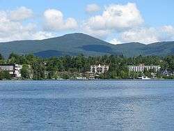
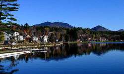
 The Adirondack Mountains of Upstate New York form the southernmost zone in the Eastern forest-boreal transition ecoregion of North America.  The hydrologic source of the Hudson River is near or at Lake Tear of the Clouds, a small tarn in the Adironacks, photo circa 19th-century.  Lake George, one of numerous oligotrophic lakes in the Adirondack region, is nicknamed the Queen of American Lakes.  Mirror Lake in the Village of Lake Placid in the Adirondacks, site of the 1932 and the 1980 Winter Olympics.  Lake Flower in the Village of Saranac Lake, nicknamed the Capital of the Adirondacks.  The Adirondack High Peaks region. |
See also
References
- ↑ Cherniak, D. J. "Ebenezer Emmons (1799–1863)". Rensselaer Polytechnic Institute. Retrieved June 23, 2015.
- ↑ Sulavik, Stephen B. (2007). Adirondack : of Indians and mountains, 1535–1838. Fleischmanns, N.Y.: Purple Mountain Press. pp. 21–51. ISBN 978-1930098794.
- ↑ "History of the Adirondack Park". New York State Adirondack Park Agency. Retrieved June 23, 2015.
- ↑ "UNESCO – MAB Biosphere Reserves Directory". www.unesco.org. Retrieved 2016-05-21.
- ↑ Ridge, J. D. (1968). Ore Deposits of the United States, 1933–1967. New York: The American Institute of Mining, Metallurgical, and Petroleum Engineers, Inc.
- 1 2 3 4 Storey, Mike (2006). Why the Adirondacks look the way they do : a natural history (2 ed.). [S.l.]: Storey. p. 22. ISBN 0-9777172-0-8.
- ↑ Dyke, A. S.; Prest, V. K. (1987). "Late Wisconsinan and Holocene History of the Laurentide Ice Sheet". Géographie physique et Quaternaire. 41 (2): 237–263.
- ↑ Staff, Editorial. "Sea Serpents in the Adirondacks? You Bet! -". Retrieved 2015-07-30.
- ↑ Olson; D. M.; E. Dinerstein; et al. (2001), "Terrestrial Ecoregions of the World: A New Map of Life on Earth", BioScience, 51 (11): 933–938, doi:10.1641/0006-3568(2001)051[0933:TEOTWA]2.0.CO;2, archived from the original on 2011-10-14.
- ↑
 Chisholm, Hugh, ed. (1911). "Adirondacks". Encyclopædia Britannica. 1 (11th ed.). Cambridge University Press. p. 193.
