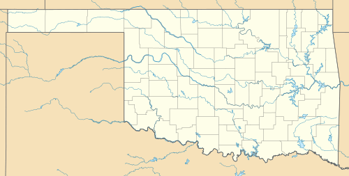
Adams, Oklahoma
| Adams | |
|---|---|
| Unincorporated community | |
 Adams  Adams Location within the state of Oklahoma | |
| Coordinates: 36°45′23″N 101°4′38″W / 36.75639°N 101.07722°WCoordinates: 36°45′23″N 101°4′38″W / 36.75639°N 101.07722°W | |
| Country | United States |
| State | Oklahoma |
| County | Texas |
| Population (2000) | |
| • Total | 182 |
| Time zone | Central (CST) (UTC-6) |
| • Summer (DST) | CDT (UTC-5) |
| ZIP codes | 73901 |
| Area code(s) | 580 |
Adams is a rural unincorporated community in Texas County, Oklahoma, United States. The post office opened June 14, 1930. The ZIP Code is 73901. The community was named for Jesse L. Adams, engineer for the Rock Island Railroad.
The post office in Adams is slated for possible closure by the US Postal service.[1]
References
- ↑ "Expanded Access Study List - Oklahoma". About.usps.com. 2011-03-28. Archived from the original on 2012-01-25. Retrieved 2012-02-20.
Further reading
- Shirk, George H. Oklahoma Place Names. Norman: University of Oklahoma Press, 1987. ISBN 0-8061-2028-2.
This article is issued from
Wikipedia.
The text is licensed under Creative Commons - Attribution - Sharealike.
Additional terms may apply for the media files.
