Acklins
.svg.png) | |
| Geography | |
|---|---|
| Location |
Atlantic Ocean 239 miles Southeast of Nassau |
| Coordinates | 22°21′N 74°1′W / 22.350°N 74.017°W |
| Archipelago | Bahamas |
| Area | 389 km2 (150 sq mi) |
| Administration | |
|
Bahamas | |
| Demographics | |
| Population | 565 (2010) |
Acklins is an island and district of the Bahamas.
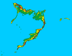
It is one of a group of islands arranged along a large, shallow lagoon called the Bight of Acklins, of which the largest are Crooked Island (76 sq mi) in the north and Acklins (120 sq mi) in the southeast, and the smaller are Long Cay (once known as Fortune Island, 8 sq mi) in the northwest, and Castle Island in the south.
History
The islands were settled by American Loyalists in the late 1780s who set up cotton plantations employing over 1,000 slaves. After the abolition of slavery in the British Empire these became uneconomical, and the replacement income from sponge diving has now dwindled as well with the rest of the natural sponge industry after the advent of synthetics. The inhabitants now live by fishing and small-scale farming.

Although Acklins Island has relatively few historical landmarks, there are some noteworthy places. Acklins is home to numerous Lucayan people sites. An ancient Lucayan Indian site, thought to be one of the largest Lucayan Indian settlements in The Bahamas, sits along Pompey Bay Beach, just south of Spring Point. Ten ancient Lucayan sites have been unearthed by National Geographic Society Archeologists in Samana Cay alone, which is northeast of Spring Point in Acklins.
Plana Cays, also northeast of Spring Point, is a protected reserve for endangered great iguanas and the very rare estimated hutias (guinea pig like rodents), the only native mammal of The Bahamas. Another site of interest is the remote Castle Island Lighthouse at the southernmost point of Acklins Island.
The population of Acklins was 565 at the 2010 census, with the most people living in Lovely Bay in the northwestern tip of the island and in Salina Point in the southernmost area of the island.[1]
Transportation
The island is served by Spring Point Airport.
References
- ↑ "ACKLINS POPULATION BY SETTLEMENT AND TOTAL NUMBER OF OCCUPIED DWELLINGS: 2010 CENSUS" (PDF). Bahamas Department of Statistics.