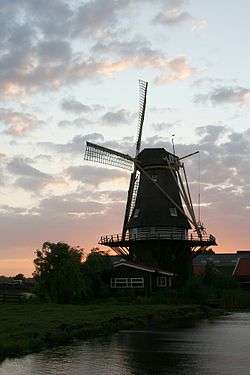
Aarlanderveen
Coordinates: 52°8′N 4°44′E / 52.133°N 4.733°E
| Aarlanderveen | ||
|---|---|---|
 | ||
| ||
 | ||
| Country | Netherlands | |
| Province | South Holland | |
| Municipality | Alphen aan den Rijn | |
| Population | about 1,200 | |
Aarlanderveen is a town in the Dutch province of South Holland. It is a part of the municipality of Alphen aan den Rijn, and lies about 4 km east of Alphen aan den Rijn.
The statistical area "Aarlanderveen", which also can include the surrounding countryside, has a population of around 500.[1]
Aarlanderveen was a separate municipality until 1918, when it became part of Alphen aan den Rijn.[2]
The area around the village is a natural landscape that is rich in grassland birds like plovers, godwits and redshanks. There are also many flower rich banks including spearwort, water and field mint, ragged robin and marsh thistle.
External links
- J. Kuyper, Gemeente Atlas van Nederland, 1865-1870, "Aarlanderveen". Map of the former municipality, around 1868.
References
- ↑ Statistics Netherlands (CBS), Gemeente Op Maat 2004: Alphen aan den Rijn .
- ↑ Ad van der Meer and Onno Boonstra, Repertorium van Nederlandse gemeenten, KNAW, 2006.

Aarlanderveen on a map of 1611.
This article is issued from
Wikipedia.
The text is licensed under Creative Commons - Attribution - Sharealike.
Additional terms may apply for the media files.
