1969–70 Australian region cyclone season
| 1969–70 Australian region cyclone season | |
|---|---|
|
Season summary map | |
| Seasonal boundaries | |
| First system formed | 8 November 1969 |
| Last system dissipated | 9 May 1970 |
| Seasonal statistics | |
| Tropical lows | 14 |
| Tropical cyclones | 14 |
| Severe tropical cyclones | 1 |
| Total fatalities | 14 |
| Total damage | Unknown |
| Related articles | |
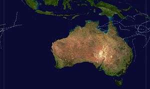
The 1969–70 Australian region cyclone season saw above average activity.
Systems
Cyclone Blossom
- Blossom, 8 to 9 November 1969 very weak to northwest of Cocos Island
Cyclone Diane
- Diane, 2 to 15 January 1970 in central Indian Ocean
Severe Tropical Cyclone Ada

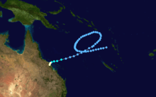
Tropical Cyclone Ada was a Category 4 cyclone that killed 14 people when it hit Queensland's Whitsunday Island Resorts and the adjacent Whitsunday Coast mainland on January 17, 1970.
Resorts and boats were destroyed or severely damaged at Hayman, Daydream and South Molle Islands, as well as the two resorts – Happy Bay and Palm Bay – on Long Island. About 80% of buildings in the mainland centres of Shute Harbour, Airlie Beach and Cannonvale were severely damaged. Some damage occurred also inland at Proserpine where, following 24-hours of heavy rain that accompanied the storm, the Proserpine River peaked at 11.16 metres: its highest recorded flood. Fourteen people died and property damage was estimated at A$390 million (1997 values).
Like Tropical Cyclone Tracy that devastated Darwin on Christmas Eve 1974, Ada was small in diameter (estimated width 30 km) and damage from her path was limited to a comparatively small geographical area. The wind from Tropical Cyclone Ada was not felt in Bowen (60 km to the north) or Mackay (120 km to the south). However the heavy rains did cause flooding in the Pioneer River (Mackay) and the Don River (Bowen). Before degenerating into a rainstorm Cyclone Ada travelled further inland to the Cathu State Forest (83 km north-west of Mackay behind the small Bruce Highway township of Calen) and caused extensive damage to the eucalypts, rainforest and pine plantations in that area.
It was as a result of complaints about lack of timely warning about the 1970 cyclone that the Bureau of Meteorology introduced the cyclone warning siren that now accompanies all media broadcasts and telecasts of cyclone warnings in Queensland.
Cyclone Glynis
- Glynis, 27 January to 7 February 1970 crossed coast near Mandurah, Western Australia but no major damage
Cyclone Harriet-Iseult
- Harriet/Iseult, 30 January to 4 February 1970 in central to western Indian Ocean
Cyclone Dolly
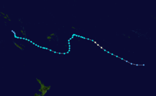
- Dolly, February 1970 also in the Coral Sea

Cyclone Ingrid
- Ingrid, 9 to 17 February 1970 crossed coast near Carnarvon, Western Australia causing severe agricultural damage.
Cyclone Judy
- Judy, 9 to 24 February 1970 in central Indian Ocean
Cyclone Dawn

- Dawn, 10 to 19 February 1970 in Coral Sea with heavy rain
Cyclone Florence

- Florence, 10 to 12 February 1970 a weak cyclone in the Coral Sea
Cyclone Cindy
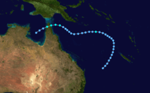
- Cindy, 11 to 22 March 1970 in Gulf of Carpentaria
Cyclone Kathy
- Kathy, 19 to 28 March 1970 in central Indian Ocean
Cyclone Isa

- Isa, 13 to 18 April 1970 in Solomon Islands area with no major damage
Cyclone Lulu
- Lulu, 4 to 9 May caused flooding around the Pilbara region of Western Australia
See also
- Atlantic hurricane seasons: 1969, 1970
- Eastern Pacific hurricane seasons: 1969, 1970
- Western Pacific typhoon seasons: 1969, 1970
- North Indian Ocean cyclone seasons: 1970
