Čačak
| Čačak Град Чачак Gradac | ||||||||
|---|---|---|---|---|---|---|---|---|
| City | ||||||||
| City of Čačak | ||||||||
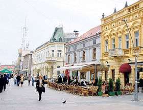
Clockwise, from top: City center promenade, National Museum, Church of Ascension of Jesus, Ovčar-Kablar Gorge, Bridges on West Morava, Hotel "Beograd" | ||||||||
| ||||||||
| Etymology: Mud (sr. blato) | ||||||||
 Location of the city of Čačak within Serbia | ||||||||
| Coordinates: 43°53′N 20°21′E / 43.883°N 20.350°ECoordinates: 43°53′N 20°21′E / 43.883°N 20.350°E | ||||||||
| Country | Serbia | |||||||
| Region | Šumadija and Western Serbia | |||||||
| District | Moravica | |||||||
| Settlements | 58 | |||||||
| Government | ||||||||
| • Mayor | Milun Todorović (SNS) | |||||||
| Area[1] | ||||||||
| Area rank | 43th | |||||||
| • Urban | 50.1 km2 (19.3 sq mi) | |||||||
| • Administrative | 636 km2 (246 sq mi) | |||||||
| Elevation | 242 m (794 ft) | |||||||
| Highest elevation (Ovčar) | 985 m (3,232 ft) | |||||||
| Lowest elevation | 204 m (669 ft) | |||||||
| Population (2011 census)[2] | ||||||||
| • Rank | 12th | |||||||
| • Urban | 73,331 | |||||||
| • Urban density | 1,500/km2 (3,800/sq mi) | |||||||
| • Administrative | 115,337 | |||||||
| • Administrative density | 180/km2 (470/sq mi) | |||||||
| Time zone | CET (UTC+1) | |||||||
| • Summer (DST) | CEST (UTC+2) | |||||||
| Postal code |
32000 32101 32102 32103 32104 32105 | |||||||
| Area code | +381(0)32 | |||||||
| ISO 3166 code | SRB | |||||||
| Car plates | ČA | |||||||
| Climate | Cfb | |||||||
| Website |
www | |||||||
Čačak (Serbian Cyrillic: Чачак, pronounced [t͡ʃǎːt͡ʃak]) is a city and the administrative center of the Moravica District of Šumadija and Western Serbia. It is located in the valley of West Morava in the geographical region of Šumadija. According to the 2011 census results, the city urban area has 73,331 inhabitants, while the administrative area has 115,337 inhabitants.
Čačak is one of the main crossroads and economic centers of Central Serbia, bordering with the several municipalities, Požega (Zlatibor District) to the west, Knić (Šumadija District) to the east and the city of Kraljevo (Raška District) to the southeast. It is also the main administrative and cultural center of the Moravica District, which includes Gornji Milanovac to the north, Lučani to the southwest and Ivanjica to the south. It is located 144 km south of the capital city of Belgrade.
The lowest altitude is 204 metres (669 ft), at the confluence of Bresnička reka and West Morava, and the highest is 985 m (3,232 ft) at the highest peak of Ovčar mountain.
The city has a unique morphological area in its surroundings, the Ovčar-Kablar Gorge, where 300 monasteries have been built since the 14th century, but only 12 remain today. This area is also called "Serbian Mount Athos." Čačak got its current name in 1408; before that it was called Gradac. One of Gradac's leaders was Stracimir Zavidović, brother of Stefan Nemanja, an important Serbian ruler. He built the church of 'Our Lady' (Church of Jesus Ascension), which still stands in the center of Čačak. The church underwent reconstruction from 2010 to 2011, following an earthquake which damaged its facade.
From 1459, when Serbia lost its independence to the Ottomans, to 1718, and again from 1739 to 1878 Čačak was a part of the Ottoman Empire. During the short period from 1718 to 1739 it was the southern settlement of the Habsburg Empire. Čačak saw heavy fighting during the Second Serbian Uprising in 1815. At the highest peak of Ljubić hill, where the main battles of the uprising were fought, now stands a monument to Tanasko Rajić, who died a brave death while protecting the city. After that Serbia was given autonomy in the Ottoman Empire in 1817. Sixty-one years later Serbia became an independent country.
After 1882, Čačak was a part of the Kingdom of Serbia, and then of Kingdom of Yugoslavia until 1941. In 1941, during World War II Čačak was the eastern settlement in the short-lived Užička republika which was cut off by Nazi Germany shortly after it was founded. After the end of World War II, it was a part of SFR Yugoslavia until 1992 and FR Yugoslavia until 2006. Since then, Čačak has been a part of the Republic of Serbia.
Geography
The city of Čačak is in the western part of central Serbia, 144 km south of the capital city, Belgrade. The nearest international border is with Bosnia and Hercegovina. Within the Moravica District, it has all the characteristics of the main center. Situated mostly in the western area of the flow of the West Morava river, it connects the hills of Šumadija in the north and higher regions of the interior to the south. These mountains incline in a gentle and wavy way toward the Čačak valley, the town and the Morava River. The city administrative area covers 636 square kilometres (246 sq mi) and contains:
- Čačak valley with an altitude between 204 and 300 m (669 and 984 ft)
- Hills between 300 and 500 m (980 and 1,640 ft) high and
- Mountains Ovčar (985 m) (W), Kablar (889 m) (W), Jelica (929 m) (S) and Vujan (857 m) (NE).
A humid continental climate brings an average temperature of 10.47 °C (50.85 °F) with 74.1% humidity, warm summers and cold winters. Winds come from the north and northeast, rarely from the west because of the mountains that block them. The average temperature in August is 22 °C (72 °F), while in January it is 0.5 °C (32.9 °F). There are, on average, 38 days with snow during the year. The average wind speed is 2.3 metres per second (5.1 mph). The usual number of foggy days is 54. There are a few recorded instances of Sahara desert sand making its way to the town via winds, when it caused problems for the town's population, especially in traffic. Average yearly precipitation is 735 mm (28.9 in).[3]
History
Prehistoric
The region has several archaeological sites, dating from prehistory to the present, the oldest from the 15th century BC.[4]
Princely tombs of Greco-Illyrian type (Glasinac culture) were found in two mounds of Atenica with Ionian glass, glass-paste, an amber bead depicting a swan, an Attic plaque of wild boar, dating to the late 6th century BC.[5] More ornithomorphic fibulae of bronze swans was found in Mojsinje.[6][7]
Prehistoric tumuli have been unearthed in Mrčajevci.[8] The Triballi and Scordisci tribes lived in this area until the Romans came.
Roman era
The town was inhabited in Roman times, with traces of the Roman settlement still visible today, like Roman baths built in the 2nd to 4th century period. These still stand behind a secondary school in the center of Čačak.
Nearby, in the village of Gradina on the Jelica mountain, a Roman compound (fort) with a martyrium and necropolis has been excavated, with three churches, one of which produced a pentanummion for the late Roman Emperor Justinian in the 526–537 period. Justinian is also believed to have founded the fort in the 530s. The presence of burnt layers on the sight could be evidence that the settlement ended in violence. In the same region, in the 6th century, four other forts were built.[9]
Middle Ages
South Slavs settled this area during the reign of the Byzantine Emperor Heraclius (610–641). From this period there are remains of sites in Culina, under the Kablar mountain. From 1168 to 1189 Stefan Nemanja's brother Stracimir Zavidović controlled the West Morava region, including Čačak (at that time Gradac). At this time he raised the church of Our Lady or Moravian Gradac. The word čačak means "mud" in the Turkish language. The Turks came here in 1459 and the Church was converted to a mosque.
16th century–present
Suleiman the Magnificent, Catib Çelebi and Evliya Çelebi in 16th century and 17th century talked about Čačak as the main place in qadi. 1717. Čačak became a part of the Habsburg Empire after Austrians defeated Ottomans. Austrian rule was short, however, because 21 years later Čačak again became a part of the Ottoman Empire. After that Čačak became virtually deserted because most of its inhabitants migrated north, to the Habsburg Empire. Their place was filled by people from Montenegro, Bosnia and Hercegovina and Old Vlach.
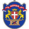
Čačak has two years on its coat of arms. The first is 1408 (from one of notes from Dubrovnik's archives), when the city was first recorded as Čačak, and the second is 1815, the year the Second Serbian Uprising began and the battle of Ljubic hill was fought. This battle is famous for the victory of the Serbian rebels who defeated a much stronger Ottoman army numbering 60,000 men.
In 1837 a grammar school was built, one of the first in Serbia. In the 1837–1941 period Čačak became a more modern town. During World War II Čačak was part of the short-lived Republic of Užice, which was cut off by German forces shortly after it was founded. On the 4 December 1944 Čačak was liberated by Yugoslav Partisans. It has since evolved into a large town and a regional center, later being given the status of a city.
Settlements
Aside from the urban area of the city, the administrative area includes the following 58 settlements:
- Atenica
- Baluga, Ljubićska
- Baluga, Trnavska
- Banjica
- Beljina
- Bečanj
- Brezovica
- Bresnica
- Vapa
- Vidova
- Viljuša
- Vranići
- Vrnčani
- Vujetinci
- Goričani
- Gornja Gorevnica
- Gornja Trepča
- Donja Gorevnica
- Donja Trepča
- Žaočani
- Zablaće
- Jančići
- Ježevica
- Jezdina
- Katrga
- Kačulice
- Konjevići
- Kukići
- Kulinovci
- Lipnica
- Loznica
- Ljubić
- Međuvršje
- Milićevci
- Miokovci
- Mojsinje
- Mrčajevci
- Mršinci
- Ovčar Banja
- Ostra
- Pakovraće
- Parmenac
- Petnica
- Preljina
- Premeća
- Pridvorica
- Prijevor
- Prislonica
- Rajac
- Rakova
- Riđage
- Rošci
- Slatina
- Sokolići
- Stančići
- Trbušani
- Trnava
Demographics
| Historical population | ||
|---|---|---|
| Year | Pop. | ±% |
| 1948 | 70,032 | — |
| 1953 | 75,485 | +7.8% |
| 1961 | 85,439 | +13.2% |
| 1971 | 97,924 | +14.6% |
| 1981 | 110,801 | +13.1% |
| 1991 | 116,808 | +5.4% |
| 2002 | 117,072 | +0.2% |
| 2011 | 115,337 | −1.5% |
| Source: [10] | ||
According to the last official census done in 2011, the city of Čačak has 115,337 inhabitants, with 73,331 living inside the city limits.
The average age of the population is 38.8 years (37.9 for males and 39.7 for females). An average household has 2.98 members. There was an increase in the population of the city itself recorded during the last three censuses.
Ethnic groups
Ethnically, the city is largely inhabited by Serbs (95.3%), followed by Roma, Montenegrins and other ethnic groups. Ethnic composition of the city:
| Ethnic group | Population |
|---|---|
| Serbs | 110,886 |
| Roma | 530 |
| Montenegrins | 328 |
| Croats | 105 |
| Yugoslavs | 117 |
| Macedonians | 112 |
| Russians | 34 |
| Others | 3,225 |
| Total | 115,337 |
Society and culture
This city traversed a long and thorny road from an anonymous settlement to a modern city in the 21st century. The very face of the city, as seen in the facades, monuments, and cultural establishments, is the reflection of the artistic spirit of its inhabitants.
During the theatrical season there are numerous theatrical ensembles on tour from all of Serbia at the Cultural Centre. The centre is home to a Drama Studio and schools of ballet, fine art and sculpture. Exhibitions and performances, cultural and literary evenings are held at the "Nadežda Petrović" and "Risim" galleries, the National Museum, the Salon of Photography, the Inter-Municipal Archive, the premises of the City Library, the Pupil Centre, etc. Fine art and sculpture colonies are most often held at the Ovčar Banja spa resort. There are numerous cultural, musical, entertainment and tourist manifestations within the city and close surroundings, which attract multitudes of followers of ethno-culture, original folk music, like the Dis spring, Memorial to Nadežda Petrović and the Flute festival in the nearby village of Prislonica, and other accompanying content. In Guča, 10 kilometres (6.2 mi) south from Čačak, every year the Guča trumpet festival is held, one of the most popular in the Balkans, alongside the Exit festival in (Novi Sad). In Serbia, there are 6,000 "Ijadas", meaning festival celebrating certain food or music whose name ends with the suffix "ijada" . The most popular in Čačak are Pitijada, Kupusijada, Fijakerijada, etc., that celebrate old traditions belonging to Serbs.
The current artwork production in the city can be followed through the auspices of groups and associations, private galleries, colonies and numerous enthusiasts.[11]
Education
There are three faculties located in Čačak; two of them are a part of the University of Kragujevac:
- Faculty of Agronomy
- Faculty of Technical Sciences
- Higher Technical School of Professional Studies
There are seven secondary schools:
- Čačak's Grammar School (one of the oldest grammar schools in Serbia, 1837)
- High School of Economics
- Technical High School
- Medicine High School
- Machine High School
- Musical High School
- F&C School
There are many primary schools and childcare centers.

 Čačak's Grammar School
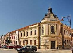 High School of Economics
- Technical High School
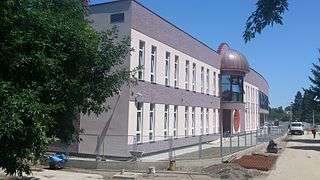 Musical High School
Tourism
In the vicinity of Čačak there are more than 20 churches and monasteries, the largest number found on such a small area in Serbia. They represent cultural and historic monuments of great significance. The most important ones are the Church of the Ascension of Jesus, a church on Ljubić hill dedicated to Saint Tsar Lazar, as well as the Vujan Monastery located on a nearby mountain of the same name. Special value is attributed to the monasteries of the Ovčar-Kablar Gorge, which as a cultural and historic whole date back to the Middle Ages and represent the particularity of the region's cultural and artistic heritage created over the centuries. There are 12 monasteries and churches in the gorge:
- Uspenje
- Vavedenje
- Jovanje
- Nikolje
- Blagoveštenje
- Vaznesenje
- Preobraženje
- Sretenje
- Sveta Trojica
- Ilinje
- Savinje
- Kadjenica
Thermal and mineral springs with medicinal properties provide the basis for the development of recreational tourism. There are three spa resorts within the territory of the city of Čačak: Gornja Trepča, Ovčar Banja and Slatinska Banja. There are also picnic sites: Gradina and the "Battle and victory" park (also called "Spomen" (remembrance) park) on the Jelica mountain, the Memorial complex on Ljubić hill, Grujine fields, rafts on West Morava river in Beljina, Parmenac, Međuvršje and Ovčar Banja, and picnic sites on the tiny rivers called Dičina, Kamenica, Čemernica and Banja.
Sport
Čačak is nationally famous for its clubs in various sports; the most popular ones are basketball, football and handball. KK Borac Čačak and FK Borac Čačak have been participating in the First leagues of Serbia for many consecutive years with much success. Women's handball is also very successful and popular.
Image gallery
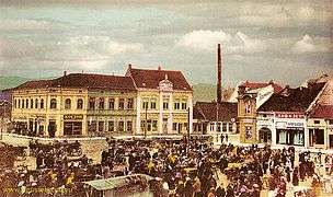 Čačak at the beginning of 20th century
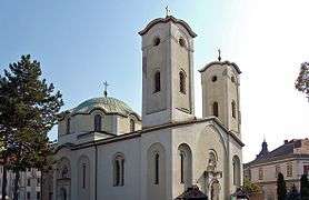 Church of Ascension of Jesus
 National museum in Čačak
 Church of Saint Tsar Lazar on Ljubić hill
 Bridges on West Morava river and Borac hall
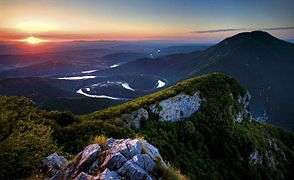
 West Morava meanders in Ovčar-Kablar Gorge
 West Morava meanders in Ovčar-Kablar Gorge
 Paragliding over Ovčar-Kablar Gorge
- KK Borac Sports Hall
Economy
The structure of the economy of the city of Čačak is composed of agriculture, industry, trade and services. Apart from agricultural production, also present are paper production, electric home appliances, blade tools for the processing of metal, non-metals and wood, chemical industry products, thermal technical appliances, wood, metal and combined carpentry, parts and kits for the pharmaceutical industry and products for medical needs, processing of forest and agricultural products, etc.
Many companies with more than 250 employees have deteriorated due to the sanctions in the 1990s. Since 2000, more than 40 government-owned companies have gone through the privatization process.[12] Today, on the territory of the city of Čačak, largest employers are Hospital Čačak, Sloboda Čačak, Fabrika reznog alata, Remont Military Institute, P.S. Fashion and others.
Private enterprise, which has its tradition from back in the 19th century, is the primary characteristic of the economy of the city. A large number of private companies grew into middle-size companies with 80 to 270 employees offering a wide variety of products.[13]
Notable people
- Boban Dmitrović, football player
- Bora Đorđević, rock musician
- Branko Jelić, football player
- Darko Lazović, football player
- Dragan Kićanović, former basketball player and coach, Olympic, World and European champion
- Dragomir Čumić, actor
- Dragutin Gavrilović, military officer († 1945)
- Dušan Markešević, athlete
- Hadži Prodan Gligorijević, leader of the Hadži Prodan's Revolt († 1825)
- Ivan Stambolić, politician († 2000)
- Ivan Stevanović, football player
- Ivica Dragutinović, football player
- Filip Filipović, mathematician, revolutionary, first secretary of Communist party of Yugoslavia
- Filip Mladenović, football player
- Lazar Marković, football player
- Luke Black, pop singer
- Marko Lomić, football player
- Marko Marinović, basketball player
- Milan Jovanović, Montenegrin football player
- Milan Stojadinović, politician († 1961)
- Milivoje Vitakić, football player
- Miloš Minić, politician († 2003)
- Milovan Destil Marković, artist
- Milovan Rajevac, football coach
- Milutin Dostanić, mathematician
- Miroslav Ilić, folk singer
- Mladomir Puriša Đorđević, film director and screenwriter
- Momčilo Perišić, general
- Nadežda Petrović, painter († 1915)
- Nemanja Kojić, athlete
- Serbian Patriarch Irinej, head of the Serbian Orthodox Church
- Petar Stambolić, politician († 2007)
- Predrag Koraksić Corax, caricaturist
- Radisav Ćurčić, former basketball player
- Radmila Bakočević, soprano
- Radojko Avramović, football coach
- Radomir Mihailović Točak, rock guitarist
- Robert Kišerlovski, road bicycle racer
- Sonja Savić, actress († 2008)
- Stepa Stepanović, general from Balkan Wars and World War I († 1929)
- Stracimir Zavidović, 12th-century Serbian noble that ruled West Morava († after 1189)
- Tadija Dragićević, basketball player
- Tanasko Rajić, captain in Second Serbian Uprising († 1815)
- Tatomir Anđelić, mathematician († 1993)
- Uroš Tripković, basketball player
- Velimir Ilić, politician
- Vera Matović, folk singer
- Vlada Jovanović, basketball coach
- Vladan Vasilijević, politician and specialist in criminal law
- Vladislav Petković Dis, poet († 1917)
- Željko Obradović, former basketball player and coach, Olympic silver medalist, World, European and eight-time Euroleague champion
- Zoran Kostić (footballer), football player
International relations
Twin towns and sister cities
Čačak is twinned with:
|
See also
References
- ↑ "Municipalities of Serbia, 2006". Statistical Office of Serbia. Retrieved 2010-11-28.
- ↑ "2011 Census of Population, Households and Dwellings in the Republic of Serbia: Comparative Overview of the Number of Population in 1948, 1953, 1961, 1971, 1981, 1991, 2002 and 2011, Data by settlements" (PDF). Statistical Office of Republic Of Serbia, Belgrade. 2014. ISBN 978-86-6161-109-4. Retrieved 2014-06-27.
- ↑ "Čačak – geographical position". TurizamCacak.org.rs. Retrieved 22 April 2017.
- ↑ "直の日記". To-Cacak.com. Retrieved 22 April 2017.
- ↑ Trebenishte: the fortunes of an unusual excavation – M. Stibbe, Rastko Vasić
- ↑ http://sehumed.uv.es/revista/numero16/SEHUMED_colecc131.PDF
- ↑ [hrcak.srce.hr/file/71455 srce.hr]
- ↑ Petrova, Ekaterina. "Balkan Travellers - Archaeologists Discover Pre-Historic Tumuli in Central Serbia". BalkanTravellers.com. Retrieved 22 April 2017.
- ↑ at Google Books
- ↑ "2011 Census of Population, Households and Dwellings in the Republic of Serbia" (PDF). stat.gov.rs. Statistical Office of the Republic of Serbia. Retrieved 11 January 2017.
- ↑ "- :: Grad Čačak ::". Cacak.org.rs. Retrieved 22 April 2017.
- ↑ "U Čačku još dva velika preduzeća nisu privatizovana - "Fabrika reznih alata" i "Sloboda"". ekapija.com (in Serbian). Retrieved 30 March 2015.
- ↑ "- :: Grad Čačak ::". Cacak.org.rs. Retrieved 22 April 2017.
External links
| Wikimedia Commons has media related to Čačak. |
.jpg)

