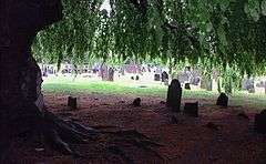
Ye Antientist Burial Ground, New London

Ye Antientist Burial Ground[1] in New London, Connecticut is one of the earliest graveyards in New England, and the oldest colonial cemetery in New London County. The hillside lot of 1.5 acres (6,000 m²) adjoins the original site of the settlement's[2] first meeting-house. From here the visitor has a broad view to the east of the Thames River,[3] and on the far shore, the heights of Groton.

Reservation of the lot for its purpose had been recorded in the summer of 1645. The first decedent "of mature age" was duly interred there in 1652. But it is the ordinance of June 6, 1653 that legally sets the place apart and declares, "It shall ever bee for a Common Buriall place, and never be impropriated by any."
A later record notes the appointment of the sexton —
Whose work is to order youth in the meeting-house, sweep the meeting-house, and beat out dogs, for which he is to have 40s. a year : he is also to make all graves ; for a man or woman he is to have 4s., for children, 2s. a grave, to be paid by survivors (Caulkins 1860, p. 111).
17th century New London was yet a rough and isolated corner of early colonial Connecticut. Private interments were not customary, and this was the only common burial place.
The dead were brought in from a distance of six or seven miles (11 km), either carried in hurdles, or borne on a bier upon men's shoulders; large companies assembling, and relieving each other at convenient distances (Prentis & Caulkins 1899, p. 7).
Few of the early graves ever had inscribed markers. The New London of that time possessed no skilled stonecutters, and those early planters simply had not the means. A few surviving families did, however, seek to address the deficiency in later years. At least four stones dated in the 17th century have been found that could not have been placed before 1720 (Slater 1987, p. 221).
Otherwise —
If the best man in the community was struck down, his companions could do no more to testify their regret, than to lay him reverently in the grave, and seal it with a rude granite ... broken with ponderous mallets from some neighboring ledge and wearily dragged with ropes to the place and laid over the remains to secure them from disturbance, and mark the spot where a brother was buried (Prentis & Caulkins 1899, p. 6).
As time wore away the unadorned burial hillocks, the older were, "covered over with fresh deposits of the dead, so that the numbers here cannot be estimated by the evidences that now remain ... Yet here undoubtably [sic] were deposited nearly the whole generation of our first settlers" (Prentis & Caulkins 1899, pp. 5,7).

Notable persons buried here
- Thomas Short (1682–1712):[4] Printer (1710) of The Saybrook Platform.
- Gurdon Saltonstall (1666–1724): Governor of the Colony of Connecticut, 1708-1724.[5]
- Sarah Kemble Knight (1666–1727): Author (1704) of The Journal of Madame Knight. (ISBN 1-55709-115-3).[6]
- Lucretia Harris Shaw (1737–1781): Wife of Captain Nathaniel Shaw, Jr. She turned her home into a hospital and nursed wounded and sick soldiers returning from the infamous British prison ships at Wallabout Bay (Shiel 2004). Resultantly, she contracted the Gaol Fever herself and succumbed. The New London chapter of the Daughters of the American Revolution is named in her honor; and her house, the Shaw-Perkins Mansion, has since 1907 been preserved as the headquarters of the New London County Historical Society (Claghorn 2003).[7]
See also
Notes
- ↑ Known by several names over the years, including: Ancient Burial Ground, Ancientest Burial Ground, Antient Burying Ground, First Burial Ground, Ye Antientist Burial Ground, Ye Towne's Antientest Buriall Place, etc.
- ↑ Until the name change was authorized in 1658, New London was known as Pequot Plantation.
- ↑ Pronounced to rhyme with "James", the river was earlier denoted by several different names including Frisius, Great, Great River of Pequot, Little Fresh, Mohegan, New London, Pequod, and Pequot.
- ↑ Operated first printing press in Connecticut, 1709-1712
- ↑ CSlib.org
- ↑ Learner.org
- ↑ Rootsweb.com
References
- Baker, Mark Allen (2014). "Connecticut Families of the Revolution, American Forebears from Burr to Wolcott" (1st ed.). Charleston, SC: The History Press.
- Caulkins, F.M. (1860). "History of New London, Connecticut" (2nd ed.). New London: The author. LCCN 26023774.
- Claghorn, C.E. III (2003). "Washington's Travels In New England: A Chronological Itinerary". Florida Society - Sons of the American Revolution. Archived from the original on 2006-10-19. Retrieved 2006-10-22. — Mrs. Shaw. (See entry for April 9, 1776.)
- Prentis, E.; Caulkins, F.M. (1899). "Ye Antient Buriall Place of New London, Conn". New London: Day Publishing. LCCN 00000181.
- Shiel, J. (2004). "Early History of Lucretia Shaw Chapter". Lucretia Shaw Chapter - Daughters of the American Revolution. Retrieved 2006-10-22.
- Slater, J.A. (1987). "The Colonial Burying Grounds of Eastern Connecticut and The Men Who Made Them". Hamden: Archon Books. ISBN 0-208-02160-4.
- "Antientest Burial Ground 1652". The New London Gazette. Oldham Publishing. Archived from the original on 2006-09-10. Retrieved 2006-10-22. — Historical sketch.
- "How New London, Connecticut, Got Its Name". The New London Gazette. Oldham Publishing. Retrieved 2006-10-22. — Early names of settlement and river.
- "Ye Ancientest Burial Ground". New London Parks Conservancy. Archived from the original on 2006-09-12. Retrieved 2006-10-22.
Park size: 1.5 acres (6,000 m²)
- "Ye Antientist Burial Ground". Geographic Names Information System Feature Detail Report. U.S. Geological Survey. — Coordinates, elevation, and accepted place names.
External links
- Research Guide to Cemetery Resources at the Connecticut State Library
- The Association for Gravestone Studies
Further reading
- Forbes, H.M. (1927). "Gravestones of Early New England and the Men Who Made Them 1653-1800" (1967 reprint ed.). New York: Da Capo Press. LCCN 67027452.
- Stewart, D.J. (2004-09-30). "'Rocks and storms I'll fear no more': Anglo-American maritime memorialization, 1700-1940". Texas A&M University.
Coordinates: 41°21′33″N 72°6′1″W / 41.35917°N 72.10028°W