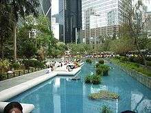
Central, Hong Kong
| Central | |||||||||||||
 Central as viewed from Tsim Sha Tsui, on the opposite side of Victoria Harbour | |||||||||||||
| Traditional Chinese | 中環 | ||||||||||||
|---|---|---|---|---|---|---|---|---|---|---|---|---|---|
| Simplified Chinese | 中环 | ||||||||||||
| |||||||||||||
Central (also Central District; Chinese: 中環) is the central business district of Hong Kong. It is located in Central and Western District, on the north shore of Hong Kong Island, across Victoria Harbour from Tsim Sha Tsui, the southernmost point of Kowloon Peninsula. The area was the heart of Victoria City, although that name is rarely used today.
As the central business district of Hong Kong, it is the area where many multinational financial services corporations have their headquarters. Consulates general and consulates of many countries are also located in this area, as is Government Hill, the site of the government headquarters. The area, with its proximity to Victoria Harbour, has served as the centre of trade and financial activities from the earliest days of the British colonial era in 1841, and continues to flourish and serve as the place of administration after the transfer of sovereignty to China in 1997.
Naming


The area of Choong Wan[1] or Chung Wan (中環), officially named Central in English, was one of the districts (四環九約) in Victoria City. The English name Central became prevalent after the Island Line of the MTR metro system was built in the early 1980s, and the connected stations of Pedder and Chater renamed as Central. On some older maps, it and the area to its west are named Kwan Tai Lo (羣帶路) below Victoria Peak. It formed a channel, Chung Mun (中門), with Tsim Sha Tsui, on the sea route along the coast of southern China. The eastern part of Central District has been known as Admiralty since the completion of Admiralty Station in the early 1980s.
Location
Central is located on the north shore of Hong Kong Island, across Victoria Harbour from Tsim Sha Tsui, the southernmost point of Kowloon Peninsula. It is bordered in the west by Sheung Wan, with the border being along Aberdeen Street (also called Wing Kut Street). It is bordered in the east by Admiralty, an eastern extension of the central business district. As such, Admiralty is sometimes considered a part of Central. Central is bordered in the south by Mid-levels, an area halfway up Victoria Peak. The boundary between Central and Mid-levels is not clearly defined.
For district council elections purposes, the area, together with Admiralty, correspond roughly to the "Chung Wan" constituency.[2] The boundaries of such constituencies may be subject to modification.[3]
History
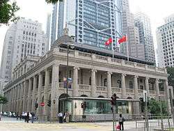
The British landed on Possession Point of Sheung Wan in 1841. They soon decided to build a city on the north coast of Hong Kong Island, and the present-day Central was chosen to house major military facilities and an administrative centre. The area soon attracted both Westerners and Chinese to trade and live in the area, and a Canton Bazaar (precursor of Central Market) was built between Cochrane Street and Graham Street in 1842. The area was soon zoned for Westerners only, and the Chinese residents were restricted to Sheung Wan. [It was zoned for "Western-style buildings," meaning buildings with minimum space and hygiene standards]. The area was largely dominated by the presence of Victoria City. The popularity of this area would also boost the population of Hong Kong from 5,000 in 1841 to 24,000 in 1848.[4] Government House and other Hong Kong Government buildings were completed during this period on Government Hill. Various barracks, naval base and residence of Commander, Flagstaff House were built on the east end of the district. Between 1860 and 1880 the construction of City Hall, Theatre Royal and other financial structures made Central the heart of Hong Kong.
In 1904 the Praya Reclamation Scheme added 59 acres (24 ha) of land to Central's waterfront. Many of the proposals came from Sir Paul Chater and James Johnstone Keswick.[5] During the 1920s, Hong Kong was able to push far ahead economically, because of the cohesive collaboration between Central and all waterfront commerce.
The military structures survived until the 1980s. Only Flagstaff House remains as Museum of Tea Ware in Hong Kong Park. City Hall sat on the present premises of the HSBC Hong Kong headquarters. Hong Kong's first road, Queen's Road, passes through the area and the business centre continued to expand toward the shoreline as far as the reclaimed lands.
Economy
Bank of China (Hong Kong) has its head office in the Bank of China Tower.[6] The Hongkong and Shanghai Banking Corporation, a subsidiary of HSBC, has its head office in the HSBC Main Building.[7] Bank of East Asia and Hang Seng Bank have their head offices in Central.[8][9]
Before 1999, Cathay Pacific had its head office in the Swire House in Central.[10] In 1999 the airline relocated its head office to Hong Kong International Airport.[11]
Notable places, streets and buildings

Office buildings
- 9 Queen's Road Central
- AIA Central
- Alexandra House
- Bank of America Tower
- Bank of China Building, housing the China Club
- Bank of China Tower
- Central Building
- Chater House
- Cheung Kong Center
- Citibank Plaza
- CITIC Tower
- Entertainment Building
- Exchange Square, housing the Hong Kong Stock Exchange
- Hong Kong Club Building, housing the Hong Kong Club
- Hong Kong Trade Centre
- HSBC Main Building
- Hutchison House
- Jardine House
- Man Yee Building
- Prince's Building
- St. John's Building
- Standard Chartered Bank Building
- The Center
- The Centrium
- The Landmark (office and shopping complex)
- International Finance Centre (IFC), the second tallest building in Hong Kong
- Wheelock House
- Wing On House
- World-Wide House
Streets and squares
- Aberdeen Street, marking the limit between Central and Sheung Wan
- Arbuthnot Road
- Battery Path
- Chater Road
- Connaught Place
- Cochrane Street
- Connaught Road Central
- Cotton Tree Drive
- D'Aguilar Street
- Des Voeux Road Central
- Edinburgh Place, a public square adjacent to the Victoria Harbour
- Elgin Street
- Gage Street, a market street
- Garden Road
- Glenealy
- Graham Street, a market street
- Gutzlaff Street
- Hollywood Road
- Ice House Street
- Jubilee Street (租庇利街). Named for the Golden Jubilee of Queen Victoria in 1887.[12]
- Lower Albert Road
- Lyndhurst Terrace
- Old Bailey Street
- On Lan Street
- Pedder Street
- Peel Street
- Pottinger Street, one of the "ladder streets"
- Queen's Road Central, the first road in Hong Kong built by the Government of Hong Kong between 1841 and 1843[13]
- Queen Victoria Street
- Queensway, in Admiralty
- Stanley Street
- Statue Square, a public pedestrian square
- Staunton Street
- Staveley Street, one of the "ladder streets"
- Theatre Lane, home to many of Hong Kong's shoe shiners
- Wellington Street
- Wyndham Street
- Wing On Street (永安街), aka. Cloth Street (花布街)
Government buildings
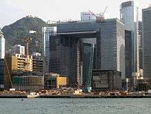
- Central Government Complex, Tamar (under construction)
- Former Central Government Offices on Government Hill
- Chinese People's Liberation Army Forces Hong Kong Building
- City Hall
- Former French Mission Building, housing the Court of Final Appeal
- General Post Office, Hong Kong
- Government House
- Hong Kong Planning and Infrastructure Exhibition Gallery
- Legislative Council Building
- Queensway Government Offices
Other historical buildings
- Bishop's House
- Central Market
- Central Police Station
- Duddell Street Steps and Gas Lamps
- Flagstaff House
- Former Central Magistracy
- Hong Kong Visual Arts Centre
- Old Dairy Farm Depot, housing the Hong Kong Fringe Club and the Foreign Correspondents' Club
- Pedder Building
- The Cenotaph
- The Helena May main building
- Victoria Prison
- Zetland Hall
- Central and Western Heritage Trail
- Dr Sun Yat-sen Historical Trail
Hotels
Central, together with Tsim Sha Tsui and Tsim Sha Tsui East, is home to many hotels.
- Conrad Hong Kong (Pacific Place, Admiralty)
- Four Seasons Hotel Hong Kong (IFC)
- Hong Kong Hilton (demolished in 1995)
- JW Marriott Hotel Hong Kong (Pacific Place, Admiralty)
- Landmark Mandarin Oriental (The Landmark)
- Mandarin Oriental (Connaught Road Central)
- Ovolo Hotels (2 Arbuthnot Road). Opened in October 2012.
- Ritz-Carlton (Chater Road), closed 1 January 2008.
- Island Shangri-La (Pacific Place, Admiralty)
Entertainment areas
- Lan Kwai Fong, the location of numerous bars, restaurants and clubs
- Hong Kong Maritime Museum, Central Ferry Pier 8
- Soho, Hong Kong
- Wyndham Street
Places of worship
- Various Buddhist temples
- St. John's Cathedral (Sheng Kung Hui, Anglican Church)
- First Church of Christ Scientist
- Union Church
- Immaculate Conception Cathedral, Hong Kong (Roman Catholic)
- St. Joseph's Church (Roman Catholic)
Parks
- Chater Garden
- Cheung Kong Park
- Hong Kong Park, former location of the Victoria Barracks
- Hong Kong Zoological and Botanical Gardens
- Statue Square
Schools
- Raimondi College
- Sacred Heart Canossian School
- St. Joseph's College, Hong Kong
- St. Paul's Co-educational College
- St. Stephen's Girls' College
- Ying Wa Girls' School
Former buildings
- Beaconsfield House, demolished in 1995
- Hong Kong Hilton, closed in 1995
- Hong Kong Hotel, closed in 1952
- Murray House, part of Murray Barracks, moved to Stanley
- Old Central Government Offices, demolished in 1954
- Wellington Barracks, demolished in 1992
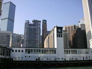
- City Hall Ferry Pier, barge pier, closed due to the Central and Wan Chai Reclamation
- Edinburgh Place Ferry Pier, demolished in 2007
- Blake Pier, Central, demolished, partially moved to Stanley
- Queen's Pier, demolished in 2008
- United Pier, demolished in 1994
Transport

Public transport
The area is a major transport hub for Hong Kong (see also Transport in Hong Kong).
- Bus
- Minibus
- Trains and Trams
- MTR – Island Line, Tsuen Wan Line, Tung Chung Line, Airport Express at Hong Kong, Central and Admiralty stations
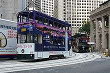
- Tram
- Peak Tram
- Ferries
- New World First Ferry, to Silvermine Bay (Mui Wo), Peng Chau and Cheung Chau
- Hong Kong & Kowloon Ferry, to Sok Kwu Wan and Yung Shue Wan on Lamma Island
- Star Ferry, to Tsim Sha Tsui and Hung Hom
- Discovery Bay Ferry, to Tsim Sha Tsui East and Discovery Bay
- Park Island Ferry
- Ferry piers:
- Pedestrian facilities
Expressways and routes
- Route 4
- Connaught Road Central
- Central-Wan Chai Bypass (under construction)
References
- ↑ Map of circa 1880
- ↑ District Council electoral boundaries – Central and Western District
- ↑ Press release: "Public consultation on proposed constituency boundaries for 2011 District Council Election", December 3, 2010
- ↑ Sanderson, Edgar (1897–1898). The British Empire in the nineteenth century: its progress and expansion at home and abroad IV. London: Blackie and Son. p. 337. LCCN 02002538. OCLC 11625716.
- ↑ Wordie, Jason. [2002] (2002) Streets: Exploring Hong Kong Island. Hong Kong: Hong Kong University Press. ISBN 962-209-563-1
- ↑ "Contact Us." Bank of China. Retrieved on 11 September 2011. "Registered Office BOC Hong Kong (Holdings) Limited 52/F Bank of China Tower 1 Garden Road Hong Kong"
- ↑ "Contact Us." HSBC. Retrieved on 12 September 2011. "The Hongkong and Shanghai Banking Corporation LtdThe Hongkong and Shanghai Banking Corporation – Hong Kong Address:GPO Box 64, Hong Kong, 1 Queen's Road Central, Hong Kong SAR, China"
- ↑ "Investor Enquiries." Bank of East Asia. Retrieved on 11 September 2011. "Registered Office : 10 Des Voeux Road Central, Central, Hong Kong"
- ↑ "Business Banking Centres." Hang Seng Bank. Retrieved on 11 September 2011. "Level 1 & 6, Hang Seng Headquarters, 83 Des Voeux Road, Central" (Map)
- ↑ "World Airline Directory" (PDF). Flight International. 30 March 1985. p. 68. Retrieved 17 June 2009. "Head Office: Swire House, 9 Connaught Road, C, Hong Kong"
- ↑ "Cathay Pacific wins award for providing a smoke-free workplace at its Hong Kong Headquarters" (Press release). Cathay Pacific. 6 January 2005. Retrieved 2 July 2009.
- ↑ Yanne, Andrew; Heller, Gillis (2009). Signs of a Colonial Era. Hong Kong University Press. p. 8. ISBN 978-962-209-944-9.
- ↑ Lim, Patricia. [2002] (2002). Discovering Hong Hong's Cultural Heritage. Central, Hong Kong: Oxford University Press. ISBN Volume One 0-19-592723-0
External links
 Hong Kong/Central travel guide from Wikivoyage
 Media related to Central, Hong Kong at Wikimedia Commons
- Photo Tour of Central Hong Kong, About.com
- Map of Central District in 1964 (crown copyright)
- Map of Hongkong Central 1911
Coordinates: 22°16′55″N 114°09′29″E / 22.28194°N 114.15806°E


.jpg)

