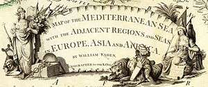
William Faden


William Faden (1749 – 1836) was an English cartographer and a publisher of maps.[1][2][3] He was the royal geographer to King George III. He replaced Thomas Jeffreys in that role.[4] The title of "geographer to the king" was given to various people in the 18th century, including John Senex, Herman Moll, Emmanuel Bowen and Thomas Jeffreys. All of these men, including William Faden, were engravers and publishers, not scholars or academics. Their part was to publish and supply maps to the crown and parliament.[5]
Life and works
William Faden was born as son of the printer Willam Faden senior (1711-1783).[6] He self printed the North American Atlas[7] in 1777, and "...it became the most important atlas chronicling the Revolution's battles." There were 29 maps in the atlas, and they included detailed battle maps drawn by eyewitnesses.[8]
William Faden was also the publisher of the periodical "the Public Ledger" or "The Daily Register" in London.[9]
A list of the English county maps printed by William Faden is also given in one of his biographies.[10]
Bibliography
- Faden, William. 1963. Catalogue of the geographical works, maps, plans, &c. published by W. Faden ... 1822. London: Map Collectors' Circle. Originally published: London: W. Faden, 1822. 16 pages.
- Jefferys, Thomas, William Faden, and Mary Sponberg Pedley. 2000. The map trade in the late eighteenth century: letters to the London map sellers Jefferys and Faden. Oxford: Voltaire Foundation. Correspondence in French, introduction and commentary in English.
- Laurence, W. (2004). "Faden, William". Oxford: Oxford University Press. Dictionary of National Biography.
- Williamson, T., & Macnair, A. (2010). William Faden and Norfolk's 18th-century landscape. Oxford: Windgather Press
References
- ↑ Worms, Laurence (June 2004). "The Maturing of British Commercial Cartography: William Faden (1749-1836) and the Map Trade". The Cartographic Journal 41 (1): 5–11. doi:10.1179/000870404225019972.
- ↑ Pedley, Mary (1996). "Maps, War, and Commerce: Business Correspondence with the London Map Firm of Thomas Jefferys and William Faden". Imago Mundi 48: 161–173. JSTOR 1151268. (subscription required)
- ↑ "William Faden (1749-1836)". Digital Scholarly Editions. Lehigh University Press.
- ↑ "A Plan of the City and Environs of Philadelphia, 1777". World Digital Library. Retrieved February 14, 2013.
- ↑ Pedley, Mary Sponberg. 2005. The Commerce of Cartography: Making and Marketing Maps in Eighteenth-Century France and England. University of Chicago Press. Page 33.
- ↑ See the data of the German National Library
- ↑ Faden, William, Thomas Hyde Page, Claude Joseph Sauthier, Thomas Hutchins, and Ross. 1776. The North American atlas: selected from the most authentic maps, charts, plans, &c. hitherto published. London: Printed for William Faden. A compilation of maps from various sources. Includes 27 maps on two facing pages: no. 1-2. Chart of the Atlantic Ocean.--no. 3. General map of the British colonies.--no. 4. Canada.--no. 5. Island of Newfoundland.--no. 6. Nova Scotia.--no. 7-8. New England.--no. 9. Boston harbour.--no. 10 Rhode Island.--no. 11. Reduced map of New York.--no. 12-14. New York.--no. 15. New Jersey.--no. 16. Pennsylvania.--no. 17. Delaware River.--no. 18-19. Virginia & Maryland.--no. 20-21. Nth & Sth Carolina.--no. 22-23. Sth Carolina & Georgia.--no. 24. Harbour of Charles Town.--no. 25. Savannah River.--no. 26. Florida.--no. 27. West Indies.Five maps are not listed. The 5 unlisted maps are: Plan of the position which the army under Lt. Genl. Burgoine took at Saratoga ... ([London]: Wm. Faden, 1780); Boston, its environs and harbour ... / from the observations of Lieut. Page. ([London]: Wm. Faden, 1778); A chronographical map of the province of New-York in North America ... / by Claude Joseph Sauthier. (London : Engraved and published by William Faden, 1779). A new map of the western parts of Virginia, Pennsylvania, Maryland and North Carolina ... / by Thos. Hutchins. (London : Engraved by T. Cheevers, 1778); Course of the river Mississippi from the Balise to Fort Chartres ... / by Lieut. Ross (London: Robt. Sayer, 1775.). Maps bear imprint dates of 1774-1780. The maps are hand-colored.
- ↑ Yokota, Kariann Akemi. 2011. Unbecoming British: How Revolutionary America Became a Postcolonial Nation. Oxford University Press. Page 30.
- ↑ Welsch, Charles. 1885. A Bookseller of the Last Century. Griffith, Farran, Okeden & Welsh. Pages 43-44.
- ↑ Macnair, Andrew, and Tom Williamson. 2010. William Faden and Norfolk's 18th century landscape: a digital re-assessment of his historic map. Bollington: Windgather.
External links
| Wikimedia Commons has media related to William Faden. |
- Fadens Map of London from fadenmapoflondon.co.uk
- William Faden maps from mostlymaps.com
- William Faden maps from geographicus.com
- William Faden maps from davidrumsey.com
|