Willesborough Dykes

Area
Willesborough is a suburb of Ashford, Kent, UK. The area has schools, post offices, shops and other local resources, it is mainly residential but as Ashford expands there is more and more commercial activity around Willesborough. The Willesborough Dykes form part of the Ashford Green Corridor
South Willesborough Dykes
On the west bank of the East Stour river is an area of sheep fields drained by dykes, the area is designated as the South Willesborough Dykes Site of Nature Conservation Interest (SNCI). The dykes continue on the east side of the East Stour river and amongst the residential areas, and a tributary stream (Aylesford Stream) runs between Newtown and South Willesborough and into the East Stour. The smallest ditches dry up completely in summer.[1] The 'South Willesborough Dykes' have limited access to the public but are none-the-less important in terms of the geology of the area, being in the river floodplain and in supporting neutral, wet grassland species. Grazing has influenced the composition of the grassland habitat and much of the area remains as grazing land today.

Similar sites
There are few other places in East Kent with the same characteristics as the South Willesborough Dykes, other areas of grazing marsh are designated as the Sandwich Bay and Hacklinge marshes SSSI, Ash Level and South Richborough Pasture an SNCI, there are nature reserves at Gazen Salts recreation ground (Sandwich) and Monk's Wall nature reserve.
Plants

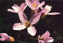
Plants that are unlikely to be recorded anywhere else in Kent are found on the South Willesborough Dykes. These include purple loosestrife (Lythrum salicaria), lady's smock (Cardamine pratensis), marsh stitchwort (Stellaria palustris), water violet (Hottonia palustris) and blue water speedwell (Veronica anagallis-aquatica). One type of moss found in the area is only present at one other site in Kent.
Birds

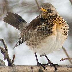
The area is also important for wintering and breeding birds such as fieldfare, linnet, swallow, lapwing (often found together with golden plover and snipe).[2] Ashford Borough Council have a project to create the Willesborough Dykes Country Park,[3] they have a strategy, with key actions for improving Ashford's open spaces, 'particularly South Willesborough Dykes' by 2007.[4]
Map
The Ashford Green Corridor web site has a very useful map showing 'South Willesborough Dykes' and other green areas within Ashford and the route of part of the Stour Valley Walk.
References
- ↑ The SWANEG site (South Willesborough and Newtown Environmental Group)
- ↑ Ashford Green Corridor
- ↑ Ashford Borough Council - Project Office
- ↑ Ashford Borough Council - Property Strategy 2005-06 (page 7)
For further information about the surrounding area see the Ashford page.
Coordinates: 51°07′59″N 0°52′19″E / 51.133°N 0.872°E