Raj Ghat and associated memorials


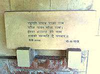
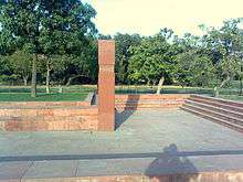
Raj Ghat is a memorial to Mahatma Gandhi. Originally it was the name of a historic ghat of Old Delhi (Shahjahanabad) on the banks of Yamuna river. Close to it, and east of Daryaganj was “Raj Ghat Gate” of the walled city, opening at Raj Ghat on Yamuna River.[1][2] Later the memorial area was also called Raj ghat. It is a black marble platform that marks the spot of Mahatma Gandhi's cremation, Antyesti (Antim Sanskar) on 31 January 1948, a day after his assassination. It is left open to the sky while an eternal flame burns perpetually at one end. It is located on the banks of the river Yamuna in Delhi in India on Ring Road officially known as Mahatma Gandhi Road. A stone footpath flanked by lawns leads to the walled enclosure that houses the memorial. All guests must remove their footwear before entering the Raj Ghat walls.
Other memorials


Raj Ghat loosely translates to King's Bank (where King alludes to the importance of the place and Bank as in -on the bank of river Yamuna). Several other samādhis or cremation spots of other famous leaders can be found in the vicinity of Raj Ghat on the banks of the Yamuna. The landscaping and planting of these memorials was performed by Alick Percy-Lancaster, the last Englishman to hold the post of Superintendent of Horticultural Operations, Government of India.
Jawaharlal Nehru's samadhi is to the north of the Raj Ghat and is known as the Shantivan or Shanti Vana meaning the "forest of peace". Adjacent to Nehru's memorial is Ekta sthal, the site where K. R. Narayanan, tenth President of India, was cremated with full state honours in 2005.
The Raj Ghat area has a park adorned with trees planted by visiting dignitaries and heads of state.
List of memorials at Raj Ghat area
The complete list of Raj Ghat and associated memorials is as follows:
| Name | Title | Year of death | Memorial name | Meaning | Area (in acres)[3] |
Feature |
|---|---|---|---|---|---|---|
| Mahatma Gandhi | Mahatma | 1948 | Raj Ghat | Royal Steps | 44.35 | Blue marble platform |
| Jawaharlal Nehru | Prime Minister of India | 1964 | Shantivan | Garden of Peace | 52.6 | A large plinth covered with a lawn |
| Lal Bahadur Shastri | Prime Minister of India | 1966 | Vijay Ghat | Victory Platform | 40 | The victory alluded to in the name of the memorial is India's performance under his leadership in the Indo-Pakistani War of 1965. |
| Indira Gandhi | Prime Minister of India | 1984 | Shakti Sthal | Place of Power | 45 | A huge greyish-red monolithic stone |
| Jagjivan Ram | Deputy Prime Minister of India | 1986 | Samta Sthal | Place of Equality | 12.5 | — |
| Choudhary Charan Singh | Prime Minister of India | 1987 | Kisan Ghat | Farmer’s Platform | 19 | — |
| Rajiv Gandhi | Prime Minister of India | 1991 | Veer Bhumi | Land of Brave | 15 | A large lotus in full bloom carved out of stone surrounded by 46 small lotuses to signify the years he lived; rocks from all the states of India are spread around.[4] |
| Giani Zail Singh | President of India | 1994 | Ekta Sthal | Place of Unity | 22.56 | — |
| Shankar Dayal Sharma[5] | President of India | 1999 | Karma Bhumi | Land of Duty | Located near Vijay Ghat. | |
| Chandra Shekhar | Prime Minister of India | 2007 | Jannayak Sthal[6] | Place of People's leader | — | |
| I. K. Gujral | Prime Minister of India | 2012 | Smiriti Sthal | Place of Remembrance | — | |
| Devi Lal | Deputy Prime Minister of India | 2001 | Sangharsh Sthal | Place of Struggle | Located near Kisan Ghat. | |
| P. V. Narasimha Rao | Prime Minister of India | 2004 | P.V. Ghat | Located at Necklace road, Hyderabad |
References
- ↑ Fanshawe, p. 67
- ↑ 1863 Atlas Map of Delhi
- ↑ "No space for 'samadhis', VVIPs to share memorial place in Delhi". Rediff.com. 16 May 2013. Retrieved 30 November 2013.
- ↑ "'Rajiv' to bloom at Veer Bhumi". The Tribune Trust. 18 August 2004. Retrieved 21 December 2008.
- ↑ "Tearful farewell to S.D. Sharma". The Tribune (The Tribune Trust). 28 December 1999. Retrieved 21 December 2008.
- ↑ "Former PM Chandrashekhar’s samadhi to be called Jannayak Sthal". The Times of India. 23 April 2015. Retrieved 19 November 2015.
- H.C. Fanshawe (1998). Delhi, past and present. Asian Educational Services. ISBN 81-206-1318-X.
External links
Coordinates: 28°38′26″N 77°14′58″E / 28.640550°N 77.249433°E
| Wikimedia Commons has media related to Rajghat. |
| ||||||||||||||||||||||||||||||||||||||||||||||||