Vatnajökull
| Vatnajökull Glacier | |
|---|---|
|
Vatnajökull, Iceland | |
| Type | Ice cap |
| Location | Iceland |
| Coordinates | 64°24′N 16°48′W / 64.400°N 16.800°WCoordinates: 64°24′N 16°48′W / 64.400°N 16.800°W |
| Area | 8,100 km2 (3,100 sq mi) |
| Thickness | 400 m (1,300 ft) average |
| Terminus | Outlet glaciers |
| Status | Retreating |

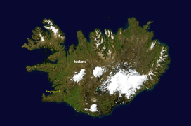
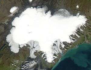
Vatnajökull (Icelandic pronunciation: [ˈvaʰtnaˌjœːkʏtl̥]), also known as the Vatna Glacier, is the largest and most voluminous ice cap in Iceland, and one of the largest in area in Europe. It is the second largest glacier in area after Austfonna on Svalbard in Norway. It is located in the south-east of the island, covering more than 8 percent of the country.[1]
Name
The name Vatnajökull is derived from vatna, the genitive plural form of vatn which means "water" in Icelandic but is also used to refer to a lake, and jökull, the Icelandic for glacier.
Size
With an area of 8,100 km², Vatnajökull is the largest ice cap in Europe by volume (3,100 km³) and the second-largest (after Austfonna on Nordaustlandet, Svalbard, Norway) in area (not counting the still larger Severny Island ice cap of Novaya Zemlya, Russia, which may be regarded as located in the extreme northeast of Europe). On 7 June 2008, it became a part of the Vatnajökull National Park.[2]
The average thickness of the ice is 400 m (1,300 ft), with a maximum thickness of 1,000 m (3,300 ft). Iceland's highest peak, Hvannadalshnúkur (2,109.6 m (6,921 ft)), is located in the southern periphery of Vatnajökull, near Skaftafell National Park.


Volcanoes
Under the ice cap, as under many of the glaciers of Iceland, there are several volcanoes. The volcanic lakes, Grímsvötn for example, were the sources of a large jökulhlaup (glacial lake outburst flood) in 1996. There was also a considerable but short-time eruption of the volcano under these lakes at the beginning of November 2004. In May 21, 2011 a volcanic eruption started in Grímsvötn in Vatnajökull National Park at around 7 p.m. The plume reached as high as 20 kilometres (12 mi). During the last ice age, numerous volcanic eruptions occurred under Vatnajökull, creating many subglacial eruptions.
Sight line
According to Guinness World Records (GWR), Vatnajökull is supposedly the object of the world's longest sight line, 550 km (340 mi) from Slættaratindur, the highest mountain in the Faroe Islands. GWR claims that "owing to the light bending effects of atmospheric refraction, Vatnajökull (2,109.6 m), Iceland, can sometimes be seen from the Faroe Islands, 340 miles (550 km) away". This may be based on an alleged sighting by a British sailor in 1939.
In culture
In 1950, a Douglas DC-4 operated by the private airline Loftleiðir crash-landed on the Vatnajökull glacier.[3]
The glacier was used as the setting for the opening sequence (set in Siberia) of the 1985 James Bond film A View to a Kill, in which Bond (played for the last time by Roger Moore) eliminated a host of armed villains before escaping in a submarine to Alaska.[4] Several other films, including another in the Bond franchise, have been filmed on or using Jökulsárlón, the terminal lake of the Breiðamerkurjökull outlet from Vatnajökull.
In November 2011, the glacier was used as a shooting location for the second season of the HBO fantasy TV series Game of Thrones.[5]
Outlet glaciers
Vatnajökull has around 30 outlet glaciers flowing from the ice cap. The Icelandic term for glacier is "jökull", and so is the term for outlet glacier. Given below is a list of outlet glaciers flowing from Vatnajökull, sorted by the four administrative territories of Vatnajökull National Park.[6] This is not a complete list.
Southern territory
- Breiðamerkurjökull
- Brókarjökull
- Falljökull
- Fjallsjökull
- Fláajökull
- Heinabergsjökull
- Hoffellsjökull
- Hólárjökull
- Hrútárjökull
- Kvíárjökull
- Lambatungnajökull
- Morsárjökull
- Skaftafellsjökull
- Skálafellsjökull
- Skeiðarárjökull
- Stigárjökull
- Svínafellsjökull
- Viðborðsjökull
- Virkisjökull
Eastern territory
- Brúarjökull
- Eyjabakkajökull
- Kverkjökull
Northern territory
Western territory
- Köldukvíslarjökull
- Síðujökull
- Skaftárjökull
- Sylgjujökull
- Tungnaárjökull
Images
-

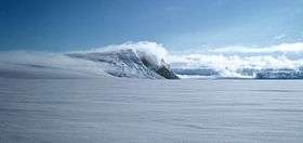
Grímsvötn in the Vatnajökull glacier
-

Vatnajökull
-

Vatnajökull from the road to Jökulsárlón
See also
References
- ↑ Guide to Iceland. "Vatnajökull". https://guidetoiceland.is/travel-iceland/drive/vatnajokull. External link in
|website=(help); - ↑ "Vatnajokull National Park". Háskóli Íslands. hi.is. Retrieved 9 July 2010.
- ↑ "COLLISIONS AND BOMBS!". dc3history.org. 2010-04-12. Retrieved 2010-05-16.
- ↑
- ↑ "Iceland filming location revealed". winter-is-coming.net. 28 October 2011. Retrieved 28 October 2011.
- ↑ "General information map". Vatnajökull National Park. Retrieved 25 October 2012.
External links
| Wikimedia Commons has media related to Vatnajökull. |
- News about Vatnajokull National park
- Search engine and map of Iceland
- Viewfinder Panoramas
- What it's like to explore the ice cap in winter.
|
