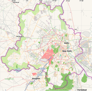
Vasant Vihar, Delhi
| Vasant Vihar | |
|---|---|
| Neighbourhood | |
|
A modern house in Vasant Vihar Block C | |
 Vasant Vihar | |
| Coordinates: 28°33′27″N 77°09′32″E / 28.5574°N 77.159°ECoordinates: 28°33′27″N 77°09′32″E / 28.5574°N 77.159°E | |
| Country | India |
| State | Delhi |
| District | South West Delhi |
| Government | |
| • Body | South Delhi Municipal Corporation |
| Languages | |
| • Official | Hindi, English |
| Time zone | IST (UTC+5:30) |
| Vehicle registration | DL-12 |
| Nearest city | Gurgaon |
| Lok Sabha constituency | New Delhi |
| Vidhan Sabha constituency | R K Puram |
| Civic agency | Municipal Corporation of Delhi |
Vasant Vihar is a neighbourhood located in the South West Delhi district of National Capital Territory of Delhi.[1][2][3] It is located near the diplomatic area of Chanakyapuri, and houses over 50 diplomatic missions of foreign countries.[4][5]
It is part of the R K Puram Delhi Legislative Assembly constituency,[6] and includes Government and Public sector residential colonies Lok Sabha and Rajya Sabha Quarters, Reserve Bank of India colony, and Indian Airlines Colony.[6]
Overview
It was originally developed in 1960s by retired Government of India officers, later developed as a posh residential locality due to its proximity to diplomatic enclave of Chanakyapuri.[7][8]
The three main streets in Vasant Vihar are Munirka Marg, Poorvi Marg and Paschimi Marg, literally Eastern and Western Street. These form a rough triangle that encloses much of the neighbourhood. The neighbourhood is primarily residential and when first planned consisted of six blocks named A to F, with each block having its own local market. Apartments in new emerging luxury buildings in Vasant Vihar sell at prices ranging from ₹5 Crore to ₹20 Crore (USD 740,000 to USD 3 million).[9]
At the edge of the neighbourhood, across the Outer Ring Road, lies the Uttara Swami Malai Temple on a small hillock. There is also a historic church located in Vasant Vihar, as well as some Mughal era monuments. Ruins of a formal Pre-Mughal garden stretching across 12 hectares lie have also been found in the locality. Situated at edge of locality, near Munirka and R.K. Puram, it dates to the late Delhi Sultanate period, from 14 to early 15th century.[10]
Education
Vasant Vihar also has schools such as Chinmaya Vidyalaya, Modern School,[11] The Shri Ram School (Junior Wing), Tagore International School, Guru Harkrishan Public School, Holy Child Auxilium School (Senior branch), Delhi Public School (Junior Branch), SBDAV, and Upras Vidyalaya.
References
- ↑ "South West District". Government of Delhi. Retrieved 2015-12-13.
- ↑ "Posh Vasant Vihar in South Delhi stares at epidemic". India Today. September 15, 2015. Retrieved 2015-12-13.
- ↑ "The Anatomy of a Tony Neighbourhood". Forbes India. May 12, 2014. Retrieved 2015-12-14.
- ↑ Embassy Listings For India Archived June 10, 2008 at the Wayback Machine
- ↑ The Government of National Capital Territory of Delhi directory. Giri's Information Services. 1999. pp. 246–248.
- 1 2 "Polling Booths in R K Puram Assembly Constituency, Delhi". Retrieved 2015-12-24.
- ↑ Viswambhar Nath; Surinder K. Aggarwal (2007). Urbanization, Urban Development, and Metropolitan Cities in India. Concept Publishing. pp. 222–. ISBN 978-81-8069-412-7.
- ↑ City, Society, and Planning: City. Concept Publishing. 2007. pp. 421, 521. ISBN 978-81-8069-459-2.
- ↑ "The Anatomy of a Tony Neighbourhood". Forbes India. May 12, 2014. Retrieved 2016-02-06.
- ↑ James L. Wescoat; Joachim Wolschke-Bulmahn (1996). Mughal Gardens: Sources, Places, Representations, and Prospects. Dumbarton Oaks. p. 74. ISBN 978-0-88402-235-0.
- ↑ A Dream Turns Seventy Five: The Modern School, 1920-1995. Allied Publishers. 1995. pp. 142–. ISBN 978-81-7023-499-9.
.jpg)