Vallegrande
- This article is about the town in Bolivia. For the dry lakebed in New Mexico, see Valle Grande.
| Vallegrande | ||
|---|---|---|
.jpg) | ||
| ||
 Vallegrande Location in Bolivia | ||
| Coordinates: 18°29′S 64°06′W / 18.483°S 64.100°W | ||
| Country |
| |
| Department | Santa Cruz Department | |
| Province | Vallegrande Province | |
| Municipality | Vallegrande Municipality | |
| Canton | Vallegrande Canton | |
| Elevation | 6,660 ft (2,030 m) | |
| Population (2001) | ||
| • Total | 6,000 | |
| Climate | Cwb | |
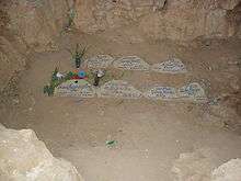
Vallegrande (Spanish: "Big Valley") is a small colonial town in Bolivia, located in the Department of Santa Cruz, some 125 km (bee-line) southwest of Santa Cruz de la Sierra. It is the capital of the Vallegrande Province and Vallegrande Municipality and serves as a regionally important market town. The small town is best known for being the first burial site of revolutionary Che Guevara, after his 1967 assassination.
Geography
The town lies in a big valley (hence the name) at an altitude of 2,030 m (6,660 ft) and has approximately 6,000 inhabitants. It has a mild temperate climate due mainly to its valley location, altitude, and the cold winter fronts the sweep the plains of Santa Cruz known as "Surazo".
Climate
Vallegrande has a subtropical highland climate (Köppen: Cwb).
| Climate data for Vallegrande | |||||||||||||
|---|---|---|---|---|---|---|---|---|---|---|---|---|---|
| Month | Jan | Feb | Mar | Apr | May | Jun | Jul | Aug | Sep | Oct | Nov | Dec | Year |
| Daily mean °C (°F) | 18.8 (65.8) |
18.3 (64.9) |
17.9 (64.2) |
16.4 (61.5) |
15.3 (59.5) |
13.9 (57) |
13.8 (56.8) |
14.8 (58.6) |
16.8 (62.2) |
17.2 (63) |
18.4 (65.1) |
18.8 (65.8) |
16.7 (62.03) |
| Average precipitation mm (inches) | 129 (5.08) |
121 (4.76) |
85 (3.35) |
42 (1.65) |
20 (0.79) |
12 (0.47) |
11 (0.43) |
13 (0.51) |
22 (0.87) |
36 (1.42) |
73 (2.87) |
103 (4.06) |
667 (26.26) |
| Source: Climate-Data.org[1] | |||||||||||||
Economy
The main industries in the area revolve around agriculture and its derived products. The region is mainly dedicated to the production of grains such as corn and wheat, and fruits such as peaches, apples, grapes, pears, chirimoyas and plums. Among the value added products the most important are homemade bread, chamas, fruit liquor, wine, handmade rugs, and other handcrafts.
History
Vallegrande was founded by the Spanish in 1612 under the name Ciudad de Jesús y Montes Claros de los Caballeros del Vallegrande (Town of Jesus and Montes Claros of the knights of Vallegrande). It was intended to serve as a frontier to prevent the constant raids of the Guarani warriors that dominated the region. Many of the original inhabitants of Vallegrande were Sephardic and Ashkenazic Jews converted to Catholicism and persecuted by the inquisition in Spain and nearby La Plata and Potosi, for they were suspected to continue to secretly practice Judaism. Others came from Santa Cruz de la Sierra as Vallegrande became the main transit point in the route that connected Santa Cruz with the mines of Peru.
During the 18th and 19th centuries Vallegrande steadily grew and became the urban and cultural center of the region with a population of 25,000 by 1900. In the 20th century, though, concurrent with the rise of the nearby Santa Cruz, Vallegrande's importance gradually declined.
Transport
Vallegrande can be accessed via a spur road branching off the (old, southern) Santa Cruz to Cochabamba highway and has an airstrip.
Che Guevara

References
- ↑ "Climate: Vallegrande". Climate-Data.org. Retrieved 12 April 2014.
External links
- Página de Vallegrande
- Página de Vallegrande
- Map of Vallegrande Province
- Vallegrande Travel Guide
- The Che Trail in Bolivia
- Che Guevara Route, Vallegrande Region
Articles
- The Local Deity: Bones or Not, Vallegrande's a Must Stop on the Che Route by Joshua Hammer, Newsweek, 1997
- Che Guevara Legacy Lives on in Bolivia BBC News, August 24, 2004
- Bolivian Town Recalls Che Assassination Prensa Latina, October 8, 2008
- Che Sat Here: The Making (and Marketing) of a Martyr by Alex Ayala Ugarte, Virginia Quarterly Review, Winter 2009 Issue
Coordinates: 18°29′S 64°06′W / 18.483°S 64.100°W
