Unthank, Derbyshire
| Unthank | |
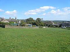
 Farmhouses on Unthank Lane |
|
 Unthank |
|
| OS grid reference | SK307760 |
|---|---|
| District | North East Derbyshire |
| Shire county | Derbyshire |
| Region | East Midlands |
| Country | England |
| Sovereign state | United Kingdom |
| Post town | DRONFIELD |
| Postcode district | S18 |
| Police | Derbyshire |
| Fire | Derbyshire |
| Ambulance | East Midlands |
| EU Parliament | East Midlands |
|
|
Coordinates: 53°16′51″N 1°32′22″W / 53.2808°N 1.5394°W
Unthank is a hamlet in the county of Derbyshire, in England. It is in the North East Derbyshire administrative district of the county. It is sited on a narrow lane on the southern slopes of the Cordwell Valley, at an altitude of about 607 feet.
External links
![]() Media related to Unthank, Derbyshire at Wikimedia Commons
Media related to Unthank, Derbyshire at Wikimedia Commons
This article is issued from Wikipedia - version of the Thursday, March 20, 2014. The text is available under the Creative Commons Attribution/Share Alike but additional terms may apply for the media files.