List of mountain peaks of California

This article comprises three sortable tables of major mountain peaks of the U.S. State of California.
Topographic elevation is the vertical distance above the reference geoid, a mathematical model of the Earth's sea level as an equipotential gravitational surface. The topographic prominence of a summit is the elevation difference between that summit and the highest or key col to a higher summit. The topographic isolation of a summit is the minimum great-circle distance to a point of equal elevation.
This article defines a significant summit as a summit with at least 100 meters (328 feet) of topographic prominence, and a major summit as a summit with at least 500 meters (1640 feet) of topographic prominence. An ultra-prominent summit is a summit with at least 1500 meters (4921 feet) of topographic prominence. There are 127 ultra-prominent summits in the United States.
All elevations in this article include an elevation adjustment from the National Geodetic Vertical Datum of 1929 (NGVD 29) to the North American Vertical Datum of 1988 (NAVD 88). For further information, please see this United States National Geodetic Survey note.
Highest major summits
The following sortable table lists the 40 highest California mountain peaks with at least 500 meters (1640.4 feet) of topographic prominence.
The first 16 of these summits each have at least 4000 meters (13,123.4 feet) of topographic elevation and at least 500 meters (1640.4 feet) of topographic prominence. See the Highest mountain peaks of California for a table of these summits.
Most prominent summits
The following sortable table lists the 40 most topographically prominent California mountain peaks.
The first nine of these summits are ultra prominent peaks, summits with at least 1500 meters (4921.3 feet) of topographic prominence.
Most isolated major summits
The following sortable table lists the 40 most topographically isolated California mountain peaks with at least 500 meters (1640.4 feet) of topographic prominence.
The first nine of these summits each have at least 100 kilometers (62.14 miles) of topographic isolation and at least 500 meters (1640.4 feet) of topographic prominence.
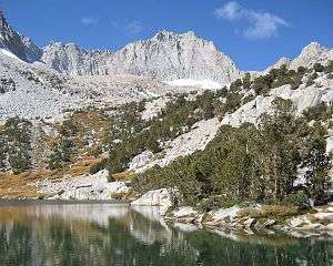
Gallery
-
Mount Whitney is the highest summit of the Sierra Nevada, the State of California, and the contiguous United States.
-

Mount Williamson is the second highest mountain peak of California.
-

White Mountain Peak is the highest summit of the White Mountains.
-

North Palisade is the highest summit of the Palisades of the Sierra Nevada.
-

The stratovolcano Mount Shasta is the second most topographically prominent California mountain peak.
-

Mount Humphreys in the Sierra Nevada.
-
Mount Darwin is the highest summit of the Evolution Peaks of the Sierra Nevada.
-

Mount Tom in the Sierra Nevada.
-

San Gorgonio Mountain is the highest summit of the San Bernardino Mountains and the third most topographically isolated California peak.
-

Telescope Peak is the highest summit of the Panamint Range.
-

San Jacinto Peak is the highest summit of the San Jacinto Mountains.
-
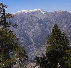
Mount San Antonio is the highest summit of the San Gabriel Mountains.
See also
- Outline of California
- Index of California-related articles
- List of highest points in California by county
- Lists of mountains
- List of mountain peaks of the United States
- List of the highest major summits of the United States
- List of the most prominent summits of the United States
- List of the most isolated major summits of the United States
- List of mountain peaks of North America
- List of the highest major summits of North America
- List of the most prominent summits of North America
- List of the most isolated major summits of North America
- Physical geography
- State of California
- Geography of California
- Category:Mountains of California
- Geography of California
References
- 1 2 3 The summit of Mount Whitney is the highest point of the Sierra Nevada, the State of California, and the contiguous United States.
- 1 2 3 "Mount Whitney". Datasheet for NGS Station GT1811. United States National Geodetic Survey. Retrieved October 24, 2015.
- 1 2 3 The elevation of Mount Whitney includes an adjustment of +1.869 m (+6.13 ft) from NGVD 29 to NAVD 88.
- 1 2 3 "Mount Whitney". Summits of the World. peakbagger.com. Retrieved October 24, 2015.
- ↑ The elevation of Mount Williamson includes an adjustment of +1.807 m (+5.93 ft) from NGVD 29 to NAVD 88.
- ↑ "Mount Williamson". Summits of the World. peakbagger.com. Retrieved October 24, 2015.
- 1 2 3 The summit of White Mountain Peak is the highest point of the White Mountains.
- 1 2 3 "White Mountain Peak". Datasheet for NGS Station HR2559. United States National Geodetic Survey. Retrieved October 24, 2015.
- 1 2 3 The elevation of White Mountain Peak includes an adjustment of +1.910 m (+6.27 ft) from NGVD 29 to NAVD 88.
- 1 2 3 "White Mountain Peak". Summits of the World. peakbagger.com. Retrieved October 24, 2015.
- 1 2 3 The summit of North Palisade is the highest point of the Palisades and the central Sierra Nevada.
- 1 2 3 "North Palisade". Datasheet for NGS Station HR2629. United States National Geodetic Survey. Retrieved October 24, 2015.
- 1 2 3 The elevation of North Palisade includes an adjustment of +1.867 m (+6.13 ft) from NGVD 29 to NAVD 88.
- 1 2 3 "North Palisade". Summits of the World. peakbagger.com. Retrieved October 24, 2015.
- 1 2 3 The summit of Mount Shasta is the highest point of the southern Cascade Range.
- 1 2 3 "Mount Shasta". Datasheet for NGS Station MX1016. United States National Geodetic Survey. Retrieved October 24, 2015.
- 1 2 3 The elevation of Mount Shasta includes an adjustment of +1.791 m (+5.88 ft) from NGVD 29 to NAVD 88.
- 1 2 3 "Mount Shasta". Summits of the World. peakbagger.com. Retrieved October 24, 2015.
- 1 2 3 "Mount Humphreys". Datasheet for NGS Station HR2626. United States National Geodetic Survey. Retrieved October 24, 2015.
- 1 2 3 The elevation of Mount Humphreys includes an adjustment of +1.842 m (+6.04 ft) from NGVD 29 to NAVD 88.
- 1 2 3 "Mount Humphreys". Summits of the World. peakbagger.com. Retrieved October 24, 2015.
- ↑ "Mount Keith". Datasheet for NGS Station GT1807. United States National Geodetic Survey. Retrieved October 24, 2015.
- ↑ The elevation of Mount Keith includes an adjustment of +1.795 m (+5.89 ft) from NGVD 29 to NAVD 88.
- ↑ "Mount Keith". Summits of the World. peakbagger.com. Retrieved October 24, 2015.
- ↑ "Mount Darwin". Datasheet for NGS Station HR2631. United States National Geodetic Survey. Retrieved October 24, 2015.
- ↑ The elevation of Mount Darwin includes an adjustment of +1.886 m (+6.19 ft) from NGVD 29 to NAVD 88.
- ↑ "Mount Darwin". Summits of the World. peakbagger.com. Retrieved October 24, 2015.
- 1 2 The summit of Mount Kaweah is the highest point of the Great Western Divide.
- 1 2 The elevation of Mount Kaweah includes an adjustment of +1.652 m (+5.42 ft) from NGVD 29 to NAVD 88.
- 1 2 "Mount Kaweah". Summits of the World. peakbagger.com. Retrieved October 24, 2015.
- 1 2 3 "Mount Morgan". Datasheet for NGS Station HR2627. United States National Geodetic Survey. Retrieved October 24, 2015.
- 1 2 3 The elevation of Mount Morgan includes an adjustment of +1.853 m (+6.08 ft) from NGVD 29 to NAVD 88.
- 1 2 3 "Mount Morgan". Summits of the World. peakbagger.com. Retrieved October 24, 2015.
- 1 2 The elevation of Mount Gabb includes an adjustment of +1.958 m (+6.42 ft) from NGVD 29 to NAVD 88.
- 1 2 "Mount Gabb". Summits of the World. peakbagger.com. Retrieved October 24, 2015.
- ↑ "Mount Tom". Datasheet for NGS Station HR2770. United States National Geodetic Survey. Retrieved October 24, 2015.
- ↑ The elevation of Mount Tom includes an adjustment of +1.379 m (+4.52 ft) from NGVD 29 to NAVD 88.
- ↑ "Mount Tom". Summits of the World. peakbagger.com. Retrieved October 24, 2015.
- ↑ The elevation of Mount Dubois includes an adjustment of +1.879 m (+6.16 ft) from NGVD 29 to NAVD 88.
- ↑ "Mount Dubois". Summits of the World. peakbagger.com. Retrieved October 24, 2015.
- ↑ The elevation of Mount Pinchot includes an adjustment of +1.810 m (+5.94 ft) from NGVD 29 to NAVD 88.
- ↑ "Mount Pinchot". Summits of the World. peakbagger.com. Retrieved October 24, 2015.
- 1 2 3 The elevation of Mount Ritter includes an adjustment of +1.786 m (+5.86 ft) from NGVD 29 to NAVD 88.
- 1 2 3 "Mount Ritter". Summits of the World. peakbagger.com. Retrieved October 24, 2015.
- ↑ "Red Slate Mountain". Datasheet for NGS Station HR2690. United States National Geodetic Survey. Retrieved October 24, 2015.
- ↑ The elevation of Red Slate Mountain includes an adjustment of +1.893 m (+6.21 ft) from NGVD 29 to NAVD 88.
- ↑ "Red Slate Mountain". Summits of the World. peakbagger.com. Retrieved October 24, 2015.
- ↑ "Mount Lyell". Datasheet for NGS Station HR2884. United States National Geodetic Survey. Retrieved October 24, 2015.
- ↑ The elevation of Mount Lyell includes an adjustment of +1.782 m (+5.85 ft) from NGVD 29 to NAVD 88.
- ↑ "Mount Lyell". Summits of the World. peakbagger.com. Retrieved October 24, 2015.
- 1 2 3 "Mount Dana". Datasheet for NGS Station HR2738. United States National Geodetic Survey. Retrieved October 24, 2015.
- 1 2 3 The elevation of Mount Dana includes an adjustment of +1.705 m (+5.59 ft) from NGVD 29 to NAVD 88.
- 1 2 3 "Mount Dana". Summits of the World. peakbagger.com. Retrieved October 24, 2015.
- 1 2 "Mount Conness". Datasheet for NGS Station HR2743. United States National Geodetic Survey. Retrieved October 24, 2015.
- 1 2 The elevation of Mount Conness includes an adjustment of +1.665 m (+5.46 ft) from NGVD 29 to NAVD 88.
- 1 2 "Mount Conness". Summits of the World. peakbagger.com. Retrieved October 24, 2015.
- ↑ The elevation of Needham Mountain includes an adjustment of +1.602 m (+5.26 ft) from NGVD 29 to NAVD 88.
- ↑ "Needham Mountain". Summits of the World. peakbagger.com. Retrieved October 24, 2015.
- ↑ The elevation of Twin Peaks includes an adjustment of +1.717 m (+5.63 ft) from NGVD 29 to NAVD 88.
- ↑ "Twin Peaks". Summits of the World. peakbagger.com. Retrieved October 24, 2015.
- 1 2 3 The summit of Olancha Peak is the highest point of the southern Sierra Nevada.
- 1 2 3 "Olancha Peak". Datasheet for NGS Station GT1820. United States National Geodetic Survey. Retrieved October 24, 2015.
- 1 2 3 The elevation of Olancha Peak includes an adjustment of +1.425 m (+4.68 ft) from NGVD 29 to NAVD 88.
- 1 2 3 "Olancha Peak". Summits of the World. peakbagger.com. Retrieved October 24, 2015.
- 1 2 3 The summit of Mount Patterson is the highest point of the Sweetwater Range.
- 1 2 3 The elevation of Mount Patterson includes an adjustment of +1.734 m (+5.69 ft) from NGVD 29 to NAVD 88.
- 1 2 3 "Mount Patterson". Summits of the World. peakbagger.com. Retrieved October 24, 2015.
- 1 2 3 The summit of San Gorgonio Mountain is the highest point of the San Bernardino Mountains.
- 1 2 3 The elevation of San Gorgonio Mountain includes an adjustment of +1.303 m (+4.27 ft) from NGVD 29 to NAVD 88.
- 1 2 3 "San Gorgonio Mountain". Summits of the World. peakbagger.com. Retrieved October 24, 2015.
- 1 2 3 The summit of Waucoba Mountain is the highest point of the Inyo Mountains.
- 1 2 3 "Waucoba Mountain". Datasheet for NGS Station HR2612. United States National Geodetic Survey. Retrieved October 24, 2015.
- 1 2 3 The elevation of Waucoba Mountain includes an adjustment of +1.381 m (+4.53 ft) from NGVD 29 to NAVD 88.
- 1 2 3 "Waucoba Mountain". Summits of the World. peakbagger.com. Retrieved October 24, 2015.
- 1 2 3 The summit of Glass Mountain is the highest point of the Glass Mountain Ridge.
- 1 2 3 "Glass Mountain". Datasheet for NGS Station HR2673. United States National Geodetic Survey. Retrieved October 24, 2015.
- 1 2 3 The elevation of Glass Mountain includes an adjustment of +1.616 m (+5.30 ft) from NGVD 29 to NAVD 88.
- 1 2 3 "Glass Mountain". Summits of the World. peakbagger.com. Retrieved October 24, 2015.
- 1 2 3 The elevation of Keynot Peak includes an adjustment of +1.347 m (+4.42 ft) from NGVD 29 to NAVD 88.
- 1 2 3 "Keynot Peak". Summits of the World. peakbagger.com. Retrieved October 24, 2015.
- 1 2 3 The summit of Telescope Peak is the highest point of the Panamint Range.
- 1 2 3 "Telescope Peak". Datasheet for NGS Station GS0799. United States National Geodetic Survey. Retrieved October 24, 2015.
- 1 2 3 The elevation of Telescope Peak includes an adjustment of +1.169 m (+3.84 ft) from NGVD 29 to NAVD 88.
- 1 2 3 "Telescope Peak". Summits of the World. peakbagger.com. Retrieved October 24, 2015.
- ↑ The elevation of Mammoth Mountain includes an adjustment of +1.766 m (+5.79 ft) from NGVD 29 to NAVD 88.
- ↑ "Mammoth Mountain". Summits of the World. peakbagger.com. Retrieved October 24, 2015.
- 1 2 3 "Freel Peak". Datasheet for NGS Station JR1221. United States National Geodetic Survey. Retrieved October 24, 2015.
- 1 2 3 The elevation of Freel Peak includes an adjustment of +1.540 m (+5.05 ft) from NGVD 29 to NAVD 88.
- 1 2 3 "Freel Peak". Summits of the World. peakbagger.com. Retrieved October 24, 2015.
- 1 2 3 The summit of San Jacinto Peak is the highest point of the San Jacinto Mountains.
- 1 2 3 "San Jacinto Peak". Datasheet for NGS Station DX5119. United States National Geodetic Survey. Retrieved October 24, 2015.
- 1 2 3 The elevation of San Jacinto Peak includes an adjustment of +1.107 m (+3.63 ft) from NGVD 29 to NAVD 88.
- 1 2 3 "San Jacinto Peak". Summits of the World. peakbagger.com. Retrieved October 24, 2015.
- 1 2 3 "Lassen Peak". Datasheet for NGS Station LT0688. United States National Geodetic Survey. Retrieved October 24, 2015.
- 1 2 3 The elevation of Lassen Peak includes an adjustment of +1.332 m (+4.37 ft) from NGVD 29 to NAVD 88.
- 1 2 3 "Lassen Peak". Summits of the World. peakbagger.com. Retrieved October 24, 2015.
- 1 2 3 The summit of Mount San Antonio is the highest point of the San Gabriel Mountains.
- 1 2 3 The elevation of Mount San Antonio includes an adjustment of +1.214 m (+3.98 ft) from NGVD 29 to NAVD 88.
- 1 2 3 "Mount San Antonio". Summits of the World. peakbagger.com. Retrieved October 24, 2015.
- 1 2 3 The summit of Eagle Peak is the highest point of the Warner Mountains.
- 1 2 3 "Eagle Peak". Datasheet for NGS Station MW0748. United States National Geodetic Survey. Retrieved October 24, 2015.
- 1 2 3 The elevation of Eagle Peak includes an adjustment of +1.342 m (+4.40 ft) from NGVD 29 to NAVD 88.
- 1 2 3 "Eagle Peak". Summits of the World. peakbagger.com. Retrieved October 24, 2015.
- 1 2 3 The summit of Mount Eddy is the highest point of the Klamath Mountains.
- 1 2 3 "Mount Eddy". Datasheet for NGS Station MX1043. United States National Geodetic Survey. Retrieved October 24, 2015.
- 1 2 3 The elevation of Mount Eddy includes an adjustment of +1.228 m (+4.03 ft) from NGVD 29 to NAVD 88.
- 1 2 3 "Mount Eddy". Summits of the World. peakbagger.com. Retrieved October 24, 2015.
- 1 2 3 The summit of Thompson Peak is the highest point of the Salmon Mountains.
- 1 2 3 "Thompson Peak". Datasheet for NGS Station MX1198. United States National Geodetic Survey. Retrieved October 24, 2015.
- 1 2 3 The elevation of Thompson Peak includes an adjustment of +1.055 m (+3.46 ft) from NGVD 29 to NAVD 88.
- 1 2 3 "Thompson Peak". Summits of the World. peakbagger.com. Retrieved October 24, 2015.
- 1 2 3 "Tin Mountain". Datasheet for NGS Station GS0792. United States National Geodetic Survey. Retrieved October 24, 2015.
- 1 2 3 The elevation of Tin Mountain includes an adjustment of +1.167 m (+3.83 ft) from NGVD 29 to NAVD 88.
- 1 2 3 "Tin Mountain". Summits of the World. peakbagger.com. Retrieved October 24, 2015.
- 1 2 3 The summit of Mount Pinos is the highest point of the San Emigdio Mountains.
- 1 2 3 "Mount Pinos". Datasheet for NGS Station EW7674. United States National Geodetic Survey. Retrieved October 24, 2015.
- 1 2 3 The elevation of Mount Pinos includes an adjustment of +1.097 m (+3.60 ft) from NGVD 29 to NAVD 88.
- 1 2 3 "Mount Pinos". Summits of the World. peakbagger.com. Retrieved October 24, 2015.
- 1 2 3 The summit of Maturango Peak is the highest point of the Argus Range.
- 1 2 3 "Maturango Peak". Datasheet for NGS Station GS0803. United States National Geodetic Survey. Retrieved October 24, 2015.
- 1 2 3 The elevation of Maturango Peak includes an adjustment of +1.142 m (+3.75 ft) from NGVD 29 to NAVD 88.
- 1 2 3 "Maturango Peak". Summits of the World. peakbagger.com. Retrieved October 24, 2015.
- 1 2 3 The summit of Toro Peak is the highest point of the Santa Rosa Mountains.
- 1 2 3 "Toro Peak". Datasheet for NGS Station DX4868. United States National Geodetic Survey. Retrieved October 24, 2015.
- 1 2 3 The elevation of Toro Peak includes an adjustment of +0.925 m (+3.03 ft) from NGVD 29 to NAVD 88.
- 1 2 3 "Toro Peak". Summits of the World. peakbagger.com. Retrieved October 24, 2015.
- 1 2 The summit of South Yolla Bolly Mountain is the highest point of the Northern California Coast Range.
- 1 2 The elevation of South Yolla Bolly Mountain includes an adjustment of +1.148 m (+3.77 ft) from NGVD 29 to NAVD 88.
- 1 2 "South Yolla Bolly Mountain". Summits of the World. peakbagger.com. Retrieved October 24, 2015.
- 1 2 The summit of Junipero Serra Peak is the highest point of the Santa Lucia Range.
- 1 2 The elevation of Junipero Serra Peak includes an adjustment of +0.971 m (+3.19 ft) from NGVD 29 to NAVD 88.
- 1 2 "Junipero Serra Peak". Summits of the World. peakbagger.com. Retrieved October 24, 2015.
- 1 2 The summit of Santiago Peak is the highest point of the Santa Ana Mountains.
- 1 2 "Santiago Peak". Datasheet for NGS Station DX1779. United States National Geodetic Survey. Retrieved October 24, 2015.
- 1 2 The elevation of Santiago Peak includes an adjustment of +0.830 m (+2.72 ft) from NGVD 29 to NAVD 88.
- 1 2 "Santiago Peak". Summits of the World. peakbagger.com. Retrieved October 24, 2015.
- 1 2 The summit of Clark Mountain is the highest point of the Mojave Desert Ranges.
- 1 2 "Clark Mountain". Datasheet for NGS Station FS1316. United States National Geodetic Survey. Retrieved October 24, 2015.
- 1 2 The elevation of Clark Mountain includes an adjustment of +0.964 m (+3.16 ft) from NGVD 29 to NAVD 88.
- 1 2 "Clark Mountain". Summits of the World. peakbagger.com. Retrieved October 24, 2015.
- 1 2 The summit of Double Mountain is the highest point of the Tehachapai Mountains.
- 1 2 "Double Mountain". Datasheet for NGS Station FU3369. United States National Geodetic Survey. Retrieved October 24, 2015.
- 1 2 The elevation of Double Mountain includes an adjustment of +1.026 m (+3.37 ft) from NGVD 29 to NAVD 88.
- 1 2 "Double Mountain". Summits of the World. peakbagger.com. Retrieved October 24, 2015.
- 1 2 The summit of Kingston Peak is the highest point of the Kingston Range.
- 1 2 The elevation of Kingston Peak includes an adjustment of +0.902 m (+2.96 ft) from NGVD 29 to NAVD 88.
- 1 2 "Kingston Peak". Summits of the World. peakbagger.com. Retrieved October 24, 2015.
- ↑ The elevation of Dry Mountain includes an adjustment of +1.205 m (+3.95 ft) from NGVD 29 to NAVD 88.
- ↑ "Dry Mountain". Summits of the World. peakbagger.com. Retrieved October 24, 2015.
- 1 2 The summit of San Benito Mountain is the highest point of the Diablo Range.
- 1 2 "San Benito Mountain". Datasheet for NGS Station GU3500. United States National Geodetic Survey. Retrieved October 24, 2015.
- 1 2 The elevation of San Benito Mountain includes an adjustment of +1.104 m (+3.62 ft) from NGVD 29 to NAVD 88.
- 1 2 "San Benito Mountain". Summits of the World. peakbagger.com. Retrieved October 24, 2015.
- 1 2 "Copernicus Peak". Datasheet for NGS Station HS4864. United States National Geodetic Survey. Retrieved October 24, 2015.
- 1 2 The elevation of Copernicus Peak includes an adjustment of +0.924 m (+3.03 ft) from NGVD 29 to NAVD 88.
- 1 2 "Copernicus Peak". Summits of the World. peakbagger.com. Retrieved October 24, 2015.
- 1 2 "Mount Diablo". Datasheet for NGS Station HS5120. United States National Geodetic Survey. Retrieved October 24, 2015.
- 1 2 The elevation of Mount Diablo includes an adjustment of +0.836 m (+2.74 ft) from NGVD 29 to NAVD 88.
- 1 2 "Mount Diablo". Summits of the World. peakbagger.com. Retrieved October 24, 2015.
- 1 2 The summit of Boulder Peak is the highest point of the Marble Mountains.
- 1 2 "Boulder Peak". Datasheet for NGS Station MX1134. United States National Geodetic Survey. Retrieved October 24, 2015.
- 1 2 The elevation of Boulder Peak includes an adjustment of +1.130 m (+3.71 ft) from NGVD 29 to NAVD 88.
- 1 2 "Boulder Peak". Summits of the World. peakbagger.com. Retrieved October 24, 2015.
- 1 2 The summit of Devils Peak is the highest point of Santa Cruz Island and the Channel Islands of California.
- 1 2 The elevation of Devils Peak includes an adjustment of +0.760 m (+2.49 ft) from NGVD 29 to NAVD 88.
- 1 2 "Devils Peak". Summits of the World. peakbagger.com. Retrieved October 24, 2015.
- ↑ The summit of Mount Orizaba is the highest point of the Santa Catalina Island.
- ↑ The elevation of Mount Orizaba includes an adjustment of +0.728 m (+2.39 ft) from NGVD 29 to NAVD 88.
- ↑ "Mount Orizaba". Summits of the World. peakbagger.com. Retrieved October 24, 2015.
- ↑ The summit of Thirst Benchmark is the highest point of San Clemente Island.
- ↑ "Thirst Benchmark". Datasheet for NGS Station TZ1944. United States National Geodetic Survey. Retrieved October 24, 2015.
- ↑ The elevation of Thirst Benchmark includes an adjustment of +0.718 m (+2.36 ft) from NGVD 29 to NAVD 88.
- ↑ "Thirst Benchmark". Summits of the World. peakbagger.com. Retrieved October 24, 2015.
External links
- National Geodetic Survey website
- United States Geological Survey website
- peakbagger.com
- peaklist.org
- peakware.com World Mountain Encyclopedia
- summitpost.org
| ||||||||||||||
| ||||||||||