Tuffah
| Tuffah حي التفاح | |
|---|---|
| Neighborhood | |
| At-Tuffah | |
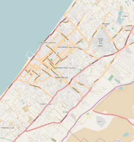
 Tuffah Location in Gaza Strip | |
| Coordinates: 31°30′57.19″N 34°28′9.49″E / 31.5158861°N 34.4693028°E | |
| Country |
|
| Governorate | Gaza Governorate |
| City | Gaza |
| Time zone | EET (UTC+2) |
| • Summer (DST) | +3 (UTC) |
Tuffah (Arabic: حي التفاح, translation: "the Apple") is a district of Gaza City,[1] located northeast of the Old City and is divided into eastern and western halves.[2] Prior to its expansion and the demolition of the Old City's walls, Tuffah was one of the three walled quarters of Gaza, the other two being al-Daraj and Zeitoun. Tuffah was situated in the northeastern section of the Old City. The local pronunciation of the district's name is at-tuffen.[3]
Tuffah has existed since early Mamluk rule in Gaza in the 13th century. The southern part of Tuffah was called "ad-Dabbaghah". According to Ottoman tax records in the late 16th century, it was a small neighborhood containing 57 households. The ad-Dabbaghah neighborhood contained Gaza's slaughterhouse and tanners' facilities during Ottoman times. The northern subdivision of Tuffah was called "Bani Amir."[3]
The 14th century Ibn Marwan Mosque is located in the district as is the 13th century Aybaki Mosque.[4] Home to the British War Cemetery, Tuffah also contains Gaza's public library and a number of Palestinian Red Crescent schools.[5]
References
Bibliography
- Butt, Gerald (1995). Life at the Crossroads: A History of Gaza. Rimal Publications. ISBN 1-900269-03-1.
- Sharon, Moshe (2009). Corpus Inscriptionum Arabicarum Palaestinae, G 4. BRILL. ISBN 90-04-17085-5.
- Shahin, Mariam (2005). Palestine: A Guide. Interlink Books. ISBN 1-56656-557-X.
- Sheehan, Sean (2000). Israel Handbook: With the Palestinian Authority Areas. Footprint Travel Guides. ISBN 978-1-900949-48-4.
External links
- SWP map 19, IAA
- SWP map 19, Wikimedia commons
| ||||||||||||||||||||||||||||||