Tsuyama Domain

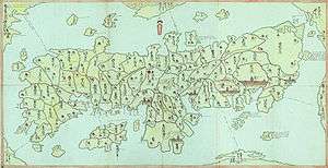
Tsuyama Domain (津山藩 Tsuyama han) was a Japanese domain of the Edo period. It was associated with Mimasaka Province in modern-day Okayama Prefecture.[1]
In the han system, Tsuyama was a political and economic abstraction based on periodic cadastral surveys and projected agricultural yields.[2] In other words, the domain was defined in terms of kokudaka, not land area.[3] This was different from the feudalism of the West.
History
In 1600, the territory that became the Tsuyama domain formed part of the territory ruled from Okayama by Kobayakawa Hideaki. However, as Hideaki died heirless in 1602, the domain was confiscated by the shogunate.
In 1603, Mori Tadamasa, the younger brother of Oda Nobunaga's page Mori Ranmaru, was transferred to Tsuyama from the Kawanakajima Domain, and given landholdings worth 186,500 koku. Up to this point, the domain was called Tsuruyama; it was with Tadamasa's entry that it became known as Tsuyama. Tadamasa was responsible for the construction of the castle town and the development of the domain's politics. In 1697, the Mori clan was transferred out of Tsuyama, and the following year, Matsudaira Nobutomi, a great-grandson of Yūki Hideyasu, was granted Tsuyama as his domain. The Matsudaira clan remained in Tsuyama until 1871.
One of the Tsuyama domain's last daimyo, Matsudaira Naritami, achieved national prominence, as he was a son of Tokugawa Ienari, and was very active in the affairs of the Tokugawa family after 1868. Naritami was also known as Matsudaira Kakudō.[4]
In 1871, the Tsuyama domain became Tsuyama Prefecture, before becoming Hōjō Prefecture and then Okayama Prefecture; the territory remains in Okayama Prefecture to the present day.
List of daimyo
The hereditary daimyo were head of the clan and head of the domain.
| Name | Tenure | |
|---|---|---|
| 1 | Mori Tadamasa (森忠政) | 1603-1634 |
| 2 | Mori Nagatsugu (森長継) | 1634-1674 |
| 3 | Mori Nagatake (森長武) | 1674-1686 |
| 4 | Mori Naganari (森長成) | 1686-1697 |
| 5 | Mori Atsutoshi (森衆利) | 1697 |
-
 Matsudaira clan 1698-1868 (shinpan; 100,000->50,000->100,000 koku)[6]
| Name | Tenure | |
|---|---|---|
| 1 | Matsudaira Nobutomi[7] (松平宣富) | 1698-1721 |
| 2 | Matsudaira Asagorō (松平浅五郎) | 1721-1726 |
| 3 | Matsudaira Nagahiro (松平長熙) | 1726-1735 |
| 4 | Matsudaira Nagataka (松平長孝) | 1735-1762 |
| 5 | Matsudaira Yasuchika (松平康哉) | 1762-1794 |
| 6 | Matsudaira Yasuharu (松平康乂) | 1794-1805 |
| 7 | Matsudaira Naritaka (松平斉孝) | 1805-1831 |
| 8 | Matsudaira Naritami (松平斉民) | 1831-1855 |
| 9 | Matsudaira Yoshitomi (松平慶倫) | 1855-1871 |
See also
References

- ↑ "Mimasaka Province" at JapaneseCastleExplorer.com; retrieved 2013-4-27.
- ↑ Mass, Jeffrey P. and William B. Hauser. (1987). The Bakufu in Japanese History, p. 150.
- ↑ Elison, George and Bardwell L. Smith (1987). Warlords, Artists, & Commoners: Japan in the Sixteenth Century, p. 18.
- ↑ Tamura, Tsuyoshi (1936). Art of the Landscape Garden in Japan, p. 178.
- ↑ Papinot, Jacques Edmond Joseph. (1906). Dictionnaire d’histoire et de géographie du Japon; Papinot, (2003). "Matsudaira (Echizen-ke)" at Nobiliare du Japon, p. 26 [PDF 40 of 80]; retrieved 2013-4-27.
- ↑ Rein, Johannes (1884). Japan: Travels and Researches Undertaken at the Cost of the Prussian Government, p. 505.
- ↑ Papinot, (2003). "Matsudaira (Echizen-ke)" at Nobiliare du Japon, p. 30 [PDF 34 of 80]; retrieved 2013-4-27.