2004 Pacific hurricane season
| |
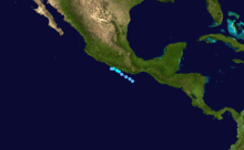
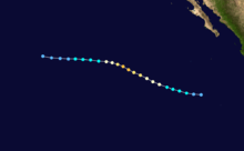
| Season summary map |
| First system formed |
May 22, 2004 |
| Last system dissipated |
October 26, 2004 |
| Strongest storm1 |
Javier – 930 mbar (hPa) (27.46 inHg), 150 mph (240 km/h) (1-minute sustained) |
| Total depressions |
17 |
| Total storms |
12 |
| Hurricanes |
6 |
| Major hurricanes (Cat. 3+) |
3 |
| Total fatalities |
0 |
| Total damage |
Unknown |
| 1Strongest storm is determined by lowest pressure |
Pacific hurricane seasons
2002, 2003, 2004, 2005, 2006 |
The 2004 Pacific hurricane season had twelve named storms – the fewest in a season since 1999. It officially started on May 15, 2004 in the eastern Pacific, and on June 1, 2004 in the central Pacific. The season officially ended on November 30, 2004, in both portions of the Pacific Ocean. These dates conventionally delimit the period of each year when most tropical cyclones form in the northeastern Pacific Ocean.
Few tropical cyclones in the East Pacific this year were notable, as this season was the first since 1984 to result in no deaths. Hurricane Javier, the strongest storm of the season, caused moderate damage in Mexico and dropped rainfall as far north as North Dakota. In addition, Hurricane Howard produced high tides along the California coastline on Labor Day weekend, resulting in more than 1,000 lifeguard rescues.
Storms
Tropical Storm Agatha
| Tropical storm (SSHWS) |
|
|
| Duration |
May 22 – May 24 |
| Peak intensity |
60 mph (95 km/h) (1-min) 997 mbar (hPa) |
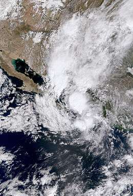
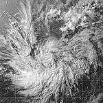
In mid-May, a stationary trough stretched from the eastern Pacific into the western Caribbean Sea interacted with a westward-moving tropical wave. With a defined low-level circulation and concentrated region of convection, the disturbance was designated as the first tropical depression of the season at 00:00 UTC on May 22 while located approximately 575 mi (925 km) south-southeast of Cabo San Lucas, Mexico. The nascent cyclone steadily organized amid a low wind shear environment, intensifying into Tropical Storm Agatha at 12:00 UTC on May 22 and reaching peak winds of 60 mph (95 km/h) twelve hours later. Steered northwestward, Agatha tracked into cooler sea surface temperatures and an increasingly stable environment, causing the system to fall below tropical storm status at 00:00 UTC on May 24 and degenerate to a remnant low twelve hours later. The circulation drifted aimlessly south of Baja California prior to dissipating on May 26.[1]
Tropical Depression Two-E
| Tropical depression (SSHWS) |
|
|
| Duration |
July 2 – July 3 |
| Peak intensity |
35 mph (55 km/h) (1-min) 1007 mbar (hPa) |
A tropical wave, with its origin from Africa, and attendant convection crossed Central Atlantic on June 25, eventually organizing into a tropical depression at 12:00 UTC on July 2 while located 750 mi (1,205 km) southwest of the southern tip of Baja California.[2] Steered westward by low-level flow, the depression failed to organize amid wind shear and cooler sea surface temperatures,[3] and it instead degenerated into a remnant low over the open East Pacific at 00:00 UTC on July 4. The post-tropical cyclone dissipated a day later.[2]
Tropical Depression One-C
| Tropical depression (SSHWS) |
|
|
| Duration |
July 5 – July 5 |
| Peak intensity |
30 mph (45 km/h) (1-min) 1007 mbar (hPa) |
An organized region of convection within the Intertropical Convergence Zone developed into a tropical depression at 03:00 UTC on July 5 while located roughly 700 mi (1,125 km) south-southeast of Johnston Atoll, becoming the farthest-south-forming central Pacific tropical cyclone since 1992's Tropical Storm Hali. Steered westward, the depression failed to intensify due to its quick forward motion despite a seemingly favorable environment, and it quickly dissipated at 00:00 UTC on July 6.[4]
Tropical Storm Blas
| Tropical storm (SSHWS) |
|
|
| Duration |
July 12 – July 15 |
| Peak intensity |
65 mph (100 km/h) (1-min) 991 mbar (hPa) |
A tropical wave crossed Central America on July 8, developing into a tropical depression at 12:00 UTC on July 12 while located about 335 mi (540 km) southwest of Zihuatanejo, Mexico; six hours later, the depression intensified into Tropical Storm Blas. Steered swiftly northwestward around a mid-level ridge over the southwestern United States, the cyclone steadily intensified and reached peak winds of 65 mph (100 km/h) early on July 13 as a large and robust convective canopy became evident. Blas began a steady weakening trend as it tracked over increasingly cool sea surface temperatures, weakening to a tropical depression at 18:00 UTC on July 14 and degenerating into a large remnant low twelve hours later. The post-tropical cyclone decelerated and curved northeastward, dissipating well west of central Baja California early on July 19.[5]
Hurricane Celia
| Category 1 hurricane (SSHWS) |
|
|
| Duration |
July 19 – July 25 |
| Peak intensity |
85 mph (140 km/h) (1-min) 981 mbar (hPa) |
A vigorous tropical wave entered the East Pacific on July 13, acquiring sufficient organization to be declared a tropical depression at 00:00 UTC on July 19 while located about 620 mi (1,000 km) south-southwest of the southern tip of Baja California. Directed west-northwest around a subtropical ridge, the cyclone steadily intensified amongst a favorable environment, becoming Tropical Storm Celia at 12:00 UTC that same day and further strengthening into a Category 1 hurricane, the season's first, at 00:00 UTC on July 22. After attaining peak winds of 85 mph (140 km/h) six hours later, an increasingly unfavorable environment began to hinder the system. Celia weakened to a tropical storm at 18:00 UTC on July 22 and eventually degenerated into a remnant low at 00:00 UTC on July 26. The post-tropical cyclone dissipated about 1,740 mi (2,800 km) west-southwest of the southern tip of Baja California later that morning.[6]
Hurricane Darby
| Category 3 hurricane (SSHWS) |
|
|
| Duration |
July 26 – August 1 |
| Peak intensity |
120 mph (195 km/h) (1-min) 957 mbar (hPa) |
A tropical depression formed at 12:00 UTC on July 26 while positioned about 760 mi (1,225 km) south-southwest of Cabo San Lucas, Mexico from a tropical wave that entered the East Pacific nearly a week previous. The system quickly intensified as it curved west-northwest around a subtropical ridge, becoming Tropical Storm Darby at 00:00 UTC on July 27 and strengthening into a Category 1 hurricane early the next day. After attaining its peak as the season's first major hurricane with winds of 120 mph (195 km/h), increasing wind shear and cooler sea surface temperatures begin to weaken the cyclone. It weakened to a tropical storm at 12:00 UTC on July 30 and further to a tropical depression a day later, at which point it entered the jurisdiction of the Central Pacific Hurricane Center. At 12:00 UTC on August 1, Darby dissipated about 850 mi (1,370 km) east of the Hawaiian Islands. Its remnants produced large waves and heavy rainfall on the islands, disrupting travel but otherwise causing no damage or fatalities.[7]
Tropical Depression Six-E
| Tropical depression (SSHWS) |
|
|
| Duration |
August 1 – August 2 |
| Peak intensity |
30 mph (45 km/h) (1-min) 1008 mbar (hPa) |
At 06:00 UTC on August 1, a tropical depression formed about 1,265 mi (2,035 km) of Cabo San Lucas, Mexico. It dissipated a day later without further intensifying.[8] Operationally, the depression was thought to have existed from July 29–30 and again from August 1–3.[9][10][11]
Tropical Storm Estelle
| Tropical storm (SSHWS) |
|
|
| Duration |
August 19 – August 24 |
| Peak intensity |
70 mph (110 km/h) (1-min) 989 mbar (hPa) |
A tropical wave interacted with a disturbance embedded in the ITCZ in mid-August, leading to the designation of a tropical depression at 06:00 UTC on August 19 while located 1,440 mi (2,315 km) east-southeast of Hilo, Hawaii. The cyclone moved west-northwest following formation, steered around a subtropical ridge. It intensified into Tropical Storm Estelle at 06:00 UTC on August 20 and attained peak winds of 70 mph (110 km/h) at 12:00 UTC the next morning as it crossed into the central Pacific. Thereafter, increasing wind shear caused Estelle to a steady weakening trend. At 00:00 UTC on August 23, the cyclone decelerated to a tropical depression while turning west-southwest, and at 18:00 UTC the following day, it further degenerated into a remnant low. The post-tropical cyclone continued on a west-southwest trajectory prior to dissipating south-southeast of the Big Island at 00:00 UTC on August 26.[12]
Hurricane Frank
| Category 1 hurricane (SSHWS) |
|
|
| Duration |
August 23 – August 26 |
| Peak intensity |
85 mph (140 km/h) (1-min) 979 mbar (hPa) |
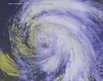
The remnants of Atlantic Ocean Tropical Storm Earl entered the eastern Pacific Ocean on August 18. Deep convection steadily organized, and the system developed into a tropical depression on August 23 while 415 mi south of the Mexican port of Cabo San Lucas, Baja California Sur. The depression rapidly organized, and strengthened into a hurricane just 12 hours after forming, an unusual occurrence. Frank continued to strengthen as it moved to the northwest, and reached a peak intensity of 85 mph on August 24. Shortly after peaking, the hurricane passed over cooler water temperatures, and Frank quickly weakened, degenerating into a remnant low by August 26. The low drifted to the southwest, and dissipated on August 27 while 750 mi west of the southern tip of the Baja California Peninsula. The storm never affected land.
Tropical Depression Nine-E
| Tropical depression (SSHWS) |
|
|
| Duration |
August 23 – August 26 |
| Peak intensity |
35 mph (55 km/h) (1-min) 1005 mbar (hPa) |
A tropical wave crossed Central America on August 15, only slowing organizing into a tropical depression at 18:00 UTC on August 23 while located about 920 mi (1,480 km) west-southwest of Cabo San Lucas, Mexico. Steered north-northwest and eventually west, the cyclone failed to intensify further into a tropical storm amid cool sea surface temperatures and southerly wind shear, and it instead degenerated into a remnant low at 18:00 UTC on August 26. The post-tropical cyclone turned west-southwest before dissipating about 1,095 mi (1,760 km) east of Hilo, Hawaii early on August 28.[13]
Tropical Storm Georgette
| Tropical storm (SSHWS) |
|
|
| Duration |
August 26 – August 30 |
| Peak intensity |
65 mph (100 km/h) (1-min) 995 mbar (hPa) |
A tropical wave emerged off the coast of Africa on August 15 and uneventually crossed the Atlantic Ocean and the Caribbean Sea. The system entered Pacific Ocean on August 24 and deep convection and overall organization quickly increased. After banding features improved significantly, the system was reclassified as Tropical Depression Ten-E on August 26, which was located about 600 miles (970 km) south-southeast of the southern tip of the Baja California Peninsula. Deep convection continued to quickly organize and strengthen, which caused the depression itself to intensify.[14]
Six hours after becoming a tropical cyclone on August 26, the depression was upgraded to Tropical Storm Georgette. After intensifying into a tropical storm, Georgette was predicted to strengthen into a hurricane.[15][16][17][18] However, upper-level northeasterly shear caused Georgette to peak as a 65 mph (100 km/h) tropical storm on August 27. Thereafter, the storm began weakening, though it briefly restrengthened on August 28. However, by early on August 30, Georgette was downgraded to a tropical depression and degenerated into a remnant low later that day.[14]
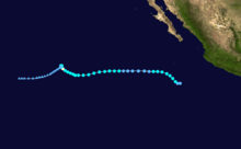
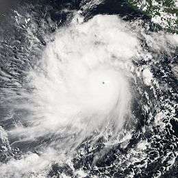
Hurricane Howard
| Category 4 hurricane (SSHWS) |
|
|
| Duration |
August 30 – September 5 |
| Peak intensity |
140 mph (220 km/h) (1-min) 943 mbar (hPa) |
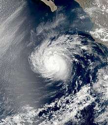
A tropical wave emerged into the Atlantic from the west coast of Africa on August 18. Minimal development occurred until August 26, as it was approaching Central America. Shortly thereafter, the system entered into the Pacific Ocean. While moving parallel to the coast of Central America and Mexico, the wave gradually organized, both in structure and convective coverage. By 1200 UTC on August 30, it developed into Tropical Depression Twelve-E, while centered about 400 miles (645 km) south-southwest of Acapulco. Tracking west-northwestward around the periphery of a mid-level ridge, the depression steadily strengthened into Tropical Storm Howard early on the following day. Continuing to intensify, Howard was upgraded to a hurricane on September 1. Thereafter, the storm rapidly deepened, and on September 2, Howard attained its peak intensity as a low-end Category 4 hurricane.[19]
However, due to decreasing SST's, Howard began to weaken. By September 4, the hurricane was downgraded to a tropical storm. After weakening to a tropical depression on September 5, Howard degenerated into a non-convective remnant low at 1800 UTC that same day, while about 265 miles (425 km) Punta Eugenia, Baja California Sur. The remnant low remained offshore and tracked southwestward until dissipating on September 10. Although the storm remained offshore,[19] the outerbands of the storm produced significant flooding across the Baja California peninsula,[20] which damaged agricultural land and at least 393 homes.[21] Large swells which reached 18 feet (5.4 m) along the Baja coastline and 10 feet (3 m) along the California coastline were reported. About 1,000 lifeguard rescues took place in California due to the waves.[22] Moisture from the storm enhanced rainfall in parts of Arizona, leading to minor accumulations.[23][24]
Hurricane Isis
| Category 1 hurricane (SSHWS) |
|
|
| Duration |
September 8 – September 16 |
| Peak intensity |
75 mph (120 km/h) (1-min) 987 mbar (hPa) |
A tropical wave, possibly the one which spawned Hurricane Frances in the Atlantic, entered into the Pacific Ocean on September 3. After developing a circulation and convective organization, the system developed into Tropical Depression Twelve-E at 0600 UTC on September 8, while located 530 miles (853 km) south of Cabo San Lucas, Baja California Sur.[25] Twelve hours after becoming a tropical cyclone, the depression was upgraded to Tropical Storm Isis.[25] Although the National Hurricane Center predicted that Isis would briefly become a hurricane on September 11,[26] no significant strengthening occurred during the next 36 hours. Instead, the storm weakened to a tropical depression at 1200 UTC on September 10 due to vertical wind shear.[25] However, the National Hurricane Center did not operationally downgrade Isis until nine hours later.
Wind shear decreased, and Isis re-attained tropical storm status on September 12. It remained a minimal tropical storm until September 15, when Isis rapidly intensified to hurricane strength. Shortly after reaching hurricane status, Isis moved over cooler water temperatures, causing it to quickly weaken to a remnant low on September 16. The remnant low drifted to the west until dissipating on September 21. Isis never affected land.
This storm was the last incarnation of the name Isis (since it went unused during the 2010 season); it was removed from the list in the spring of 2015 due to political considerations.[27]
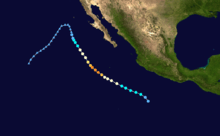
Hurricane Javier
| Category 4 hurricane (SSHWS) |
|
|
| Duration |
September 10 – September 19 |
| Peak intensity |
150 mph (240 km/h) (1-min) 930 mbar (hPa) |
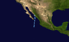
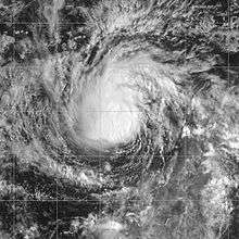
Tropical Depression Thirteen-E formed out of an area of low pressure south-southeast of the Gulf of Tehuantepec on September 10. It slowly moved northwest, being designated Tropical Storm Javier on the morning of September 11. It was upgraded to a hurricane on the afternoon of September 12, and peaked at Category 4 strength on the Saffir-Simpson Hurricane Scale after rapidly strengthening on September 13. Warnings began to be issued on September 15 for Baja California. While Javier peaked at Category 4, with windspeeds of 150 mph (240 km/h), it weakened dramatically before striking land south of San Ignacio, Baja California Sur, as only a tropical depression. Its remnants continued over Baja and inland.
Javier produced moderate damage across northwestern Mexico. In the United States, the storm's rainfall brought relief to a severe drought.
Tropical Storm Kay
| Tropical storm (SSHWS) |
|
|
| Duration |
October 4 – October 6 |
| Peak intensity |
45 mph (75 km/h) (1-min) 1004 mbar (hPa) |
A disturbance in the intertropical convergence zone developed into Tropical Depression Fourteen-E on October 4 about 590 mi (950 km) to the southwest of Manzanillo, Mexico, based on satellite imagery indicating a circulation.[28] It moved generally westward due to a ridge to its north, and only slow intensification was predicted due to the presence of wind shear.[29] Its appearance was asymmetric due to the shear,[30] but the depression was able to intensify into Tropical Storm Kay on October 5.[28]
Due to the shear, its center of circulation was at the northern edge of the convection,[31] and Kay only reached winds of 45 mph (75 km/h) before starting to weaken.[28] The center of circulation became displaced from the area of deep convection, and Kay was reduced to a small low-level swirl of clouds with intermittent thunderstorms.[32] Late on October 5, Kay weakened to tropical depression status, and after turning to the southwest it dissipated on October 6. There were no reports of casualties or damage.[28]
Tropical Storm Lester
| Tropical storm (SSHWS) |
|
|
| Duration |
October 11 – October 13 |
| Peak intensity |
50 mph (85 km/h) (1-min) 1000 mbar (hPa) |
An area of disturbed weather organized into Tropical Depression Fifteen-E on October 11, while located 90 miles (140 km) off the coast of Mexico. With a weak anticyclone near the system, the depression slowly strengthened, and intensified into a tropical storm on October 12. Lester neared the coast of Mexico, and weakened due to land interaction and interaction with a system to its southwest. The storm weakened to a tropical depression on October 13, and dissipated shortly thereafter.[33]
The Mexican government issued a tropical storm warning along the Guerrero coast from Punta Maldonado to Zihuatanejo. Affects from the storm were minimal. Throughout Mexico, the storm produced 3 to 5 inches (76 to 127 mm) of rain. As a result of the precipitation,[33] at least one mudslide occurred and 14 trees were felled near Acapulco. Offshore, two ships capsized, while two other were washed ashore.[34] No damage figures existed nor were any fatalities attributed to Lester.[33]
Tropical Depression Sixteen-E
| Tropical depression (SSHWS) |
|
|
| Duration |
October 25 – October 26 |
| Peak intensity |
35 mph (55 km/h) (1-min) 1004 mbar (hPa) |
A tropical wave moved off the coast of Africa on October 8, and moved westward across the unfavorable Atlantic Ocean. The wave entered the eastern Pacific Ocean on October 18, and developed an area of low pressure the next day while south of Guatemala. It continued slowly westward, and moved to into an area 520 mi south of Baja California Peninsula. There, it combined with an area of disturbed weather due to two previous tropical waves. The system organized as deep convection concentrated into curved bands, and a tropical depression formed on October 25 while 315 mi south-southeast of the Baja California Peninsula. The depression moved northward around the western periphery of a high pressure system. Due to anticipated strengthening, the Government of Mexico issued a tropical storm warning for portions of the country's western coast. However, vertical shear prevented further strengthening. The depression continued northward, and made landfall in Sinaloa, midway between Guasave and Topolobampo, on October 26. It quickly dissipated.[35]
The depression dropped heavy rainfall in western Mexico, including a peak 24 hour total of 7.1 in in Sinaloa.[36] The media reported a possible tornado in Culiacán when the storm was making landfall. The depression's mid-level circulation produced strong thunderstorms and locally heavy rainfall across the U.S. states of New Mexico, Texas, and Oklahoma.[35]
Storm Names
The following names were used for named storms that formed in East Pacific in 2004. This is the same list used in the 1998 season. No names were retired by the World Meteorological Organization in the spring of 2005, therefore this list was re-used in the 2010 season.
|
|
- Isis
- Javier
- Kay
- Lester
- Madeline (unused)
- Newton (unused)
- Orlene (unused)
- Paine (unused)
|
- Roslyn (unused)
- Seymour (unused)
- Tina (unused)
- Virgil (unused)
- Winifred (unused)
- Xavier (unused)
- Yolanda (unused)
- Zeke (unused)
|
For storms that form in the Central Pacific Hurricane Center's area of responsibility, encompassing the area between 140 degrees west and the International Date Line, all names are used in a series of four rotating lists. The next four names that were slated for use in 2004 are shown below, however none of them were used.
See also
References
- ↑ Lixion A. Avila (June 2, 2004). Tropical Cyclone Report: Tropical Storm Agatha (PDF) (Report). Miami, Florida: National Hurricane Center. Retrieved May 23, 2015.
- 1 2 Miles B. Lawrence (July 17, 2004). Tropical Cyclone Report: Tropical Depression Two-E (PDF) (Report). Miami, Florida: National Hurricane Center. p. 1. Retrieved May 26, 2015.
- ↑ Lixion A. Avila (July 2, 2004). "Tropical Depression Two-E Discussion Number 2". Miami, Florida: National Hurricane Center. Retrieved May 26, 2015.
- ↑ Andy Nash; Tim Craig; Roy Matsuda; Jeffrey Powell (February 2005). Overview of the 2004 Central North Pacific Tropical Cyclone Season: Tropical Depression 01-C (Report). Honolulu, Hawaii: Central Pacific Hurricane Center. Retrieved May 26, 2015.
- ↑ Richard J. Pasch (August 5, 2004). Tropical Cyclone Report: Tropical Storm Blas (PDF) (Report). Miami, Florida: National Hurricane Center. pp. 1–3. Retrieved May 26, 2015.
- ↑ Stacy R. Stewart (October 12, 2004). Tropical Cyclone Report: Hurricane Celia (PDF) (Report). Miami, Florida: National Hurricane Center. pp. 1, 2. Retrieved May 26, 2015.
- ↑ Jack L. Beven II (December 17, 2004). Tropical Cyclone Report: Hurricane Darby (PDF) (Report). Miami, Florida: National Hurricane Center. p. 1. Retrieved May 26, 2015.
- ↑ Lixion A. Avila; et al. (December 1, 2004). Monthly Tropical Weather Summary (Report). Miami, Florida: National Hurricane Center. Retrieved May 26, 2015.
- ↑ Stacy R. Stewart (July 29, 2014). "Tropical Depression Six-E Discussion Number 1". Miami, Florida: National Hurricane Center. Retrieved May 26, 2015.
- ↑ James L. Franklin (July 30, 2014). "Tropical Depression Six-E Discussion Number 4". Miami, Florida: National Hurricane Center. Retrieved May 26, 2015.
- ↑ Richard D. Knabb; James L. Franklin (August 3, 2014). "Tropical Depression Six-E Discussion Number 12". Miami, Florida: National Hurricane Center. Retrieved May 26, 2015.
- ↑ Lixion A. Avila (November 3, 2004). Tropical Cyclone Report: Tropical Storm Estelle (PDF) (Report). Miami, Florida: National Hurricane Center. pp. 1, 4. Retrieved May 28, 2015.
- ↑ Richard J. Pasch (November 12, 2004). Tropical Cyclone Report: Tropical Depression Nine-E (PDF) (Report). Miami, Florida: National Hurricane Center. p. 1. Retrieved June 9, 2015.
- 1 2 Stacy R. Stewart (2004-12-02). "Tropical Storm Georgette Tropical Cyclone Report" (PDF). National Hurricane Center. Retrieved 2015-05-22.
- ↑ Jack Beven (2004-08-26). "Tropical Storm Georgette Discussion Number 2". National Hurricane Center. Retrieved 2012-03-16.
- ↑ Hugh Cobb and Richard Pasch (2004-08-27). "Tropical Storm Georgette Discussion Number 3". National Hurricane Center. Retrieved 2012-03-16.
- ↑ David Roberts and Lixion Avila (2004-08-27). "Tropical Storm Georgette Discussion Number 4". National Hurricane Center. Retrieved 2012-03-16.
- ↑ Jack Beven (2004-08-27). "Tropical Storm Georgette Discussion Number 5". National Hurricane Center. Retrieved 2012-03-16.
- 1 2 Jack L. Beven (2004-12-13). "Hurricane Howard Tropical Cyclone Report" (PDF). National Hurricane Center. Retrieved 2015-05-22.
- ↑ Luciano Garcia Valenzuela (2004-09-04). "Decretan alerta por "Howard"" (in Spanish). El Siglo de Durango. Retrieved 2009-03-01.
- ↑ Staff Writer (2004-09-09). "Apoyaran Para Rehabilitar Viviendas" (in Spanish). Navajoa. Archived from the original on July 5, 2007. Retrieved 2012-03-20.
- ↑ "NCDC: Event Report". National Climatic Data Center. 2004. Retrieved 2012-03-20.
- ↑ Associated Press (2004-09-06). "Meteorologists: Monsoon season weakest in years". KVOA. Retrieved 2009-03-01.
- ↑ Chuck George (2004-09-03). "Rainy Start To Tucson's Labor Day Weekend". KOLD. Retrieved 2012-03-20.
- 1 2 3 James L. Franklin and David P. Roberts (2004-11-17). "Hurricane Isis Tropical Cyclone Report" (PDF). National Hurricane Center. Retrieved 2015-05-22.
- ↑ Stacy R. Stewart (2004-09-09). "Tropical Storm Isis Discussion Number 5". National Hurricane Center. Retrieved 2012-03-21.
- ↑ "'Isis' among names removed from UNlist of hurricane names". Reuters. April 17, 2015. Retrieved April 17, 2015.
- 1 2 3 4 David Roberts and Miles Lawrence (2004-11-20). "Tropical Storm Kay Tropical Cyclone Report" (PDF). National Hurricane Center. Retrieved 2015-05-22.
- ↑ Pasch (2004-10-04). "Tropical Depression Fourteen-E Discussion Number 1". National Hurricane Center. Retrieved 2012-03-20.
- ↑ Eric Blake & Miles Lawrence (2004-10-05). "Tropical Depression Fourteen-E Discussion Number 2". National Hurricane Center. Retrieved 2012-03-20.
- ↑ Richard Pasch (2004-10-05). "Tropical Storm Kay Discussion Number 4". National Hurricane Center. Retrieved 2012-03-20.
- ↑ Richard Pasch (2004-10-05). "Tropical Storm Kay Discussion Number 5". National Hurricane Center. Retrieved 2012-03-20.
- 1 2 3 Richard J. Pasch and David P. Roberts (2004-12-10). "Tropical Storm Lester Tropical Cyclone Report" (PDF). National Hurricane Center. Retrieved 2015-05-22.
- ↑ Amado Ramirez (2004-10-13). "Raging storm 'Lester' to Guerrero". Noticieros Televisa. Archived from the original on May 21, 2011. Retrieved 2012-03-16.
- 1 2 NHC Tropical Cyclone Report
- ↑ CNA.SMN. Depresión Tropical N° 16 del Océano Pacífico. Temporada 2004
External links
|
|---|
| | | |
-
 Book Book
-
 Category Category
-
 Portal Portal
-
 WikiProject WikiProject
-
 Commons Commons
|
|







.jpg)




.jpg)


.jpg)
