1999 Atlantic hurricane season
 | |
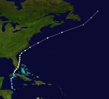
| Season summary map | |
| First system formed | June 11, 1999 |
|---|---|
| Last system dissipated | November 23, 1999 |
| Strongest storm1 | Floyd – 921 mbar (hPa) (27.2 inHg), 155 mph (250 km/h) |
| Total depressions | 16 |
| Total storms | 12 |
| Hurricanes | 8 |
| Major hurricanes (Cat. 3+) | 5 |
| Total fatalities | 465 |
| Total damage | $5.9 billion (1999 USD) |
| 1Strongest storm is determined by lowest pressure | |
1997, 1998, 1999, 2000, 2001 | |
| Related article | |
The 1999 Atlantic hurricane season had five Category 4 hurricanes – the highest amount recorded in a single season in the Atlantic basin. The season officially began on June 1, and ended on November 30. These dates conventionally delimit the period of each year when most tropical cyclones form in the Atlantic basin. It was a fairly active season, mostly due to a persistent La Niña that developed in the latter half of 1998. The first storm, Arlene, formed on June 11 to the southeast of Bermuda. It meandered slowly for a week and caused no impact on land. Other tropical cyclones that did not affect land were Hurricane Cindy, Tropical Storm Emily, and Tropical Depression Twelve. Minor impact on land was caused by Hurricanes Bret, Gert, and Jose, Tropical Storms Harvey and Katrina, and Tropical Depression Seven.
The most significant storm of the season was Hurricane Floyd, a strong Category 4 hurricane that caused devastating flooding along the East Coast of the United States, especially in North Carolina. Damage from the storm was $4.5 billion (1999 USD)[nb 1] and there were at least 57 fatalities, making the deadliest hurricane in the United States since Hurricane Agnes in 1972. Flooding from Floyd in North Carolina resulted from its passage in the wake of Hurricane Dennis, a slow and erratic moving storm that dropped heavy rainfall in the eastern portion of the state. A tropical depression in October contributed to extreme flooding in Mexico, though impact directly from the system and its remnants is unknown. Hurricane Irene caused extensive flooding in Cuba and Florida, with lesser effects in North Carolina and The Bahamas. Hurricane Lenny was an unusually eastward moving storm in the Caribbean Sea and a strong late season storm. It caused extensive damage in the Lesser Antilles in the month of November. Collectively, the storms of the 1999 Atlantic hurricane season caused at least 465 fatalities and $5.9 billion in losses.
Season summary
Season activity

The Atlantic hurricane season officially began on June 1, 1999, with the first tropical cyclone developing on June 11. It was an above average season in which 16 tropical cyclones formed. Twelve depressions attained tropical storm status and eight of these became a hurricane. Five hurricanes further intensified into major hurricanes. A persistent La Niña that developed during the previous season was attributed to the above average activity.[1] Six hurricanes and two tropical storms made landfall during the season and caused at least 132 deaths and approximately $8.23 billion in damage. Hurricane Gert also caused damage and fatalities, despite not making landfall.[2] The last storm of the season, Hurricane Lenny, dissipated on November 23, which one week before the official season ending on November 30, 1999.
Overall, the season's activity was reflected with a cumulative accumulated cyclone energy (ACE) rating of 177.[3] ACE is, broadly speaking, a measure of the power of the hurricane multiplied by the length of time it existed, so storms that last a long time, as well as particularly strong hurricanes, have high ACEs. It is only calculated for full advisories on tropical systems at or exceeding 34 knots (39 mph, 63 km/h) or tropical storm strength.[4]
Storms
Tropical Storm Arlene
| Tropical storm (SSHWS) | |||
|---|---|---|---|
| |||
| Duration | June 11 – June 18 | ||
| Peak intensity | 60 mph (95 km/h) (1-min) 1006 mbar (hPa) | ||
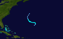
Along a diffuse front, a broad area of low pressure in association with an upper-level low pressure was noted several hundred miles northeast of Puerto Rico on June 8. After reformation of a low-level circulation, it is estimated that Tropical Depression One developed at 18:00 UTC on June 11, while located about 535 mi (860 km) southeast of Bermuda. Initially, the system resembled a subtropical cyclone, due to its frontal characteristics. After developing on June 11, the depression almost immediately began to drift, a motion which lasted about 24 hours. The depression strengthened and was upgraded to Tropical Storm Arlene at 12:00 UTC on June 12.[5]
The storm intensified further and at 00:00 UTC on June 13, Arlene attained its peak intensity with maximum sustained winds of 60 mph (95 km/h) and a minimum barometric pressure of 1,006 mbar (29.7 inHg). However, westerly shear weakened Arlene as it tracked westward on June 13 and then northwestward on June 14. Because the steering current became poorly defined, it drifted starting on June 15, and executed a small cyclonic loop later that day. At 00:00 UTC on June 17, Arlene was downgraded to a tropical depression. Later that day, it passed about 115 mi (185 km) east of Bermuda. The storm weakened further due to decreasing sea surface temperatures and dissipated early on June 18.[5]
Tropical Depression Two
| Tropical depression (SSHWS) | |||
|---|---|---|---|
| |||
| Duration | July 2 – July 3 | ||
| Peak intensity | 35 mph (55 km/h) (1-min) 1004 mbar (hPa) | ||
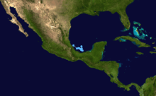
A tropical wave crossed the west coast of Africa on June 20. As the wave moved into the western Caribbean Sea on June 30, a broad cyclonic turning was noted. The system moved over the Yucatán peninsula on July 1, a day before emerging into the Bay of Campeche as a weak low pressure area. Later on July 2, deep convection became more organized while the system was centered over the southwestern Gulf of Mexico. By 18:00 UTC, the low developed into Tropical Depression Two. Around 04:00 UTC on July 3, the depression made landfall about 40 mi (65 km) south-southeast of Tuxpan, Veracruz, with winds of 35 mph (55 km/h). Eight hours later, it dissipated over the mountains of Mexico.[6] The depression dropped heavy rain on the area amounting to a maximum of 20.37 in (517 mm) at Tanzabaca, San Luis Potosí.[7] In some areas, up to 12.49 in (317 mm) of precipitation fell in 24 hours. No damage was reported in relation to Tropical Depression Two.[6]
Hurricane Bret
| Category 4 hurricane (SSHWS) | |||
|---|---|---|---|
| |||
| Duration | August 18 – August 25 | ||
| Peak intensity | 145 mph (230 km/h) (1-min) 944 mbar (hPa) | ||
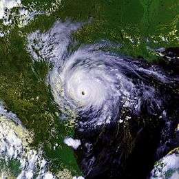
A tropical wave located over the Bay of Campeche developed into Tropical Depression Three at 1800 UTC on August 18. Initially, the depression drifted and did not intensify due to wind shear. However, by late on August 19, the depression was upgraded to Tropical Storm Bret. The storm then moved generally northward and continued to strengthen. Early on August 21, it became a hurricane – the first of the season. Bret strengthened significantly over the next 36 hours, peaking as a 145 mph (230 km/h) Category 4 hurricane on August 22. Thereafter, the storm began to weaken while curving west-northwestward. At 00:00 UTC on August 23, Bret made landfall in central Padre Island as a Category 3 hurricane with winds of 115 mph (185 km/h).[8] After moving inland, the storm initially weakened quickly, falling to tropical depression status on August 24. Early the following day, Bret dissipated near the border of Coahuila and Chihuahua.[8]
Bret made landfall in a sparsely populated region of Texas, resulting in relatively little damage.[8] Heavy rainfall fell in the area, peaking at 13.18 in (335 mm) in Sarita.[7] At least 200 homes and large agricultural fields were flooded in Duval County.[9] Strong winds left approximately 64,000 people without electricity in South Texas.[10] Four people died in the state after a truck and a tractor collision near Laredo due to slick roads.[11] In Mexico, the storm brought flooding to Coahuila, Nuevo Leon, and Tamaulipas,[12] with an estimated 14 in (360 mm) of rain falling in Nuevo Leon.[8] Numerous homes in the affected regions were damaged or destroyed, leaving roughly 150 people homeless.[13] Three people died in Mexico, one from being tramped to death during evacuation, another from being electrocuted, and a third from drowning.[14][15] Overall, the storm caused $15 million in damage.[16]
Hurricane Cindy
| Category 4 hurricane (SSHWS) | |||
|---|---|---|---|
| |||
| Duration | August 19 – August 31 | ||
| Peak intensity | 140 mph (220 km/h) (1-min) 942 mbar (hPa) | ||
On August 18, a tropical wave moved westward off the coast of Africa. With low pressures and gradually organizing convection, Tropical Depression Four developed west of Senegal early on August 19.[17] Initially it failed to intensify due to wind shear,[17] and the center became ill-defined on August 20.[18] After passing south of Cape Verde,[19] the depression intensified into Tropical Storm Cindy as the convection became concentrated around the center.[20] Due to a strong ridge, Cindy moved westward, before turning northwestward by August 21.[21] Banding features gradually increased as outflow improved,[22] and late on August 21, Cindy became a hurricane.[23] After becoming a hurricane, an increase in wind shear caused the convection to be sheared from the center,[24] causing Cindy to weaken to a tropical storm.[25]
By August 23, high wind shear remained and winds decreased to as low as 60 mph (100 km/h).[26] The shear decreased on August 24,[17] and the convection increased over the center.[27] By late on August 25, Cindy regained hurricane status.[17] A ragged eye appeared on satellite imagery on August 27,[28] and early on August 28 it attained major hurricane status.[29] Cindy turned north-northwestward, now showing a well-defined eye,[17] and reached Category 4 intensity with winds of 140 mph (220 km/h).[30] Turning northward, the storm remained at peak intensity until August 30 when wind shear became prominent again, and Cindy began to weaken.[17] On August 31, Cindy was downgraded to a tropical storm,[31] and later that day it merged with a large extratropical storm northwest of the Azores. There were no reports of damage or fatalities.[17]
Hurricane Dennis
| Category 2 hurricane (SSHWS) | |||
|---|---|---|---|
| |||
| Duration | August 24 – September 7 | ||
| Peak intensity | 105 mph (165 km/h) (1-min) 962 mbar (hPa) | ||
A tropical wave developed into Tropical Depression Five while centered about 220 mi (355 km) east of Turks Islands on August 23. Despite unfavorable westerly shear, the depression became Tropical Storm Dennis on the following day and a hurricane by August 26. After striking the Abaco Islands in the Bahama, conditions improved, allowing for strengthening into a Category 2 by August 28. Around this time, Dennis began to move parallel to the Southeastern United States. On August 31, steering currents collapsed and the storm interacted with a cold front, causing Dennis to move erratically offshore North Carolina. Wind shear and cold air associated with the front weakened Dennis to a tropical storm on September 1 and removed some of its tropical characteristics. Eventually, warmer ocean temperatures caused some re-strengthening. By September 4, Dennis turned northwestward and made landfall in Cape Lookout, North Carolina, as a strong tropical storm. The storm slowly weakened inland, before transitioning into an extratropical cyclone while centered over western New York on September 7.[32]
In the Bahamas, Dennis primarily impacted San Salvador, Crooked Island, Eleuthera, and Abaco Islands with moderate winds and rain and storm surge. These conditions resulted in some roof damage and inflicted impact on coastal properties.[33] Dennis brought 6–8 ft (1.8–2.4 m) waves to the east coast of Florida, causing only minor erosion. However, four drowning deaths occurred.[32]
Tropical Storm Emily
| Tropical storm (SSHWS) | |||
|---|---|---|---|
| |||
| Duration | August 24 – August 28 | ||
| Peak intensity | 50 mph (85 km/h) (1-min) 1004 mbar (hPa) | ||
A tropical wave emerged into the Atlantic from the west coast of Africa on August 15. Minimal tropical cyclogenesis occurred until August 21, while centered well east of the Windward Islands. By 06:00 UTC on August 24, Tropical Depression Six developed while located about 470 mi (760 km) east-northeast of Tobago. The depression strengthened into Tropical Storm Emily six hours later. At 1800 UTC on August 24, Emily attained its peak intensity with winds of 50 mph (85 km/h).[34] The National Hurricane Center initiated advisories at 21:00 UTC and indicated sustained winds of 65 mph (105 km/h).[35] However, post-season analysis concludes that winds never exceeded 50 mph (85 km/h).[34]
Increased wind shear generated by Hurricane Cindy caused Emily to weaken slightly on August 25. The storm began moving slowly northwestward, but posed no significant threat to the Lesser Antilles. Although the storm progressively became more influenced by Cindy, convective bursts prevented further weakening. Later on August 26, it curved northward and remained well offshore the Lesser Antilles. Eventually, the storm no longer produced convective burst, and by 12:00 UTC on August 28, Emily weakened to a tropical depression. Six hours later, the storm was absorbed into Cindy, while located northeast of the Leeward Islands.[34]
Tropical Depression Seven
| Tropical depression (SSHWS) | |||
|---|---|---|---|
| |||
| Duration | September 5 – September 7 | ||
| Peak intensity | 35 mph (55 km/h) (1-min) 1006 mbar (hPa) | ||
Interaction between a strong monsoon-type flow and a tropical wave in the Bay of Campeche resulted in the development of Tropical Depression Seven on September 5. By 00:00 UTC on September 6, the depression attained its peak intensity with maximum sustained winds of 35 mph (55 km/h) and a minimum barometric pressure of 1,006 mbar (29.7 inHg).[36] Shortly thereafter, the center of circulation of the depression became difficult to locate, but was likely heading north-northwestward. Despite almost no deep convection and its close proximity to land, the SHIPS model predicted further intensification, due to warm ocean temperatures.[37]
At 12:00 UTC on September 6, the depression made landfall near La Pesca, Tamaulipas, with winds of 35 mph (55 km/h). The depression quickly weakened inland, and dissipated about twenty-four hours after landfall. The intensity forecast predicted the depression would strengthen to a tropical storm shortly before landfall, as a result, the government of Mexico issued a tropical storm warning for Tampico to Matamoros, Tamaulipas, Mexico.[36] The storm caused heavy rainfall in Mexico, with as much as 17.43 in (443 mm) falling in Ciudad Mante, though damage and death totals are unknown. In Texas, the depression produced light rainfall, peaking at 3.35 in (85 mm) in Harlingen.[38]
Hurricane Floyd
| Category 4 hurricane (SSHWS) | |||
|---|---|---|---|
| |||
| Duration | September 7 – September 17 | ||
| Peak intensity | 155 mph (250 km/h) (1-min) 921 mbar (hPa) | ||
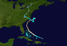
A westward moving tropical wave developed into Tropical Depression Eight while located about 1,000 miles (1,600 km) east of the Lesser Antilles on September 7. The depression strengthened and was upgraded to Tropical Storm Floyd on the following day. Floyd became a hurricane on September 10, while curving northwestward. Late on the following day, the storm resumed its initial west-northwestward course. Significant intensification occurred on September 12 and September 13. At 12:00 UTC on the latter date, Floyd attained its peak intensity with maximum sustained winds of 155 mph (250 km/h) and a minimum barometric pressure of 921 mbar (27.2 inHg). Thereafter, the storm began weakened while approaching The Bahamas. Floyd moved through The Bahamas as a borderline Category 3–4 hurricane on September 14, striking Eleuthera and the Abaco Islands. The storm curved north-northwestward, remaining offshore Florida. Late on September 15, Floyd weakened to a Category 2 hurricane while re-curving to the northeast. At 16:30 UTC on September 16, Floyd made landfall near Cape Fear, North Carolina, with winds of 105 mph (170 km/h). Thereafter, the storm rapidly weakened and was a tropical storm by early on the following day. Shortly thereafter, Floyd transitioned into an extratropical cyclone while interacting with a frontal zone over Maine on September 17.[39]
In The Bahamas, a combination of strong winds surge destroyed numerous restaurants, hotels, shops, and homes, and left tens of thousands without water, electricity, and food. One death was reported, and there were only a few injuries. Although millions evacuated Florida, damage was relatively minor. The outerbands of Floyd produced up to 3.2 in (81 mm) of rain and tropical storm force winds. As a result, hundreds of trees were downed, which damaged at 467 houses, and several hotels and businesses. Impact in Georgia and South Carolina was negligible. North Carolina bore the brunt of the storm. Heavy precipitation fell in the eastern portion of the state, peaking at 24.06 in (611 mm) near Southport. Numerous rivers experienced at least 500-year floods, causing extensive flooding. 7,000 homes were destroyed and an additional 56,000 suffered damage, of which 17,000 houses were left uninhabitable. At the height of the storm, more than 500,000 people lacked electricity. 35 fatalities and an estimated $4 billion in damage occurred in North Carolina. Flooding in Virginia from heavy rainfall damaged about 182 businesses and 9,250 houses, left 12 ft (3.7 m) of standing water in Franklin, and caused 3 deaths and $101 million in losses. In Maryland, flooding damaged at least 694 homes, impacted numerous bridges and roads, left over 250,000 residents without power, and caused $7.9 million in losses. Similar affects occurred in Delaware, with at least 171 houses damaged and numerous roads suffering flooding. Damage in Delaware totaled to $10.5 million. In Pennsylvania, flash flooding affected over 10,000 homes and left more than 500,000 people without electricity. Losses reached $60 million and there were 13 deaths in the state. The storm also impacted New Jersey, New York, New England, and Atlantic Canada, but to a much lesser degree. Overall, Hurricane Floyd caused $4.5 billion in damage and at least 57 fatalities.
Hurricane Gert
| Category 4 hurricane (SSHWS) | |||
|---|---|---|---|
| |||
| Duration | September 11 – September 23 | ||
| Peak intensity | 150 mph (240 km/h) (1-min) 930 mbar (hPa) | ||
Gert formed from an African tropical wave several hundred miles west of Cape Verde on September 12. Gert's track arced across the Atlantic, and it became a strong Category 4 storm on September 16. Gert threatened Bermuda as a weakening Category 2 storm, but turned away to the north-northeast. On September 23, Gert became extratropical and merged with another low pressure system off the coast of Newfoundland.[40]
Gert caused isolated instances of hurricane force winds on Bermuda, but damage there was limited to coastal erosion. No deaths are directly attributable to Gert, although two people drowned in Maine when a large wave swept them into the ocean. This wave may have been generated by Gert, despite being thousands of miles away from Maine at the time.[40]
Tropical Storm Harvey
| Tropical storm (SSHWS) | |||
|---|---|---|---|
| |||
| Duration | September 19 – September 22 | ||
| Peak intensity | 60 mph (95 km/h) (1-min) 995 mbar (hPa) | ||
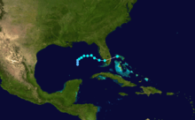
A tropical wave in the Gulf of Mexico developed into Tropical Depression Ten at 06:00 UTC on September 19. The depression initially tracked due northward and strengthened into Tropical Storm Harvey by early on September 20. Harvey gradually intensified further and 24 hours after the upgrade, the storm peaked with winds of 60 mph (95 km/h) and a minimum barometric pressure of 995 mbar (29.4 inHg). Thereafter, no significant change in intensity occurred before the storm made landfall in Everglades City, Florida, late on September 21. Harvey then accelerated across Florida and by early on September 22, merged with a developing extratropical low while located near Grand Bahama.[41]
In Florida, precipitation peaked at 10.24 in (260 mm) in Naples. As a result, at least 34 houses and businesses were flooded. There were sporadic reports of tropical storm-force winds throughout the state, as well as two tornadoes. Damage estimates in Florida reached about $15 million. Throughout the rest of the United States, impact was limited, confined to light rainfall in Georgia, North Carolina and South Carolina. Heavy rainfall was reported in Atlantic Canada and Harvey became the wettest tropical cyclone on record in that country. Significant flooding, especially to roads and houses, was reported throughout Atlantic Canada, with damage totaling several million dollars.
Tropical Depression Eleven
| Tropical depression (SSHWS) | |||
|---|---|---|---|
| |||
| Duration | October 4 – October 6 | ||
| Peak intensity | 35 mph (55 km/h) (1-min) 1002 mbar (hPa) | ||
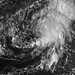
A tropical wave organized minimally until reaching the western Caribbean Sea on September 30. The system eventually emerged into the Gulf of Mexico and developed into Tropical Depression Eleven on October 4. Weak steering current caused the depression to drift slowly and erratically, with the depression initially heading southward, before curving northwest. A surface trough over the central and eastern Gulf of Mexico prevented significant strengthening. The depression remained below tropical storm intensity, attaining its peak intensity on October 5, with maximum sustained winds of 35 mph (55 km/h) and a minimum barometric pressure of 1,002 mbar (29.6 inHg).[42]
While approaching the Gulf Coast of Mexico, the depression was absorbed by the surface trough at 18:00 UTC on October 6.[42] The depression and its remnants contributed significantly to an ongoing flood in Mexico, bring 43.23 in (1,098 mm) of rain to Jalacingo, Veracruz.[43] Overall, the flooding event caused 636 fatalities and an estimated $1 billion in damage in Mexico. 560,000 people were left homeless due to water-intruded homes, while more than 75% of Tabasco was flooded. However, impact by the depression itself cannot be distinguished.
Tropical Depression Twelve
| Tropical depression (SSHWS) | |||
|---|---|---|---|
| |||
| Duration | October 6 – October 8 | ||
| Peak intensity | 35 mph (55 km/h) (1-min) 1007 mbar (hPa) | ||
A tropical wave emerged into the Atlantic Ocean from the west coast of Africa on September 30. It slowly began to organize during the next several days and by early on October 6, developed into Tropical Depression Twelve while located about 1,075 miles (1,730 km) east of Martinique.[44] Due to an anticyclone, conditions appeared favorable for significant strengthening, with the National Hurricane Center predicting the depression to be at least a strong tropical storm by October 9.[45] However, wind shear began undercutting the anticyclone,[46] which prevented any significant intensification.[44] Later on October 6, the low-level circulation became exposed to the west of the deep convection.[47] The depression never re-organized and instead deteriorated in structure due to shearing. Despite a burst in convection on October 8,[48] the depression dissipated at 18:00 UTC while located about 875 mi (1,408 km) east-northeast of Barbuda.[44]
Hurricane Irene
| Category 2 hurricane (SSHWS) | |||
|---|---|---|---|
| |||
| Duration | October 12 – October 19 | ||
| Peak intensity | 110 mph (175 km/h) (1-min) 960 mbar (hPa) | ||
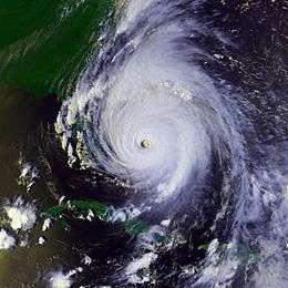
Irene formed on October 12 from a broad trough of low pressure while south of the Isle of Youth. It headed north and passed over the Isle of Youth and western Cuba on October 14. While over the Straits of Florida, Irene reached hurricane strength. The next day, it made landfall at Key West, Florida, and again near Cape Sable. Half a day later, Irene moved back over water near Jupiter as a minimal hurricane. It slowly strengthened as it paralleled the Florida through North Carolina. When Irene interacted with a trough from the west while over the warm Gulf Stream waters, the hurricane rapidly intensified to a peak of 110 mph (180 km/h), but it accelerated to the northeast, weakening over the cooler waters of the North Atlantic. On October 19, Irene became extratropical near Newfoundland, and was absorbed by an extratropical low shortly thereafter.[49]
Irene dropped heavy rainfall throughout its path, especially in Cuba and Florida. Rainfall on Cuba peaked at 35.6 in (905 mm) in Manaca-Iznaga,[50] while the rest of the island reported more than 7 in (178 mm).[49] Flooding resulted more the heavy rains, damaging more than 27,000 homes and caused significant effects to banana plantations and sugar cane fields.[51] Hurricane forces winds were also reported in Havana.[49] There is no estimated damage toll, however, there were four fatalities reported.[52][53] Total damage in Florida was around $800 million. There were no direct deaths in the United States that are attributed to Irene, though there were eight indirect deaths. Damage in Cuba is not known. Irene also contributed slightly to ongoing flood problems in North Carolina in the aftermath of Hurricane Floyd.[49]
Hurricane Jose
| Category 2 hurricane (SSHWS) | |||
|---|---|---|---|
| |||
| Duration | October 17 – October 25 | ||
| Peak intensity | 100 mph (155 km/h) (1-min) 979 mbar (hPa) | ||
A tropical wave entered the Atlantic on October 8 and developed into a tropical depression while located 700 mi (1,100 km) east of the Windward Islands on October 17. The depression strengthened and by early on October 18, it was upgraded to Tropical Storm Jose. Intensification continued as Jose tracked west-northwestward and Jose reached hurricane status late on October 19. The storm became a Category 2 hurricane, though unfavorable conditions weakened it back. Later on October 21, Jose began moving through the Lesser Antilles as a Category 1 and fell to tropical storm intensity before reentering the Atlantic later that day. While north of Puerto Rico on October 22, Jose re-curved northeastward. The storm eventually began to accelerate and re-strengthen, reaching hurricane status again on October 24. After twelve hours as a hurricane, colder sea surface temperatures weakened Jose to a tropical storm on October 25, shortly before it became extratropical.[54]
The worst of the effects from Jose occurred in Antigua and Barbuda, as winds up to 102 mph (164 km/h) were reported. About 500 houses and a newly built church were destroyed. About 50% of residents were left without water and 90% of people experienced power outages.[55] Overall, twelve people were injured, one fatality occurred, and an elderly blind man was listed as missing.[56] Flooding in Saint Kitts and Nevis washed out several major roads and caused landslides. Additionally, one person was killed during the storm. In Sint Maarten, mudslides and flooding damaged houses and roads, especially those in low-lying areas.[54] Nearly 15 in (380 mm) of rain and winds up to 100 mph (160 km/h) in Anguilla left roads impassable and power outages, and damaged houses, crops, and shipping facilities.[56][57] Strong winds and heavy rainfall in Puerto Rico and the United States Virgin Islands caused extensive power outages and minor damage, estimated at $40,000. Overall, losses from the storm was less than $5 million.[58]
Tropical Storm Katrina
| Tropical storm (SSHWS) | |||
|---|---|---|---|
| |||
| Duration | October 28 – November 1 | ||
| Peak intensity | 40 mph (65 km/h) (1-min) 999 mbar (hPa) | ||
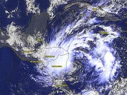
A broad area of low pressure associated with remnants of a cold front developed into Tropical Depression Fifteen in the southwestern Caribbean Sea on October 28. Twenty-four hours later, it strengthened into Tropical Storm Katrina. The storm made near landfall at Puerto Cabezas, Nicaragua on October 30. Later that day, Katrina weakened back to a tropical depression. It continued northwestward across Nicaragua and Honduras, before reemerging into the Caribbean Sea off the coast of Honduras on October 31. However, Katrina did not re-intensify and moved inland over the Yucatán Peninsula later that day. While approaching the Gulf of Mexico, Katrina was absorbed by a cold front on November 1.[59]
Katrina dropped heavy rainfall across, which was reported between 10 and 15 in (250 to 375 mm) throughout Nicaragua and Honduras.[60] As a result of the flooding, roughly 1,200 people were evacuated to emergency shelters in Honduras. Flooding also damage five bridges in Honduras, and the cities of Tocoa and Trujillo were isolated as the Aguán and Siline rivers overflowed their banks.[61] Katrina also destroyed water pipes that were replaced shortly after destruction from Hurricane Mitch. Damage from Katrina was minimal, totaling to only $9,000.[62] Shortly before dissipating, Katrina dropped moderate rainfall across the Yucatán Peninsula and eastern Mexico, peaking at 6.32 in (161 mm) in Cunduacán.[63]
Hurricane Lenny
| Category 4 hurricane (SSHWS) | |||
|---|---|---|---|
| |||
| Duration | November 13 – November 23 | ||
| Peak intensity | 155 mph (250 km/h) (1-min) 933 mbar (hPa) | ||
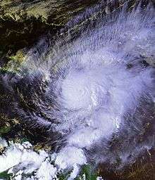
A low pressure area developed into Tropical Depression Sixteen while located about 175 mi (280 km) south of the Cayman Islands at 18:00 UTC on November 13. The depression began to move an unprecedented west-to-east track across the Caribbean Sea and strengthened into Tropical Storm Lenny on the following day. It attained hurricane status south of Jamaica on November 15 and passed south of Hispaniola and Puerto Rico over the next few days. Beginning on November 16, Lenny underwent a 24-hour period of rapid deepening, reaching major hurricane status while south of the Mona Passage. Late on November 17, Lenny peaked as a Category 4 hurricane with winds of 155 mph (250 km/h) near Saint Croix. It gradually weakened due to wind shear while moving through the Leeward Islands, where it struck Saint Martin, Anguilla, and Saint Barthélemy. The system weakened to a tropical storm on November 19. After clearing the islands, Lenny deteriorated to a tropical depression on November 21 and dissipated on November 23, while located about 690 mi (1,110 km) east of the Lesser Antilles.[64]
Before moving through the Lesser Antilles, Lenny produced rough surf that killed two people in northern Colombia.[64] Strong winds and rainfall resulted in heavy crop damage in southeastern Puerto Rico. Lenny brought more heavy rains to areas in the Leeward Islands that had been affected by Hurricane Jose just one month earlier, and brought more damage to areas struck by Hurricane Georges in 1998.[65] Despite the hurricane's passage near Saint Croix at peak intensity,[64] damage on the small island was only described as "moderate", although there was widespread flooding and erosion.[64][65] Damage in the United States territories totaled about $330 million.[64] The highest precipitation total was 34.12 in (867 mm) at the police station on the French side of Saint Martin.[66] On the island, the hurricane killed three people and destroyed more than 200 properties.[64][67] In nearby Antigua and Barbuda, the hurricane killed one person;[68] torrential rainfall there contaminated the local water supply. Significant storm damage occurred as far south as Grenada, where high surf isolated towns from the capital city.[69]
Storm names
The following names were used during the 1999 Atlantic hurricane season in North Atlantic for systems that reached at least tropical storm intensity. It is the same list used for the 1993 season. A storm was named Lenny for the first (and only) time in 1999. The World Meteorological Organization retired the names Floyd and Lenny in the spring of 2000 and replaced them with Franklin and Lee for use in the 2005 season. All of the remaining names were re-used in the 2005 season. Names that were not assigned are marked in gray.
|
Season effects
This is a table of the storms in 1999 and their landfall(s), if any. Deaths in parentheses are additional and indirect (an example of an indirect death would be a traffic accident), but are still storm-related. Damage and deaths include totals while the storm was extratropical or a wave or low.
| Saffir–Simpson hurricane wind scale | ||||||
| TD | TS | C1 | C2 | C3 | C4 | C5 |
| Name | Dates active | Peak classification | Sustained wind speeds |
Pressure | Land areas affected | Damage (USD) |
Deaths | Refs |
|---|---|---|---|---|---|---|---|---|
| Arlene | June 11 – June 18 | Tropical storm | 60 mph (97 km/h) | 1,006 hPa (29.7 inHg) | None | None | 0 | |
| Two | July 2 – July 3 | Tropical depression | 35 mph (56 km/h) | 1,004 hPa (29.6 inHg) | Tuxpan, Veracruz (July 3; 35 mph (56 km/h)) | 0 | 0 | |
| Bret | August 18 – August 25 | Category 4 hurricane | 145 mph (233 km/h) | 944 hPa (27.9 inHg) | Kenedy County, Texas (August 23; 115 mph (185 km/h)) | $60 million | 0 (4) | |
| Cindy | August 19 – August 31 | Category 4 hurricane | 140 mph (230 km/h) | 942 hPa (27.8 inHg) | None | 0 | 0 | |
| Dennis | August 24 – September 9 | Category 2 hurricane | 105 mph (169 km/h) | 962 hPa (28.4 inHg) | Harkers Island, North Carolina (September 5; 70 mph (110 km/h)) | $157 million | 4 | |
| Emily | August 24 – August 28 | Tropical storm | 50 mph (80 km/h) | 1,004 hPa (29.6 inHg) | None | 0 | 0 | |
| Seven | September 5 – September 7 | Tropical depression | 35 mph (56 km/h) | 1,006 hPa (29.7 inHg) | La Pesca, Tamaulipas (September 6; 35 mph (56 km/h)) | Minor | 0 | |
| Floyd | September 7 – September 17 | Category 4 hurricane | 155 mph (249 km/h) | 921 hPa (27.2 inHg) | Eleuthera Island, Bahamas (September 14; 155 mph (249 km/h)) | $4.5 billion | 57 (20–30) | |
| Abaco Islands, Bahamas (September 14; 155 mph (249 km/h)) | ||||||||
| Cape Fear, North Carolina (September 16; 105 mph (169 km/h)) | ||||||||
| Long Island, New York (September 17; 45 mph (72 km/h)) | ||||||||
| Gert | September 11 – September 23 | Category 4 hurricane | 150 mph (240 km/h) | 930 hPa (27 inHg) | None | $1.9 million | 2 | |
| Harvey | September 19 – September 22 | Tropical storm | 60 mph (97 km/h) | 994 hPa (29.4 inHg) | Everglades City, Florida (September 21; 55 mph (89 km/h)) | $15 million | 0 | |
| Eleven | October 4 – October 6 | Tropical depression | 35 mph (56 km/h) | 1,002 hPa (29.6 inHg) | None | unknown | 384 | |
| Twelve | October 6 – October 8 | Tropical depression | 35 mph (56 km/h) | 1,007 hPa (29.7 inHg) | None | 0 | 0 | |
| Irene | October 12 – October 19 | Category 2 hurricane | 110 mph (180 km/h) | 958 hPa (28.3 inHg) | Isle of Youth, Cuba (October 14; 70 mph (110 km/h)) | $800 million | 3 (15) | |
| Batabano, Cuba (October 14; 70 mph (110 km/h)) | ||||||||
| Key West, Florida (October 15; 80 mph (130 km/h)) | ||||||||
| Cape Sable, Florida (October 15; 80 mph (130 km/h)) | ||||||||
| Jose | October 17 – October 25 | Category 2 hurricane | 100 mph (160 km/h) | 979 hPa (28.9 inHg) | Leeward Islands (October 20; 90 mph (140 km/h)) | $5 million | 2 | |
| Katrina | October 27 – November 1 | Tropical storm | 40 mph (64 km/h) | 999 hPa (29.5 inHg) | Puerto Cabezas, Nicaragua (October 29; 40 mph (64 km/h)) | Minor | 0 | |
| Yucatán Peninsula (October 31; 30 mph (48 km/h)) | ||||||||
| Lenny | November 13 – November 23 | Category 4 hurricane | 155 mph (249 km/h) | 933 hPa (27.6 inHg) | Saint Croix, U.S. Virgin Islands (November 17; 155 mph (249 km/h)) | ≥$330 million | 17 | |
| Saint Martin (November 18; 125 mph (201 km/h)) | ||||||||
| Antigua (November 19; 100 mph (160 km/h)) | ||||||||
| Saint Barthélemy (November 19; 85 mph (137 km/h)) | ||||||||
| Antigua (November 20; 65 mph (105 km/h)) | ||||||||
| Season Aggregates | ||||||||
| 16 cyclones | June 11 -November 23 | 155 mph (249 km/h) | 921 hPa (27.2 inHg) | $5.9019 billion | 469 (39-49) | |||
See also
- List of Atlantic hurricanes
- List of Atlantic hurricane seasons
- 1999 Pacific hurricane season
- 1999 Pacific typhoon season
- 1999 North Indian Ocean cyclone season
- South-West Indian Ocean cyclone seasons: 1998–99, 1999–00
- Australian region cyclone seasons: 1998–99, 1999–00
- South Pacific cyclone seasons: 1998–99, 1999–00
Notes
References
- ↑ Cold and Warm Episode by Season. Climate Prediction Center (Report) (College Park, Maryland: National Oceanic and Atmospheric Administration). July 6, 2015. Retrieved July 20, 2015.
- ↑ "Mata a 3 coletazo de ' Bret '". El Norte (in Spanish). August 25, 1999. p. 1.
- "Evacuan a 7 familias en Apodaca". El Norte (in Spanish). August 26, 1999. p. 16.
- Gary Padgett. Monthly Global Tropical Cyclone Summary August 1999 (Report). Retrieved March 10, 2015.
- Hurricane Bret (August 1999). National Weather Service in Houston-Galveston, Texas (Report) (National Oceanic and Atmospheric Administration). June 20, 2008. Archived from the original on April 11, 2008. Retrieved June 12, 2009.
- Jack L. Beven (January 10, 2000). Preliminary Report: Hurricane Dennis (PDF). National Hurricane Center (Report) (National Oceanic and Atmospheric Administration). Retrieved July 20, 2015.
- Eric S. Blake, Christopher W. Landsea, and Ethan J. Gibney (August 10, 2011). The deadliest, costliest and most intense United States tropical cyclones from 1851 to 2010 (and other frequently requested hurricane facts) (PDF). National Climatic Data Center and National Hurricane Center (NOAA Technical Memorandum NWS NHC-6) (National Oceanic and Atmospheric Administration). p. 47. Retrieved July 20, 2015.
- Climate-Watch, September 1999 (PDF). National Climatic Data Center (Report) (National Oceanic and Atmospheric Administration). March 2, 2000. p. 2-3. Retrieved July 20, 2015.
- Event Record Details: High Wind. National Climatic Data Center (Report) (National Oceanic and Atmospheric Administration). Archived from the original on April 22, 2010. Retrieved April 22, 2010.
- Gert-1999 (Report). Environment Canada. September 14, 2010. Retrieved July 20, 2015.
- Miles B. Lawrence (July 22, 2000). Preliminary Report: Hurricane Gert (PDF). National Hurricane Center (Report) (National Oceanic and Atmospheric Administration). Retrieved July 20, 2015.
- John L. Guiney (December 9, 1999). Preliminary Report: Tropical Storm Harvey (PDF). National Hurricane Center (Report) (National Oceanic and Atmospheric Administration). Retrieved July 20, 2015.
- 1999-Harvey (Report). Environment Canada. Retrieved July 20, 2015.
- Mary Miranda (October 15, 1999). "Four Dead or Missing; Thousands Evacuated as a Result of Irene". Cuba Free Press. Retrieved July 20, 2015.
- Lixion A. Avila (November 12, 1999). Preliminary Report: Hurricane Irene (PDF). National Hurricane Center (Report) (National Oceanic and Atmospheric Administration). Retrieved July 20, 2015.
- Event Record Details: Hurricane. National Climatic Data Center (Report) (National Oceanic and Atmospheric Administration). Archived from the original on November 14, 2006. Retrieved April 22, 2010.
- John Zarrella and Jeff Flock (October 15, 1999). "Hurricane Irene pulls plug on 700,000 utility customers". CNN. Archived from the original on January 9, 2006. Retrieved 2006-06-28.
- Richard J. Pasch (December 22, 1999). Preliminary Report: Hurricane Jose (PDF). National Hurricane Center (Report) (National Oceanic and Atmospheric Administration). Retrieved July 20, 2015.
- Caribbean Disaster Emergency Response Agency (October 21, 1999). Hurricane Jose Post Impact Situation Report #2 (HTML) (Report). ReliefWeb. Retrieved January 10, 2013.
- Wendy Griffin (November 29, 1999). "Heavy rains wreck havoc on North Coast". Honduras This Week National (Tegucigalpa, Honduras). Archived from the original on March 17, 2013. Retrieved June 27, 2009.
- John L. Guiney (February 22, 2000). Preliminary Report: Hurricane Lenny (PDF). National Hurricane Center (Report) (Miami, Florida: National Oceanic and Atmospheric Administration). Retrieved July 20, 2015.
- Eastern Caribbean: Hurricane Lenny Information Bulletin No. 3. International Federation of Red Cross and Red Crescent Societies (Report) (ReliefWeb). 1999-11-18. Retrieved July 20, 2015.
- Northeastern Caribbean Hurricane Lenny Fact Sheet #1, FY 2000. US Agency for International Development (Report) (ReliefWeb). November 23, 1999. Retrieved July 20, 2015.
- ↑ Atlantic basin Comparison of Original and Revised HURDAT. Hurricane Research Division; Atlantic Oceanographic and Meteorological Laboratory (Report) (Virginia Key, Florida: National Oceanic and Atmospheric Administration). March 2011. Retrieved May 9, 2013.
- ↑ David Levinson (August 20, 2008). 2005 Atlantic Ocean Tropical Cyclones. National Climatic Data Center (Report) (Asheville, North Carolina: National Hurricane Center). Archived from the original on 29 June 2011. Retrieved May 9, 2013.
- 1 2 James L. Franklin (July 7, 1999). Preliminary Report: Tropical Storm Arlene (PDF). National Hurricane Center (Report) (Miami, Florida: National Oceanic and Atmospheric Administration). Retrieved March 10, 2015.
- 1 2 Jack L. Beven (January 20, 2000). Brief Information about Tropical Depression Two (PDF). National Hurricane Center (Report) (Miami, Florida: National Oceanic and Atmospheric Administration). Retrieved March 10, 2015.
- 1 2 Roth, David M. (2015-04-30). "Tropical Cyclone Point Maxima". Tropical Cyclone Rainfall Data. Weather Prediction Center. Retrieved 2015-09-06.
- 1 2 3 4 Miles B. Lawrence and Todd B. Kimberlain (February 26, 2001). Preliminary Report: Hurricane Bret (PDF). National Hurricane Center (Report) (Miami, Florida: National Oceanic and Atmospheric Administration). Retrieved March 10, 2015.
- ↑ Stephen Del Greco. Storm Data and Unusual Weather Phenomena with Late Reports and Corrections (PDF). National Climatic Data Center (Report) (Asheville, North Carolina: National Oceanic and Atmospheric Administration). p. 166. Archived from the original (PDF) on March 10, 2015. Retrieved March 10, 2015.
- ↑ "Hurricane Bret Disaster Update". Washington, D.C.: Federal Emergency Management Agency. August 24, 1999. Archived from the original on March 14, 2004. Retrieved March 10, 2015.
- ↑ Gary Padgett. Monthly Global Tropical Cyclone Summary August 1999 (Report). Retrieved March 10, 2015.
- ↑ "Vive Matamoros alerta permanente". El Norte (in Spanish). August 24, 1999. p. 16.
- ↑ "Pierden todo en una hora". El Norte (in Spanish). August 27, 1999. p. 18.
- ↑ "Mata a 3 coletazo de ' Bret '". El Norte (in Spanish). August 25, 1999. p. 1.
- ↑ "Evacuan a 7 familias en Apodaca". El Norte (in Spanish). August 26, 1999. p. 16.
- ↑ Hurricane Bret (August 1999). National Weather Service in Houston-Galveston, Texas (Report) (National Oceanic and Atmospheric Administration). June 20, 2008. Archived from the original on April 11, 2008. Retrieved June 12, 2009.
- 1 2 3 4 5 6 7 John L. Guiney (December 9, 1999). Preliminary Report: Hurricane Cindy (PDF). National Hurricane Center (Report) (Miami, Florida: National Oceanic and Atmospheric Administration). Retrieved March 13, 2015.
- ↑ Brian R. Jarvinen (August 20, 1999). Tropical Depression Four Discussion Number 6 (TXT). National Hurricane Center (Report) (Miami, Florida: National Oceanic and Atmospheric Administration). Retrieved July 14, 2011.
- ↑ Brian R. Jarvinen (August 20, 1999). Tropical Depression Four Advisory Number 6 (TXT). National Hurricane Center (Report) (Miami, Florida: National Oceanic and Atmospheric Administration). Retrieved July 14, 2011.
- ↑ Jack L. Beven (August 20, 1999). Tropical Storm Cindy Discussion Number 8 (TXT). National Hurricane Center (Report) (Miami, Florida: National Oceanic and Atmospheric Administration). Retrieved July 14, 2011.
- ↑ Richard J. Pasch (August 21, 1999). Tropical Storm Cindy Discussion Number 10 (TXT). National Hurricane Center (Report) (Miami, Florida: National Oceanic and Atmospheric Administration). Retrieved July 14, 2011.
- ↑ B. Max Mayfield (August 21, 1999). Tropical Storm Cindy Discussion Number 11 (TXT). National Hurricane Center (Report) (Miami, Florida: National Oceanic and Atmospheric Administration). Retrieved July 14, 2011.
- ↑ Brian R. Jarvinen (August 22, 1999). Hurricane Cindy Advisory Number 13 (TXT). National Hurricane Center (Report) (Miami, Florida: National Oceanic and Atmospheric Administration). Retrieved July 14, 2011.
- ↑ Brian R. Jarvinen (August 22, 1999). Hurricane Cindy Discussion Number 14 (TXT). National Hurricane Center (Report) (Miami, Florida: National Oceanic and Atmospheric Administration). Retrieved July 14, 2011.
- ↑ Lixion A. Avila (August 22, 1999). Tropical Storm Cindy Discussion Number 16 (TXT). National Hurricane Center (Report) (Miami, Florida: National Oceanic and Atmospheric Administration). Retrieved July 14, 2011.
- ↑ James L. Franklin (August 23, 1999). Tropical Storm Cindy Discussion Number 17 (TXT). National Hurricane Center (Report) (Miami, Florida: National Oceanic and Atmospheric Administration). Retrieved July 14, 2011.
- ↑ B. Max Mayfield (August 25, 1999). Tropical Storm Cindy Discussion Number 25 (TXT). National Hurricane Center (Report) (Miami, Florida: National Oceanic and Atmospheric Administration). Retrieved July 14, 2011.
- ↑ James L. Franklin (August 27, 1999). Hurricane Cindy Discussion Number 35 (TXT). National Hurricane Center (Report) (Miami, Florida: National Oceanic and Atmospheric Administration). Retrieved July 14, 2011.
- ↑ Brian R. Jarvinen (August 28, 1999). Hurricane Cindy Discussion Number 37 (TXT). National Hurricane Center (Report) (Miami, Florida: National Oceanic and Atmospheric Administration). Retrieved July 14, 2011.
- ↑ James L. Franklin (August 28, 1999). Hurricane Cindy Discussion Number 40 (TXT). National Hurricane Center (Report) (Miami, Florida: National Oceanic and Atmospheric Administration). Retrieved July 14, 2011.
- ↑ Brian R. Jarvinen (August 30, 1999). Tropical Storm Cindy Advisory Number 50 (TXT). National Hurricane Center (Report) (Miami, Florida: National Oceanic and Atmospheric Administration). Retrieved July 14, 2011.
- 1 2 Jack L. Beven (January 10, 2000). Preliminary Report: Hurricane Dennis (PDF). National Hurricane Center (Report) (National Oceanic and Atmospheric Administration). Retrieved July 20, 2015.
- ↑ "Tropical Cyclones which affected the Bahamas". The Bahamas Meteorological Department. Retrieved July 21, 2015.
- 1 2 3 Lixion A. Avila (September 30, 1999). Preliminary Report: Tropical Storm Emily (PDF). National Hurricane Center (Report) (Miami, Florida: National Oceanic and Atmospheric Administration). Retrieved March 13, 2015.
- ↑ Lixion A. Avila (August 24, 1999). Tropical Storm Emily Discussion One (TXT). National Hurricane Center (Report) (Miami, Florida: National Oceanic and Atmospheric Administration). Retrieved July 14, 2011.
- 1 2 Lixion A. Avila (October 17, 1999). Preliminary Report: Tropical Depression Seven (PDF). National Hurricane Center (Report) (Miami, Florida: National Oceanic and Atmospheric Administration). Retrieved March 13, 2015.
- ↑ Miles B. Lawrence (September 5, 1999). Tropical Depression Seven Discussion Number 2 (TXT). National Hurricane Center (Report) (Miami, Florida: National Oceanic and Atmospheric Administration). Retrieved July 14, 2011.
- ↑ David M. Roth (May 1, 2009). Tropical Depression #7 - September 3-10, 1999. Weather Prediction Center (Report) (College Park, Maryland: National Oceanic and Atmospheric Administration). Archived from the original on 25 July 2011. Retrieved March 13, 2015.
- ↑ Richard J. Pasch, Todd B. Kimberlain, Stacy R. Stewart (November 18, 1999). Preliminary Report: Hurricane Floyd (PDF). National Hurricane Center (Report) (National Oceanic and Atmospheric Administration). Retrieved July 20, 2015.
- 1 2 Miles B. Lawrence (July 22, 2000). Preliminary Report: Hurricane Gert (PDF). National Hurricane Center (Report) (National Oceanic and Atmospheric Administration). Retrieved July 20, 2015.
- ↑ John L. Guiney (December 9, 1999). Preliminary Report: Tropical Storm Harvey (PDF). National Hurricane Center (Report) (National Oceanic and Atmospheric Administration). Retrieved July 20, 2015.
- 1 2 John L. Beven (December 1, 1999). Preliminary Report: Tropical Depression Eleven (PDF). National Hurricane Center (Report) (National Oceanic and Atmospheric Administration). Retrieved July 20, 2015.
- ↑ David M. Roth (June 16, 2007). Tropical Depression #11 – September 30-October 9, 1999. Weather Prediction Center (Report) (College Park, Maryland: National Oceanic and Atmospheric Administration). Retrieved July 14, 2011.
- 1 2 3 James L. Franklin (November 9, 1999). Preliminary Report: Tropical Depression Twelve (PDF). National Hurricane Center (Report) (National Oceanic and Atmospheric Administration). Retrieved July 20, 2015.
- ↑ Lixion A. Avila (October 6, 1999). Tropical Depression Twelve Discussion Number 1 (TXT). National Hurricane Center (Report) (National Oceanic and Atmospheric Administration). Retrieved July 7, 2012.
- ↑ Jack L. Beven (October 6, 1999). Tropical Depression Twelve Discussion Number 3 (TXT). National Hurricane Center (Report) (National Oceanic and Atmospheric Administration). Retrieved July 7, 2012.
- ↑ Jack L. Beven (October 6, 1999). Tropical Depression Twelve Discussion Number 4 (TXT). National Hurricane Center (Report) (National Oceanic and Atmospheric Administration). Retrieved July 7, 2012.
- ↑ James L. Franklin (October 8, 1999). Tropical Depression Twelve Discussion Number 11 (TXT). National Hurricane Center (Report) (National Oceanic and Atmospheric Administration). Retrieved December 18, 2012.
- 1 2 3 4 Lixion A. Avila (November 12, 1999). Preliminary Report: Hurricane Irene (PDF). National Hurricane Center (Report) (National Oceanic and Atmospheric Administration). Retrieved July 20, 2015.
- ↑ Alejandro Bezanilla (January 2000). Cyclone Season of 1999 on the North Atlantic Ocean. SOMETCUBA Bulletin (Report) (Cuban Meteorological Society). Archived from the original on 16 July 2011. Retrieved July 14, 2011.
- ↑ "Cuba revela nuevas cifras de daños causados por huracán Irene". CubaNet News (in Spanish). 1999. Archived from the original on 16 June 2011. Retrieved July 14, 2011.
- ↑ "Hurricane Irene lashes Cuba". BBC News. October 15, 1999. Retrieved July 14, 2011.
- ↑ Mary Miranda (October 15, 1999). "Four Dead or Missing; Thousands Evacuated as a Result of Irene". Cuba Free Press. Retrieved July 14, 2011.
- 1 2 Richard J. Pasch (December 22, 1999). Preliminary Report: Hurricane Jose (PDF). National Hurricane Center (Report) (National Oceanic and Atmospheric Administration). Retrieved July 20, 2015.
- ↑ Lixion A. Avila (October 20, 1999). Hurricane Jose Tropical Cyclone Update (Report). Caribbean Hurricane Network. Retrieved March 13, 2015.
- 1 2 Margareta Wahlström and George Weber (November 3, 1999). Antigua and Barbuda: Hurricane Jose (PDF) (Report). International Federation of Red Cross and Red Crescent Societies. Retrieved March 13, 2015.
- ↑ Historical Tropical Cyclone (Hurricane) Information for Anguilla from 1955-2000 (Report). World-Weather-Travellers-Guide.com. Retrieved March 13, 2015.
- ↑ Stephen Del Greco. Storm Data and Unusual Weather Phenomena with Late Reports and Corrections (PDF). National Climatic Data Center (Report) (Asheville, North Carolina: National Oceanic and Atmospheric Administration). p. 56 and 63. Archived from the original (PDF) on March 13, 2015. Retrieved March 13, 2015.
- ↑ Miles B. Lawrence (November 30, 1999). Preliminary Report: Tropical Storm Katrina (PDF). National Hurricane Center (Report) (National Oceanic and Atmospheric Administration). Retrieved July 20, 2015.
- ↑ Atlantic Hurricane 1999 Season Summary (Report). Silver Springs, Maryland: National Oceanic and Atmospheric Administration. May 10, 2000. Archived from the original on July 16, 2011. Retrieved July 14, 2011.
- ↑ Honduras - Floods OCHA - Situation Report No. 7 (Report). Geneva, Switzerland: Office for the Coordination of Humanitarian Affairs. November 7, 1999. Retrieved March 2, 2013.
- ↑ Wendy Griffin (November 29, 1999). "Heavy rains wreck havoc on North Coast". Honduras This Week National (Tegucigalpa, Honduras). Archived from the original on March 17, 2013. Retrieved June 27, 2009.
- ↑ David M. Roth (January 27, 2007). Tropical Storm Katrina – October 28-November 1, 1999. Weather Prediction Center (Report) (College Park, Maryland: National Oceanic and Atmospheric Administration). Retrieved March 2, 2013.
- 1 2 3 4 5 6 John L. Guiney (February 22, 2000). Preliminary Report: Hurricane Lenny (PDF). National Hurricane Center (Report) (Miami, Florida: National Oceanic and Atmospheric Administration). Retrieved July 20, 2015.
- 1 2 Preliminary Storm Report on Hurricane Lenny November 16–19, 1999. San Juan, Puerto Rico National Weather Service Office (Report) (San Juan, Puerto Rico: National Oceanic and Atmospheric Administration). Retrieved July 20, 2015.
- ↑ David M. Roth (May 4, 2006). Hurricane Lenny – November 14–21, 1999 (Report). Weather Prediction Center. Retrieved July 20, 2015.
- ↑ Eastern Caribbean: Hurricane Lenny Information Bulletin No. 3. International Federation of Red Cross and Red Crescent Societies (Report) (ReliefWeb). 1999-11-18. Retrieved July 20, 2015.
- ↑ Northeastern Caribbean Hurricane Lenny Fact Sheet #1, FY 2000. US Agency for International Development (Report) (ReliefWeb). November 23, 1999. Retrieved July 20, 2015.
- ↑ Hurricane Lenny Recovery in the Eastern Caribbean (DOC) (Report). USAID. April 17, 2000. Retrieved July 20, 2015.
External links
| Wikimedia Commons has media related to 1999 Atlantic hurricane season. |
| |||||||||||||



_GOES-8_Color.png)






.jpg)
