Tour de Cargèse
| Tour de Cargèse | |
|---|---|
 | |
| Coordinates | 42°7′59″N 8°35′22″E / 42.13306°N 8.58944°ECoordinates: 42°7′59″N 8°35′22″E / 42.13306°N 8.58944°E |
| Built | 1605–1606 |
| Architect | Giacomo della Piana |
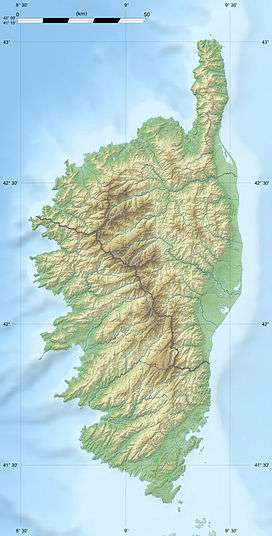
 Location of Tour de Cargèse in Corsica | |
The Tour de Cargèse (French: Torra di Carghjese) is a ruined Genoese tower located in the commune of Cargèse on the French island of Corsica. Only the base of the tower has survived. It sits on the highest point of the Puntiglione headland at an elevation of 157 meters above the sea.
The Tour de Cargèse was built between 1605 and 1606 under the direction of Giacomo della Piana. It was one of a series of coastal defences constructed by the Republic of Genoa between 1530 and 1620 to stem the attacks by Barbary pirates.[1][2]
Parts of the Puntiglione headland and the adjacent coastline covering an area of 174 hectares (430 acres) are owned by an agency of the French state, the Conservatoire du littoral.[3]

Drawing from the Genoese archives showing the tower immediately after construction.
Notes and references
- ↑ "Canton: Les Deux-Servi - L'architecture militaire" (in French). Direction Régional des Affaires Culturelles de Corse (DRAC). Retrieved 4 May 2014.
- ↑ Graziani, Antoine-Marie (2000). "Les ouvrages de défense en Corse contre les Turcs (1530-1650)". In Vergé-Franceschi, Michel; Graziani, Antoine-Marie. La guerre de course en Méditerranée (1515-1830) (in French). Paris: Presses de l'Université Paris IV-Sorbonne. pp. 143–144. ISBN 2-84050-167-8.
- ↑ "Puntiglione". Conservatoire du littoral, Ministère de l'écologie, du développement durable et de l'énergie. Retrieved 22 July 2015.
Further reading
- Nivaggioni, Mathieu; Verges, Jean-Marie. "Les Tours Génoises Corses" (in French). Includes information on how to reach 90 towers and many photographs.
- "Cargèse : Présentation" (in French). I Torregiani. Retrieved 18 May 2014.
This article is issued from Wikipedia - version of the Wednesday, July 22, 2015. The text is available under the Creative Commons Attribution/Share Alike but additional terms may apply for the media files.