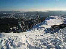
Thuringian Forest

The Thuringian Forest[1][2] (Thüringer Wald in German), running northwest to southeast, forms a continuous range of ancient rounded mountains posing ample difficulties in transit routing save through a few navigable passes in the southern reaches of the German state of Thuringia. It is about 120 km (75 mi) long and 35 km (22 mi) wide. The highest elevation is the Großer Beerberg, 982 m (3,222 ft).
The Rennsteig (sometimes called Rennweg) is an ancient path following its summits along the main ridge. It is now a famous hiking path and it marks the traditional boundary between the hills-dominated terrain of central Germany and the more rugged terrain characteristic of southern Germany, the boundary between central/north Thuringia and Franconia. Dialects and traditional customs and costumes are different on either side of the Rennsteig. The Rennsteig is also the subject of the song Rennsteiglied (de), the unofficial hymn of Thuringia.
The Thuringian Forest is famous for Wartburg Castle outside Eisenach (where Martin Luther lived in exile) and year round tourism, including many winter sports resorts. It is also highly regarded by Germans for its cultural traditions in literature, classical music, philosophy and art - the Thuringian town of Weimar was the smallest city in Europe to have been awarded the honour of 'European Capital of Culture'
Geologically, the Thuringian Forest is defined by a belt of strongly uplifted and deformed metamorphic and igneous rock that divides the relatively flat sedimentary plains of the Thüringer Becken (to the northeast) from similar rock formations in the valley of the Werra (to the southwest). The Schwarza River, following the axis of the Schwarzburg anticline (Schwarzburger Sattel), divides the Thuringinan Forest from the slate hills of Thuringia and Franconia, to the southeast.[3] Ore deposits associated with this upthrust have been of significant historical importance in the development of the region, for example, in Suhl[4] and Ilmenau.[5]


Tabarz-Oberhof Thuringian Forest

The B 247 from Luisenthal via Oberhof and Zella-Mehlis to Suhl, which follows the Ohra to the north, a section along the Lichtenau to the south and finally the lower reaches of the Mühlwasser, together with the good 10 km long L 1028 road that runs parallel to it to the northwest separates this natural sub-division of the Thuringian Forest from the rest. Apart from the south, this region is hardly dissected by any public roads and is only populated in the south – in the villages of Schnellbach and Struth-Helmershof in the municipality of Floh-Seligenthal, the Rotterode, Unterschönau and Oberschönau suburbs of Steinbach-Hallenberg and the town of Zella-Mehlis.
The Elbe-Weser watershed, accompanied by the Rennsteig reaches heights of around 900 m at several places southwest to west of Oberhof, but does not really form any individual mountains and has very much the character of a mountain crest. By contrast, the Großer Hermannsberg und Ruppberg (see below) that rise to the southwest of the ridge are better known and popular tourist destinations. To the northeast, where the terrain gradually flattens out, are two of the 3 largest reservoirs in the Thuringian Forest (see below). The best known rock formation in the mountain range, the Falkenstein, is also found in this area.
Rivers and lakes

The northeastern flank of the mountains is drained by right tributaries of the Apfelstädt, especially the Schmalwasser, and left tributaries of the Ohra, notably the Kernwasser, via the (Apfelstädt,) Gera and Unstrut into the Saale. The Apfelstädt is impounded by the Tambarz-Dietharz Dam into a small lake and the Schmalwasser and Ohra by the Schmalwasser and Ohra Dams into larger reservoirs.
The south is drained by the Asbach which flows via the Stille into the Schmalkalde and, from the Fächer der Hasel, the rivers and streams of the Schwarza,[6] Häselbach,[7] Lichtenau and Bach aus Albrechts into the Werra.
Mountains

- Großer Beerberg (984 m, main crest 3,4 km east of Zella-Mehlis, highest elevation in the Thuringian Forest)
- Schützenberg (904 m, main crest southwest of Oberhof)
- Greifenberg (901 m, main crest west of Oberhof)
- Gebrannter Stein (897 m, south of the Rennsteig, north of Zella-Mehlis)
- Donnershauk (894 m, main crest, centre section)
- Schmalkalder Loibe (886 m, main crest in the western section)
- Großer Hermannsberg (867 m, southwest flank) - local mountain for Steinbach-Hallenberg, AT
- Ruppberg (866 m, southwest flank) - local mountain (northwest) for Zella-Mehlis', AT
- Großer Buchenberg (813 m, north of the main crest and southwest of the Schmalwasser Dam)
- Krämerod (765 m, main crest in the extreme northwest, by the L 1028)
- Schwarzer Kopf (749 m, extreme south, southwest of Zella-Mehlis)
- Siegelberg (734 m, extreme northeast, southeast of Luisenthal)
See also
References
- ↑ Elkins, T H (1972). Germany (3rd ed.). London: Chatto & Windus, p. 288-9. ASIN B0011Z9KJA.
- ↑ Kohl, Horst; Marcinek, Joachim and Nitz, Bernhard (1986). Geography of the German Democratic Republic, VEB Hermann Haack, Gotha, p. 7 ff. ISBN 978-3-7301-0522-1.
- ↑ Bergmanssverein-erfurt.de
- ↑ Eisenstrasse.de
- ↑ Ilmweb.de
- ↑ The Schwarza is called the Haselbach in its upper reaches and the Schönau in its middle course
- ↑ The Häselbach is, especially in its source region, also called the Dürre Hasel
External links
| Wikimedia Commons has media related to Thuringian Forest. |
- Thueringer-wald.de
- Thueringer-landschaften.de, a web page with many pictures of thuringian landscapes
Coordinates: 50°40′N 10°50′E / 50.667°N 10.833°E
| ||||||||
|
