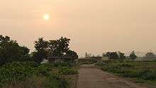
Tharial
| Tharial थरियाल शहीदों का गांव,Thariyal | |
|---|---|
| village | |
 Tharial Location in Punjab, India | |
| Coordinates: 32°21′17″N 75°36′24″E / 32.3547°N 75.6067°ECoordinates: 32°21′17″N 75°36′24″E / 32.3547°N 75.6067°E | |
| Country |
|
| State | Punjab |
| District | Gurdaspur |
| Population | |
| • Total | 10,000 |
| Languages | |
| • Official | Punjabi |
| Time zone | IST (UTC+5:30) |
| PIN | 145024 |
| Telephone code | 01870 |
| Vehicle registration | PB- |
| Coastline | 0 kilometres (0 mi) |
| Nearest city | Pathankot |
| Literacy | 80%% |
| Lok Sabha constituency | Gurdaspur |
Village Tharial
Village Tharial is a village in the Indian state of Punjab. It falls within the Gurdaspur district.[1] It lies on the Pathankot- Jammu road.[2] The nearest railway station to Tharial is Madhopur and main station is Pathankot railway station at a distance of 8.5 km. Tharial Chowk is a name of a chowk near Madhopur in Pathankot, Punjab, India. Population of this village is around 10,000.
Tharial is also called Sheeda Da Pind (शहीदों के गांव) (a village of martyrs) because a lots of people from this village are serving in the Indian Army some of them are martyrs. Recently Indian government has made Gates in Memory of martyrs of this village like martyrs Shamsher Singh and martyrs Parmod Dhiman and others who served this country.
There is center point of this village.Tharial Chowk this chowk is a link between village Mutfarka, Village Tharial, Village Jaini Upparali and Village Jaini Nichli, Village Baroi, Village Ranipur, village Gurra Khurd, village Jandraii, etc. Tharial has natural beauty because it is surrounded by fields. The climate is very rich due to Himalyan hills. Mostly people are farmers. There are several educational institutes available in nearby Pathankot.

Other Important information
Pathankot (19.6km) Jammu (103.4km) Amritsar (136.5km) Kulu (206.1km)
Places close to Tharial: Pathankot,Sujanpur, Kathua,Jammu, Amritsar, Jalandhar, Nurpur,Dalhousie, Mukerian, Talwara, Chamba,Dasua, Qadian, Sangli, Dharmshala, Kangra
Nearest Police Station: Shapur Kandi (Jugial)
Police Helpline No. 100
Coordinates are approximately: 32.355422, 75.611944
References
Manjit 21:33, 23 December 2010 (UTC)